

 Travel Essentials
 Travel Essentials

Explore the Beartooth Highway's 68-mile journey through alpine tundra, glacial lakes, and towering peaks, connecting Red Lodge to Yellowstone's northeast entrance with unmatched scenic beauty.
 Travel Essentials
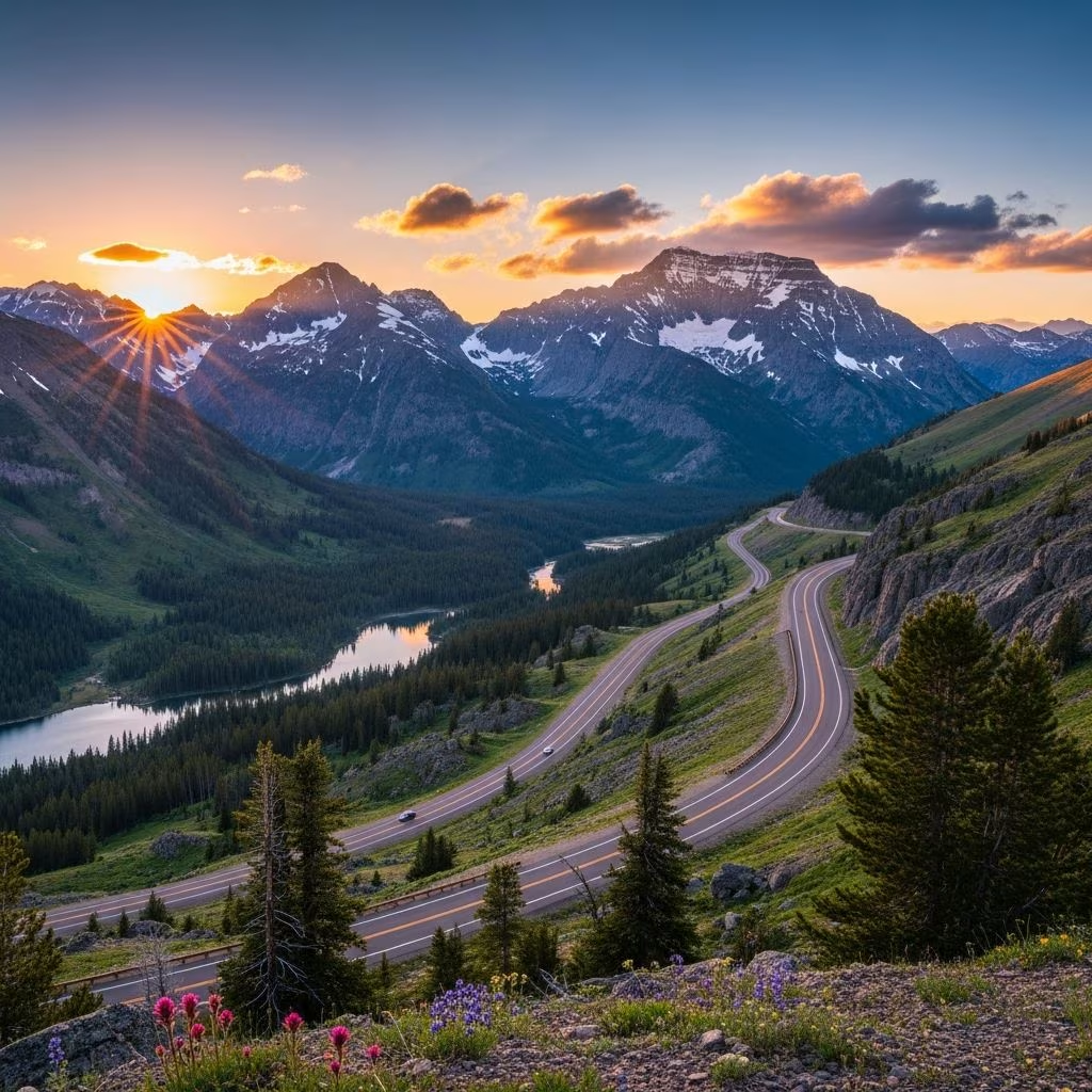
The Beartooth Highway stands as one of the most exhilarating drives in the United States, a 68-mile stretch of U.S. Highway 212 that snakes through the dramatic landscapes of southwest Montana and northwest Wyoming, culminating at Yellowstone National Park’s northeast entrance. Designated as an All-American Road, this route offers drivers a front-row seat to some of the nation’s highest and most rugged terrain, climbing from lush forests to exposed alpine plateaus with elevations topping 10,947 feet at Beartooth Pass—the highest point on any paved road in the Northern Rockies.
Travelers embarking on this journey transition rapidly through diverse ecosystems, starting in dense lodgepole pine forests and ascending to treeless tundra reminiscent of the Arctic. The highway parallels the vast Absaroka-Beartooth Wilderness, encompassing over 943,000 acres of protected land within Custer Gallatin and Shoshone National Forests. Here, 20 peaks soar above 12,000 feet, including Montana’s highest, Granite Peak at 12,799 feet, with glaciers clinging to north-facing slopes of nearly every summit over 11,500 feet.
Iconic geological formations dot the route, such as the Bear’s Tooth—a sharply sculpted granite pyramid carved by ancient glaciers, which inspired the highway’s name from the Crow people’s description. Glacial cirques, U-shaped valleys, and cascading waterfalls create a picturesque backdrop, especially vibrant with wildflowers in summer. Over 950 alpine lakes sparkle like jewels across the plateau, many accessible for short hikes or fishing.
Beginning in the charming town of Red Lodge, Montana—a historic mining community with a vibrant downtown—the drive heads south on U.S. 212. The road quickly gains elevation through hairpin switchbacks, offering sweeping views of the Pryor Mountains and Beartooth Plateau. Key milestones include the halfway point between the equator and North Pole, marked by interpretive signs, and the Top of the World Store at the summit, a quirky rest stop with panoramic vistas.
Descending toward Cooke City and Silver Gate, Montana, the highway levels into subalpine meadows before entering Yellowstone. The full traverse typically takes 3-4 hours due to winding sections and scenic pullouts, though allowances for stops extend it into a full-day adventure.
| Route Segment | Distance | Elevation Gain | Highlights |
|---|---|---|---|
| Red Lodge to Beartooth Pass | ~28 miles | 5,000+ feet | Switchbacks, forests to tundra, Bear’s Tooth view |
| Beartooth Pass to Top of the World | ~10 miles | Plateau | Alpine lakes, glaciers, wildlife spotting |
| Top of the World to Cooke City | ~30 miles | Descent | Beartooth Lake, meadows, Yellowstone approach |
Open only from late May to mid-October (weather permitting), the Beartooth Highway closes for winter due to heavy snow accumulation, sometimes exceeding 20 feet at the pass. Peak season from July to September offers the most stable conditions, with clear skies ideal for photography and longer daylight hours. Early summer brings snowfields and wildflowers, while fall delivers golden aspens and fewer crowds.
The Beartooth Corridor teems with wildlife, providing prime viewing opportunities just outside Yellowstone. Grizzly and black bears roam the slopes, alongside elk, moose, bighorn sheep, mountain goats, deer, mountain lions, and bobcats. Marmots and picas scurry across rocky talus fields, while birds like golden eagles soar overhead. Upon entering Yellowstone, Lamar Valley—known as the “Serengeti of North America”—amplifies sightings of wolves, bison herds, and pronghorn.
Safe viewing practices include using pullouts, binoculars, and maintaining distance—bears can appear suddenly on the road.
Beyond driving, the highway unlocks myriad pursuits:
Red Lodge, MT, serves as the northern hub with cozy lodges, breweries, and the historic Pollard Hotel. Cody, WY, 80 miles south via Chief Joseph Scenic Byway, immerses visitors in Buffalo Bill history with rodeos and museums. Cooke City/Silver Gate offer rustic cabins near the park entrance.
Fuel up in Red Lodge or Cooke City, as services are sparse. Vehicles should be in top condition for steep grades; RVs under 30 feet are advised, and trailers may require chains in wet weather. Pack layers for rapid weather shifts, bear spray, and ample water.
No, it typically opens late May to mid-October, subject to snowmelt and weather.
3-4 hours without stops; plan 6-8 hours with photo ops and hikes.
Yes, dispersed sites in national forests and developed campgrounds like Colter Bay in Yellowstone.
Beartooth Pass at 10,947 feet.
Possible but challenging; check vehicle length restrictions and conditions.
Since its completion in 1936 as a Depression-era project, the highway has drawn millions, balancing access with conservation. Visitors are urged to tread lightly, following Leave No Trace principles to protect this irreplaceable treasure.
