

 Travel Essentials
 Travel Essentials

Explore Big Sur's premier hiking trails with detailed guides on distances, difficulties, and scenic highlights for every adventurer.
 Travel Essentials
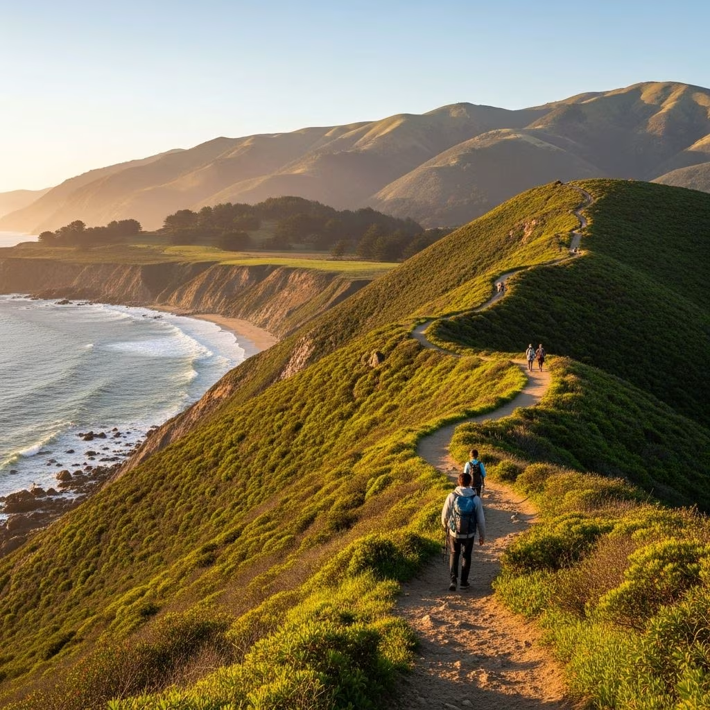
Big Sur stretches along California’s dramatic central coast, where towering mountains plunge into the Pacific Ocean, creating a hiker’s paradise. This region boasts rugged cliffs, hidden beaches, cascading waterfalls, and ancient redwood groves, all accessible via a network of trails that range from gentle strolls to strenuous overnighters. Whether you’re seeking panoramic vistas or serene forest immersion, Big Sur delivers unparalleled natural beauty. Trails here demand respect due to steep inclines, poison oak overgrowth, and wildlife like rattlesnakes and mountain lions, but the rewards—turquoise waters, wildflower blooms, and solitude—are unmatched.
The allure of Big Sur lies in its untamed wilderness. Unlike more developed coastal areas, hikes here plunge you into diverse ecosystems: chaparral-covered ridges offering 360-degree ocean views, lush canyons with crystal-clear creeks, and pockets of old-growth redwoods. Spring brings vibrant wildflowers and flowing waterfalls, while fall offers milder weather and fewer crowds. Highway 1, the iconic scenic route, provides easy access to trailheads, though its curves and frequent closures from landslides require planning. Always check California State Parks websites for updates on conditions, as fires and erosion can alter access.
Big Sur’s trails cater to all levels. Short, family-friendly paths lead to iconic sights like waterfalls, while moderate loops explore canyons, and expert loops tackle wilderness ridges. Here’s a breakdown:
Perfect for a half-hour detour or sunset stroll, these trails showcase Big Sur’s postcard views without exhaustive effort.
Starting from the scenic overlook near Ragged Point Inn, this steep 0.7-mile roundtrip descends 350 feet to a secluded black-sand beach via rugged cliffs. Spot Black Swift Falls during wet seasons and enjoy whale sightings in winter. The return climb tests legs, but benches along a flatter parallel nature trail offer easier panoramic views of the Santa Lucia Mountains and ocean. Allow 30-60 minutes; wear sturdy shoes for slippery sections post-rain.
This flat 2.5-mile beach-to-hill loop begins at William R. Hearst Memorial Beach, meandering through dunes and coastal scrub. Marvel at San Simeon Bay, historic pier remnants, and Hearst Castle silhouettes. Seasonal wildflowers and wildlife like shorebirds abound. It’s wheelchair-accessible in parts and great for birdwatching, taking 1-1.5 hours roundtrip.
A effortless 0.6-mile paved path in Julia Pfeiffer Burns State Park leads to the famous 80-foot McWay Falls, tumbling onto a sandy cove beach—one of Big Sur’s most photographed spots. The short boardwalk keeps you above the fragile ecosystem. Visit at dawn to avoid crowds; parking fills quickly ($10 fee).
These hikes balance challenge with immersion in Big Sur’s verdant heart, often featuring water features and forest shade.
Just north of Ragged Point, this 0.6-5 mile out-and-back (extendable) climbs gently from Highway 1 to twin 120-foot falls, best after rains. The full 5-mile version enters Silver Peak Wilderness with ocean vistas. Kid-friendly to the base; upper extensions reach hidden pools. 1,200 feet gain total; 2-4 hours. Watch for poison oak.
In Julia Pfeiffer Burns State Park, this 4.5-mile moderate loop ascends through dense redwood and oak forest via McWay Canyon. Cross footbridges over fern-draped creeks, emerging to ridge views before descending. Strenuous sections include 1,600 feet gain and stream crossings. 3-5 hours; a Big Sur classic for its variety.
From Pfeiffer Big Sur State Park, follow 2-4 miles of shaded fire roads and singletrack along the emerald Big Sur River. Wade boulder-strewn pools to a waterfall-fed swimming hole (water shoes advised). Oaks, sycamores, and willows provide cover; early starts beat crowds. 500 feet gain; 2-3 hours to the main pool.
A 4-mile loop in Pfeiffer Big Sur State Park climbs 900 feet through young redwoods to a 360-degree panorama of mountains and coast. Cross the river via a footbridge; fall foliage enhances the scene. Well-signed and maintained; 2-3 hours. Check for closures.
For seasoned hikers, these demand fitness, navigation, and overnight gear, revealing Big Sur’s wild interior.
This 15.1-mile, 4-day loop in Silver Peak Wilderness starts at Buckeye Trailhead, tackling 4,547 feet gain across chaparral ridges (2,500+ feet elevation for ocean vistas), redwood pockets, canyons, and waterfalls like Upper Salmon Creek Falls. Immediate 2,000-foot climb; unmaintained sections heavy with poison oak. No permit needed; best October-May. Bears possible; pack out waste.
A customizable 2-8 mile out-and-back from Ragged Point climbs steeply through wildflower meadows to Silver Peak ridges. Solitude reigns with Highway 1 and Pacific views. 2,000+ feet gain to summit; 3-6 hours. National Forest land; free access.
| Trail Name | Distance (miles) | Elevation Gain (ft) | Difficulty | Highlights |
|---|---|---|---|---|
| Ragged Point Cliffside | 0.7 | 350 | Easy | Black sand beach, falls |
| San Simeon Bay | 2.5 | Minimal | Easy | Bay views, wildlife |
| McWay Falls | 0.6 | Minimal | Easy | Iconic waterfall |
| Salmon Creek | 1-5 | 1,200 | Moderate | Double falls, wilderness |
| Ewoldsen Loop | 4.5 | 1,600 | Moderate | Redwoods, canyon |
| Big Sur Gorge | 2-4 | 500 | Moderate | River pools, swimming |
| Buzzards Roost | 4 | 900 | Moderate | Panoramic summit |
| Buckeye Loop | 15.1 | 4,547 | Strenuous | Full wilderness circuit |
| Baldwin Ranch | 2-8 | 2,000+ | Strenuous | Ridge solitude |
Best Seasons: October-May for cooler temps and water flow; summers are hot and foggy. Avoid post-fire zones.
Gear Essentials: Hiking boots, long pants (poison oak defense), 3L water/day, sun protection, map/GPS (cell service spotty). Bear canister for overnights.
Permits & Fees: State parks charge $10/vehicle; wilderness free but fire permits for stoves. Reserve campsites early.
Safety Notes: Steep drops, no railings; rattlesnakes active spring-fall. Tell someone your plans; Highway 1 closures common.
Wildlife & Leave No Trace: Spot condors, otters, elephants seals. Pack out all trash; stay on trail.
Most state park trails prohibit dogs to protect wildlife; check national forest options like Baldwin Ranch.
Garrapata Bluff Trail or Ragged Point nature path offer flat coastal panoramas.
Park entry fees suffice; overnight wilderness may need free fire permit.
Dispersed camping limited; use designated sites in Pfeiffer or Limekiln parks.
Many close due to slides; verify via parks.ca.gov.
Big Sur’s hikes forge unforgettable connections with nature’s raw power. From quick coastal gems to epic wilderness loops, each trail unveils layers of beauty. Prepare thoroughly, respect the land, and let the Santa Lucias and Pacific inspire your next adventure. Safe travels!
