

Travel EssentialsBest Hikes in Bozeman, Montana: Top Trails Near Town
Explore Bozeman's premier hiking trails, offering diverse options for all skill levels amid Montana's breathtaking landscapes, alpine lakes, and wildlife.
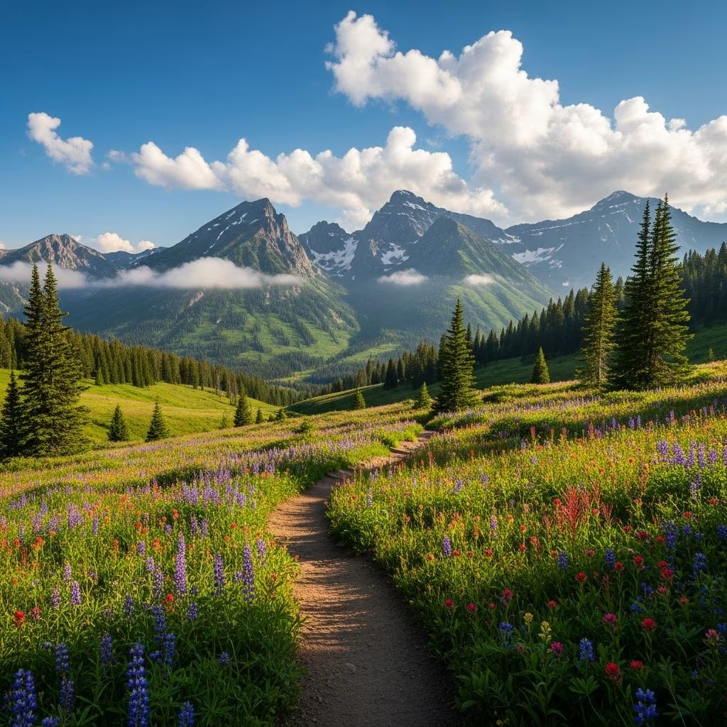
Travel EssentialsBozeman, nestled in the heart of Montana’s Gallatin Valley, serves as a gateway to some of the most spectacular hiking opportunities in the American West. Surrounded by towering mountain ranges including the Bridgers, Gallatins, and Madisons, the area boasts trails that cater to every fitness level and interest. Whether you’re seeking a quick post-arrival stroll with panoramic city views or a full-day expedition to pristine alpine lakes, Bozeman delivers. These paths wind through wildflower meadows, alongside cascading creeks, and up to summits offering 360-degree vistas. Local favorites emphasize accessibility, with many trailheads just minutes from downtown, making it ideal for visitors combining urban exploration with nature immersion.
Why Bozeman Excels as a Hiking Destination
The region’s geography creates a hiker’s paradise. Five major mountain ranges encircle the valley, providing endless variety: shaded canyon treks, exposed ridge walks, and high-elevation basins dotted with lakes. Summers bring vibrant wildflowers and clear skies, while fall paints the hills in golden hues. Wildlife sightings—deer, elk, bears, and birds of prey—are common, adding thrill to every outing. Proximity to Hyalite Recreation Area and Gallatin National Forest means world-class scenery without long drives. Trails see heavy use in peak season (June-September), so early starts help avoid crowds and secure parking.
Essential Trail Profiles for Every Hiker
Below, we detail standout routes, organized by proximity and difficulty. Each includes key stats, highlights, and pro tips drawn from local itineraries and trail reports.
Quick Urban Escapes: Trails Near Downtown
- M Trail (College M): This 1.7-3 mile round-trip (depending on route) moderate climb starts right off Bozeman’s edge. Switchbacks or a steeper direct ascent lead to a massive white ‘M’ installed by Montana State University students. Summit rewards include sweeping Gallatin Valley views, with the Bridgers, Gallatins, and Absarokas in sight. Wildflowers bloom profusely in July; extend to Mount Baldy for a 10+ mile epic.
- Drinking Horse Mountain: A 2.5-mile loop classified easy-moderate, perfect for families or recovery days. Cross a footbridge over Bozeman Creek, climb gently through pine forest to open ridges, and picnic at the summit table. Pair with the M Trail across the road for a 5-mile combo. Watch for mule deer at dawn.
Gallatin Canyon Gems: Scenic Drives to Serenity
- Lava Lake Trail: 6 miles round-trip, moderate with steady elevation through aspen groves and rocky crossings beside the Gallatin River. The payoff is a glassy alpine lake framed by cliffs. Adventurous hikers push 10 miles further to Table Mountain’s Spanish Peaks overlook. Trailhead 30 minutes south; bear spray recommended.
- Palisade Falls: Short 1.2-mile out-and-back to a 80-foot waterfall thundering over basalt columns. Easy access makes it popular; arrive early. Nearby Gallatin River offers fly-fishing spots post-hike.
Hyalite Canyon’s Alpine Wonders
Just 16 miles south, Hyalite is Bozeman’s hiking crown jewel—a granite playground with reservoirs, peaks over 10,000 feet, and cascading waters. Roads close in winter, but summer opens 50+ miles of trail.
- Hyalite Creek to Hyalite Lake: 11-mile moderate-hard round-trip past 12+ waterfalls in a lush gorge. The final basin reveals an emerald lake beneath jagged peaks. Extend to Hyalite Peak (10,000+ ft) for bagged summits. Shaded most of the way; pack layers for wind.
- Mount Blackmore: 12-mile strenuous out-and-back with switchbacks through meadows to Blackmore Lake, then a saddle and final push to 10,900-foot summit. Horizon-spanning views; wildflowers peak mid-summer. Trailhead before Hyalite Reservoir.
Bridger Mountains Challenges
North of town, the Bridgers offer dry, exposed hikes with big elevation. Ski area in winter, hiking haven in summer.
- Sacajawea Peak: 7-9 miles round-trip to 9,654 feet, the range’s highest. Steep from Bridger Bowl or easier via Middle Cottonwood Canyon trail (shaded creek walk). Summit panorama includes Bozeman and three ranges. Exposed; start pre-dawn in heat.
- Mount Baldy: Extreme 9-mile face climb from M Trail base, gaining 4,000+ feet. Sheer exposure and scree test endurance; elite views compensate.
Hidden and Lesser-Known Paths
- Storm Castle Peak: 5-mile moderate-hard with switchbacks to Gallatin River overlooks. Steep finale; wildflowers and solitude.
- Bozeman Creek Trail (Sourdough Canyon): Variable 5-20 miles, easy rolling through woods. Mystic Lake extension for overnighters; mountain bike crossover.
- Middle Cottonwood Canyon: Shady 6-8 mile creek-hugging ramble in Bridgers. Relaxed pace, waterfalls; pairs with Sacajawea.
- Frazier Lake: Quick 2-mile jaunt, though lake may dry seasonally. Peaceful forest immersion near town.
Trail Comparison Table
| Trail Name | Distance (RT) | Difficulty | Drive from Downtown | Key Feature |
|---|---|---|---|---|
| M Trail | 3 miles | Moderate | 5 min | Valley panorama |
| Drinking Horse | 2.5 miles | Easy-Mod | 5 min | Forest loop |
| Lava Lake | 6 miles | Moderate | 30 min | Alpine lake |
| Hyalite Creek | 11 miles | Mod-Hard | 20 min | Waterfalls |
| Sacajawea Peak | 8 miles | Hard | 20 min | High summit |
Planning Your Hike: Practical Tips
Best Seasons: June-October; July-August for wildflowers, September for fewer crowds. Snow lingers high until July.
Gear Essentials: Sturdy boots, trekking poles, 2-3L water, snacks, bear spray (grizzlies present), map app (AllTrails/Gaia), sun protection. Hyalite requires free permit for camping.
Safety Notes: Check fs.usda.gov/gallatin for closures (fires, bears). Tell someone your plans; cell service spotty. Afternoon thunderstorms common—summit early.
Post-Hike Refuel: Western Café for breakfast, The Market’s eateries (burgers, sushi), Jump for lunch, Bozeman Hot Springs for soak.
Frequently Asked Questions (FAQs)
What’s the easiest hike near Bozeman?
Drinking Horse Mountain: 2.5-mile loop with minimal gain, forests, and views.
Are dogs allowed on trails?
Yes, leashed on most; voice control in Hyalite. Pack out waste.
Best hike for families?
Palisade Falls or Grotto Falls (nearby): short, flat to waterfalls.
Can I camp after hiking?
Dispersed sites in Gallatin NF; Hyalite reservoirs have developed campgrounds. Permits needed.
Any free trail maps?
Visit-Bozeman.com and USFS sites offer downloads.
Advanced Adventures and Multi-Day Ideas
For overnighters, combine Hyalite Creek to lake camp, summit Blackmore next day. 4-day itinerary: Day 1 M/Drinking Horse, Day 2 Lava Lake, Day 3 Hyalite, Day 4 Bridgers. Guided trips via local outfitters for beginners.
Bozeman’s trails embody Montana’s wild spirit—accessible yet untamed. Lace up and explore.

References
- Itinerary: 4 Days of Epic Hikes in Bozeman — Visit Bozeman. 2023. https://visit-bozeman.com/itinerary/hikes-bozeman
- 10 Day Hikes Around Bozeman — Crazy Mountain Outdoor Company. 2023. https://www.crazymountainoutdoorcompany.com/blog/10-day-hikes-bozeman
- Bozeman’s Top Trails — Outside Bozeman. 2023. https://outsidebozeman.com/activities/hiking/bozemans-top-trails
- Our FAVORITE Hike near Bozeman, Montana (Frazier Lake) — YouTube (Curtis Johnson). 2023. https://www.youtube.com/watch?v=30tsyZVdAOw
- THE 5 BEST Bozeman Hiking Trails (2026) — TripAdvisor. 2026. https://www.tripadvisor.com/Attractions-g45095-Activities-c61-t87-Bozeman_Montana.html
More in Travel Essentials
Travel Essentials
Travel Essentials200+ Disney Instagram Captions for Magical Park Photos
Travel Essentials
