

 Travel Essentials
 Travel Essentials

Explore curated Lake Tahoe hikes across easy, moderate, and difficult levels, featuring waterfalls, alpine lakes, and panoramic lake views for every adventurer.
 Travel Essentials
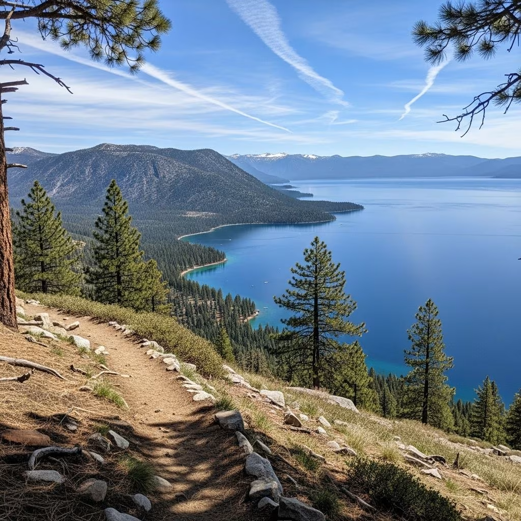
Lake Tahoe, straddling California and Nevada, offers some of the most breathtaking hiking opportunities in the Sierra Nevada. Surrounded by granite peaks, crystal-clear waters, and diverse ecosystems, its trails cater to every type of outdoor enthusiast. Whether you’re seeking a quick family outing or a strenuous multi-day trek, Tahoe’s paths deliver unparalleled scenery, from wildflower meadows in summer to snow-capped vistas in shoulder seasons. This guide highlights standout routes, organized by difficulty, with practical tips drawn from official park resources and trail data.
The region’s trails showcase unique geological features like ancient glaciers, volcanic formations, and over 70 miles of the Tahoe Rim Trail encircling the lake. Hikers can expect elevations from 6,200 feet at lake level to over 10,000 feet at high points, with seasonal variations: wildflowers bloom June-August, fall colors peak in September, and winter snowshoeing adds challenge. Always check permits for Desolation Wilderness areas via the USDA Forest Service, as day-use quotas apply year-round.
These short trails provide big rewards with minimal effort, ideal for introducing kids or easing into Tahoe’s terrain. They often feature accessible parking and interpretive signs from state parks.
Pro tip: Start early to avoid crowds at these hotspots, and pack bear spray—black bears roam Tahoe year-round, per National Park Service guidelines.
Building on easy routes, these 3-7 mile paths offer elevation gains of 500-1,500 feet, rewarding with lakes, falls, and ridgeline views. Sturdy shoes and 2-4 liters of water are essentials.
| Trail Name | Distance/Elevation | Highlights | Access |
|---|---|---|---|
| Frog Lake Loop | 3 miles / 600 ft | Pacific Crest Trail segment, alpine tarn with Red Lake views, wildflowers | Highway 88 near Carson Pass |
| Cascade Falls | 1.5 miles / 400 ft | Stone stairs to 200-ft waterfall, Cascade Lake overlook, minimal shade | Bayview Campground, Hwy 89 |
| Rubicon Trail | 7.5 miles out-back / 400 ft | Shoreline path between state parks, coves, and Sierra Nevada panoramas | Emerald Bay or D.L. Bliss SP |
| Maggies Peak | 5-6 miles RT / 1,200 ft | Granite Lake stop, Desolation Wilderness peaks over Fallen Leaf Lake | Fallen Leaf Lake trailhead |
The Rubicon Trail stands out for its flat profile hugging Tahoe’s edge, passing private estates and hidden beaches—prime for wildflower spotting in July. Frog Lake delights with PCT vibes and reflective pools mirroring Sonora Pass peaks.
For those craving intensity, these routes demand fitness, navigation skills, and early starts. Gains exceed 2,000 feet, often entering backcountry with stream crossings and exposure.
Technical note: Use AllTrails or Gaia GPS for offline maps, as cell service fades. USDA Forest Service reports increasing rockfall risks on east-face descents post-2024 fires.
Tahoe’s microclimates vary: South shore thaws first, North stays snowy longer. Summer highs hit 80°F (27°C), but lightning storms roll in afternoons—aim for pre-11 AM starts. Winter requires microspikes, per California State Parks advisories.
Tahoe shines for inclusive outings. Trails like Martis Peak Fire Lookout (3 miles easy-moderate) offer 360° vistas from a historic tower—great for kids. Fallen Leaf Lake loop (flat 2 miles) welcomes leashed dogs year-round. Wheelchair-accessible paths exist at Spooner Lake and Tahoe East Shore Trail segments.
Extend day hikes into overnighters on the 165-mile Tahoe Rim Trail. Sections like Page Meadows to Armstrong Pass (20 miles) feature meadows and aspen groves. Secure free permits online; bear canisters required basin-wide by USFS regs.
June-October for snow-free trails; July-August peaks wildflowers. Shoulder seasons offer solitude but check road closures.
Yes for Desolation Wilderness (e.g., Eagle Lake, Tallac)—$5 day-use via recreation.gov. Free for most others.
Leashed on most trails; prohibited in Desolation Wilderness. Fallen Leaf and Rubicon are pup-friendly.
Emerald Bay area busiest weekends; North Tahoe quieter. Arrive by 8 AM.
Descend immediately, hydrate, rest. Symptoms start above 8,000 ft; acclimate over days.
Base in South Lake Tahoe for Hwy 89 access or Truckee for north trails. Camp at dispersed sites (free permit) or reservable spots via recreation.gov. Combine hikes with paddling or gondola rides at Heavenly or Palisades for hybrid days. With over 300 miles of maintained paths, Tahoe rewards repeat visits—track via Strava or AllTrails communities.
