

 Travel Essentials
 Travel Essentials

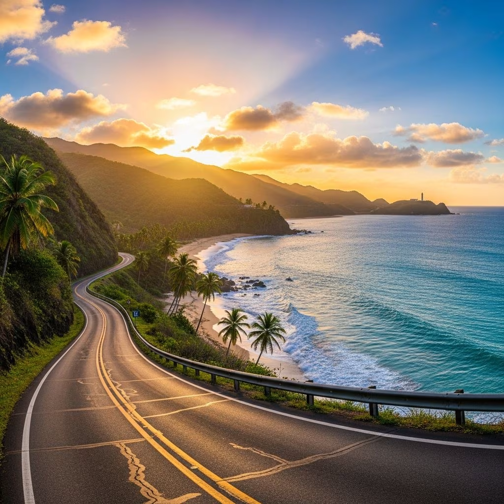
Navigate Puerto Rico's diverse landscapes through curated driving routes spanning rainforests, bioluminescent bays, colonial towns, and pristine beaches.
 Travel Essentials
Puerto Rico offers travelers an exceptional opportunity to experience Caribbean beauty through self-guided exploration. The island’s well-maintained road network connects diverse ecosystems, historic communities, and spectacular natural wonders. Whether you have a single day or an extended vacation, driving routes across this island territory reveal experiences ranging from lush rainforest canopies to crystalline bays that glow with bioluminescent organisms. Understanding the best routes and planning stops strategically transforms a simple beach holiday into a comprehensive island discovery.
Before embarking on any Puerto Rico driving adventure, several practical considerations ensure a smooth journey. The island spans approximately 100 miles east to west, making multiple routes feasible within various timeframes. Rental vehicles are widely available at major airports and tourist centers, though advance booking often secures better rates and vehicle selection. Most major routes are well-marked, and GPS navigation proves invaluable for discovering smaller attractions and alternative pathways.
Understanding Puerto Rico’s geography helps contextualize route planning. The island features a mountainous interior corridor, densely developed northern coastal regions, and more sparsely populated southern and western areas. Travel times between destinations vary significantly depending on chosen routes—scenic mountain passages take longer than direct highway routes but provide memorable experiences. Fuel availability is generally reliable along main routes, though smaller southern communities may have limited options.
Most road trip journeys appropriately begin in San Juan, the island’s largest metropolitan area and primary international gateway. This historic city serves as both a destination and launching point for broader exploration. Old San Juan particularly deserves extended attention, featuring narrow colonial streets, pastel-colored architecture, and cultural landmarks spanning centuries.
Within Old San Juan, several attractions merit dedicated time:
Beyond historic exploration, San Juan offers culinary significance. The piña colada—Puerto Rico’s national cocktail—originated in this city. Multiple establishments claim historical authenticity, including the Caribe Hilton and Barrachina, both offering their own versions of this iconic beverage. Sampling variations across different venues provides insight into local hospitality culture and mixology traditions.
Located approximately 45 minutes northeast of San Juan, El Yunque National Forest represents one of the Caribbean’s most significant natural attractions. This tropical rainforest spans nearly 30,000 acres and represents one of the only tropical rainforests within the U.S. National Forest system. The drive from urban San Juan to the park entrance transitions from developed infrastructure to increasingly natural landscapes.
Preparation enhances the El Yunque experience considerably. The El Portal Visitor Center near the main entrance provides orientation, trail information, and safety guidelines. Advance reservations through recreation.gov ensure access to popular trails, particularly during peak seasons. Comfortable hiking footwear, insect protection, and adequate water prove essential for trail exploration in humid rainforest conditions.
Notable trail experiences within El Yunque include:
| Trail Name | Distance | Primary Features |
|---|---|---|
| La Mina Trail | 2.5 miles | Waterfall with swimming holes |
| Angelito Trail | 1.6 miles | Shorter waterfall hike, beginner-friendly |
| El Yunque Trail | 3.7 miles | Elevated views and forest canopy exposure |
| Mount Briton Tower Trail | 1.2 miles | Observation tower with panoramic vistas |
The Yokahu Observation Tower provides elevated perspectives of the rainforest expanse without requiring strenuous hiking. Juan Diego Creek and La Coca Falls offer alternative water-based experiences for visitors preferring less demanding activities. Swimming in designated waterfalls and natural pools refreshes visitors while providing memorable photo opportunities.
The scenic northern coastline offers distinct advantages for road trip exploration. Highway 681 winds through dramatic coastal formations, featuring numerous pullouts and beach access points. This route connects several notable destinations through approximately 50 miles of shoreline driving.
Key northern coastal attractions include:
Western coastal regions provide contrasting experiences to northern routes. The drive toward Rincón and Aguadilla passes through increasingly rural communities. Cerro Gordo Beach, Playa Puerto Nuevo, and Playa Mar Chiquita represent accessible beach stops along this passage. The western coast’s exposure to Atlantic swells creates varying water conditions throughout seasons, influencing swimming safety and photography opportunities.
Puerto Rico’s interior mountainous regions, collectively referenced as La Ruta Panorámica, traverse the island’s central highlands over approximately 100 miles. This route winds through coffee-growing regions, small mountain communities, and elevation changes offering dramatic visual contrasts to coastal experiences.
Notable interior destinations include:
The scenic mountain route from Humacao southeast requires traversing Highway 53 toward Highway 3, creating a southern arc through the island’s interior. This passage descends through hillside communities offering valley views and glimpses of traditional rural Puerto Rican life. Small villages along this route provide cultural authenticity and opportunities to experience communities less focused on tourism infrastructure.
Approximately 30 to 45 minutes east of Cabo Rojo, the municipality of Lajas hosts La Parguera, one of Puerto Rico’s three bioluminescent bays. This location represents the only bioluminescent bay where swimming is permitted, creating a singular natural phenomenon experience. The bay’s dinoflagellate organisms produce light through biochemical reactions when disturbed by movement, creating an otherworldly glowing effect.
Experiencing the bioluminescent bay requires planning. Evening tours operate during specific conditions, with availability varying seasonally. Swimming in the glowing water creates a magical interaction—movement through the bay trails luminescent patterns, and immersion produces visibility of glowing organisms at close proximity. The drive to La Parguera from central island locations requires approximately two to three hours, making it feasible as a day trip destination or evening excursion.
The town of La Parguera itself offers dining and lodging options, with several establishments catering to tourists discovering the bioluminescent phenomenon. Local restaurants feature fresh seafood and traditional Puerto Rican cuisine, providing gastronomic experiences complementing the natural attraction.
The southwestern coastal region features distinct characteristics differentiating it from northern routes. Cabo Rojo represents an essential southern destination, hosting the Cabo Rojo National Wildlife Refuge and distinctive salt flats. The Los Morrillos Lighthouse marks a picturesque coastal point accessible via short hiking paths providing ocean vistas.
Unique to southern Puerto Rico, the Cabo Rojo Salt Flats create surreal landscape photography opportunities. These crystalline white formations contrast dramatically with surrounding turquoise water and Caribbean vegetation. The salt flats’ shallow, mineral-rich waters have attracted salt harvesting operations historically and continue to draw visitors seeking unusual natural formations.
Playa Sucia (locally known as La Playuela) represents a popular local beach destination accessible via somewhat challenging road conditions. This beach rewards visitors with crystalline water and fewer tourist facilities than developed beaches, creating a more authentic Puerto Rican community beach experience. Weekday visits or early weekend arrivals provide optimal conditions due to limited parking and seasonal crowding.
For extended road trip experiences, Puerto Rico’s smaller islands warrant consideration. Vieques, accessible via ferry from the eastern town of Fajardo, hosts Bioluminescent Bay Vieques and unique beaches. The island’s undeveloped character and bio bay swimming opportunities create contrasting experiences from main island attractions.
Culebra represents another island option requiring ferry transportation. Flamenco Beach on Culebra consistently ranks among Caribbean region’s most spectacular beaches, featuring white sand, calm waters, and limited commercial development. Island exploration depends on ferry schedules and availability, requiring advance planning to coordinate vehicle transportation or island rental options.
Different travel durations accommodate various road trip configurations. A single-day excursion might focus on El Yunque rainforest and return to San Juan. A weekend adventure could encompass Old San Juan, El Yunque, and one secondary destination like Ponce or Rincón.
Multi-day itineraries typically follow circular patterns:
Road conditions throughout Puerto Rico generally meet modern standards, though driving habits and infrastructure vary significantly between urban and rural areas. Urban San Juan exhibits congestion and aggressive driving patterns typical of large metropolitan areas. Rural southern and western routes feature quieter traffic but occasionally narrow roadways and limited lighting.
Insurance, vehicle documentation, and valid driver’s licenses are legally required. International driving permits prove helpful for non-U.S. residents. Fuel prices fluctuate but generally exceed mainland U.S. rates. Planning fuel stops along longer routes prevents inconvenient situations in remote areas.
Puerto Rico’s tropical climate features warm temperatures year-round but distinct wet and dry seasons. Northern routes experience occasional rain during summer and fall months, while southern regions remain relatively drier. Hurricane season extends from June through November, potentially affecting travel plans during peak risk periods.
Water conditions vary seasonally—northern beaches experience stronger swells during winter months, while southern beaches maintain calmer conditions. These variations influence beach swimming safety and photography conditions. Researching seasonal conditions before travel planning ensures optimal experience alignment with weather patterns.
A complete island circumnavigation requires approximately 6-8 hours of driving without stops. Most travelers allocate 5-10 days to adequately explore multiple destinations while allowing time for activities, meals, and rest.
While public transportation exists in urban areas, self-driving provides considerably more flexibility for accessing remote beaches, rainforest trails, and rural communities. Most comprehensive road trip experiences benefit from private vehicle rental.
December through April offers optimal driving conditions with dry weather, lower humidity, and minimal hurricane risk. These months coincide with peak tourism and higher accommodation costs.
Vehicle ferry service operates from Fajardo to both islands, allowing private vehicle transportation. However, most travelers opt for rental vehicles on the islands rather than ferry costs.
