

 Travel Essentials
 Travel Essentials

Explore Santorini's most captivating destinations through carefully curated driving routes that showcase beaches, historical sites, and panoramic vistas.
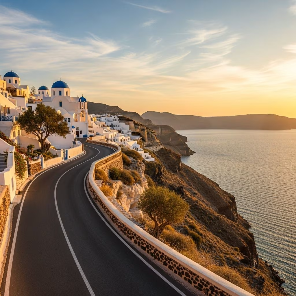 Travel Essentials
Santorini presents a remarkable opportunity for independent travelers to experience the island’s diverse attractions through self-guided driving expeditions. The island’s compact geography—spanning less than an hour from north to south—makes vehicle exploration an efficient and rewarding way to encounter the region’s most compelling features without the constraints of organized tour schedules.
Selecting appropriate transportation proves essential for navigating Santorini’s terrain effectively. A compact rental vehicle serves most travelers well, as the island’s roads, while occasionally narrow and winding, accommodate standard passenger cars comfortably. The volcanic nature of Santorini’s landscape creates elevation changes that warrant a vehicle with adequate power for climbing steep inclines, particularly when accessing elevated viewpoints or mountain villages. For solo travelers or couples, economy sedans provide sufficient capability and maneuverability through tight village streets.
The island’s road infrastructure has been developed to handle tourist traffic, with well-marked routes connecting major destinations. However, visitors accustomed to wide highways should anticipate narrower passages through settlements and be prepared for occasional unpaved sections leading to remote beaches or archaeological sites.
The southeastern coastal drive from the island’s central hub presents an immersive journey through Santorini’s maritime and cultural evolution. This route encompasses approximately 10 kilometers and provides insight into how the island has transformed economically over recent decades.
Beginning from the main urban center, travelers descend toward the southeastern coastline where volcanic black sand beaches dominate the landscape. The drive passes through charming fishing communities that maintain traditional Greek island character despite increasing tourism. These settlements showcase authentic harbor scenes where local fishermen continue practices that have sustained the community for generations.
A particularly significant stop along this route leads to an industrial heritage site that documents Santorini’s agricultural prominence. The former processing facility now houses a cultural institution dedicated to preserving memories of the island’s agrarian past, featuring exhibitions highlighting the transformation of local crops into commercial products. This conversion from industrial to cultural use exemplifies sustainable tourism development.
The route concludes at a dramatic black sand beach environment where the contrast between dark volcanic sand and azure Mediterranean waters creates striking visual compositions. Small tavernas situated near the beach provide opportunities for refreshment and local cuisine sampling.
The drive to Santorini’s highest point represents one of the most rewarding automotive journeys on the island, offering progressive elevation gains and increasingly expansive vistas. This route traverses approximately 8 kilometers through terraced vineyards and hillside settlements before reaching the island’s summit.
Intermediate stops along the climb reveal medieval architecture preserved in fortified hilltop villages. These settlements feature narrow labyrinthine streets designed historically to confuse potential pirates and hostile invaders. Whitewashed stone structures interlock in organic patterns that demonstrate sophisticated vernacular architecture adapted to the Mediterranean climate.
The final destination—a monastic structure constructed in the early eighteenth century—occupies the island’s highest elevation. Though the main religious sanctuary remains closed to casual visitors, an associated chapel and gift shop welcome travelers. From this vantage point, the 360-degree perspective encompasses the entire island, surrounding waters, and occasionally visible aircraft approaching the regional airport. This accessibility by vehicle rather than hiking trails keeps visitor density manageable compared to other panoramic locations.
The eastern coastal drive showcases the remarkable diversity of Santorini’s beach environments, each colored and textured distinctly by different volcanic mineral compositions. This route spans approximately 12 kilometers through multiple communities and geological zones.
The journey begins by accessing a particularly dramatic beach environment where towering crimson cliffs frame sand colored in russet and burgundy tones. The iron oxide-rich composition creates the distinctive hue that distinguishes this location from other Mediterranean beaches. The precarious geological conditions necessitate careful attention to warning signs, as the unstable cliff faces pose hazards to beachgoers.
Continuing along the coastal drive, travelers encounter succeeding beach environments featuring progressively darker sand as the volcanic composition shifts. Communities built above these beaches maintain fishing traditions alongside seasonal tourism economies. Local restaurants operate along the shoreline, offering fresh seafood harvested from the surrounding waters.
The route traverses multiple small villages, each maintaining distinct architectural character while sharing fundamental Cycladic design principles. Detours into settlement centers reveal small shops, traditional kafeneia (coffee houses), and narrow pathways connecting residential areas.
Santorini’s viticultural traditions span millennia, with ancient volcanic soil producing distinctive wines recognized internationally. This route encompasses approximately 9 kilometers through agricultural zones dominated by vineyards cultivated using traditional methods.
The region’s unique growing conditions—volcanic mineral-rich soil combined with minimal rainfall—produce grapes with concentrated flavors unavailable in more temperate wine regions. Many vineyard operators welcome visitors for tastings and explanations of their cultivation and fermentation methodologies. These encounters provide direct engagement with producers rather than tourist-oriented establishments.
The drive passes through valleys where terraced cultivation patterns follow topographical contours, demonstrating agricultural engineering adapted to challenging hillside terrain. Seasonal variations dramatically transform the landscape’s appearance—from barren volcanic soil visible during dormant months to verdant canopies during growing seasons.
Several establishments combine wine production with hospitality amenities, offering comprehensive agricultural tourism experiences that extend beyond simple tastings to encompass cultural education about island traditions and contemporary sustainability practices.
The northern portion of Santorini presents the island’s most recognizable landscape features, with clifftop settlements perched dramatically above the submerged volcanic caldera. This route encompasses approximately 7 kilometers of spectacular driving through UNESCO-recognized areas.
The primary destination—a picturesque community renowned globally for sunset viewing—features whitewashed cubic architecture with blue-domed accents characteristic of Cycladic design. The settlement’s narrow pedestrian pathways restrict vehicle traffic to designated parking areas, requiring visitors to navigate on foot through atmospheric alleys lined with galleries, restaurants, and boutique accommodations.
Beyond the famous settlement, the northern coast presents less crowded alternatives offering comparable caldera perspectives with reduced tourist density. These secondary viewpoints provide authentic island experiences without the commercial intensity characterizing the primary destination.
The drive traverses the caldera’s rim, offering continuous vistas of the submerged volcano’s geological significance. Historical narratives of the island’s catastrophic eruption and subsequent geological transformation become visceral when observed from these elevated positions, where the massive underwater crater’s dimensions become comprehensible.
Several factors merit attention when planning autonomous driving expeditions across Santorini:
Santorini’s modest dimensions permit comprehensive exploration within three consecutive days of dedicated driving and exploration. However, individual preferences regarding activity pacing, social interaction, and site engagement significantly influence optimal duration planning.
A concentrated single-day itinerary covering primary highlights requires early departure and continuous movement, limiting in-depth engagement with individual locations. The moderate-paced three-day framework permits leisurely exploration of selected destinations while accommodating unexpected discoveries or extended dining experiences.
Extended four- to five-day itineraries enable deeper cultural immersion, revisiting favorite locations under different atmospheric conditions, and engaging more extensively with local communities beyond cursory tourist interactions.
Successful driving expeditions necessitate adequate preparation and supplementary resources:
| Equipment | Purpose | Notes |
|---|---|---|
| Detailed island map or GPS device | Navigation through village systems and secondary routes | Mobile coverage varies in remote areas; offline maps provide backup |
| Sun protection supplies | Mitigation of intense Mediterranean UV exposure | Most scenic routes involve significant open-air time |
| Hydration containers | Maintenance of adequate fluid intake during exploration | Refreshment options limited in remote locations |
| Comfortable walking footwear | Navigation of archaeological sites and beach access paths | Some locations require traversing uneven volcanic terrain |
| Camera equipment | Documentation of landscapes and cultural sites | Memory capacity often exhausted by visual abundance |
International driving permits combined with valid home-country licenses satisfy Greek regulatory requirements for most nationalities. Insurance coverage verification and rental contract comprehension prove essential before vehicle departure from rental facilities.
While navigable for careful operators, the island’s narrow passages, elevation changes, and occasional pedestrian-dense areas create challenges for hesitant drivers. Defensive driving practices and reduced speeds enhance safety in confined village streets.
Early morning departures avoid midday heat and congestion while providing superior photographic lighting conditions. Evening exploration permits sunset experiences at panoramic locations with extended daylight enabling return navigation before darkness.
Positioning accommodations centrally enables exploration in multiple directions without repeated long transfers. Alternatively, changing lodgings permits fuller immersion in different communities’ character and local hospitality traditions.
Basic transit requires 1.5 to 2 hours per route, but meaningful engagement with each location necessitates 4 to 6 additional hours for exploration, dining, and cultural interaction.
