

 Travel Essentials
 Travel Essentials

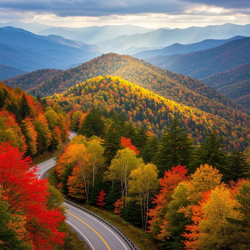
Explore curated driving routes through Great Smoky Mountains, featuring scenic overlooks, historic landmarks, hiking trails, and natural wonders.
 Travel Essentials
The Great Smoky Mountains National Park stands as one of America’s most treasured destinations, attracting millions of visitors annually who seek to experience its breathtaking landscapes and rich cultural heritage. For travelers who prefer leisurely exploration over strenuous backcountry expeditions, embarking on a scenic driving tour through the park offers an accessible yet profoundly rewarding way to witness the region’s natural splendor. From historic mountain communities to cascading waterfalls and ancient forest ecosystems, these automotive routes provide gateways to unforgettable mountain experiences.
The journey into the Smoky Mountains often begins in welcoming communities that serve as natural launching points for deeper exploration. These towns blend outdoor recreation infrastructure with cultural attractions, making them ideal headquarters for multi-day adventures.
Located just outside the park’s western boundary, the Nantahala Outdoor Center functions as a comprehensive base camp for mountain enthusiasts. This sprawling facility integrates multiple recreational amenities within a single location, allowing visitors to structure their days according to their interests and energy levels. The Adventure Center hosts adrenaline activities including ziplining courses and high-altitude climbing towers for those seeking vertical challenges. Beyond these thrilling pursuits, the property encompasses an outfitter store stocked with quality gear, a consistently open restaurant serving mountain cuisine, and diverse lodging options ranging from traditional motel rooms to cabin retreats, hostel accommodations, and designated campsites. The presence of both the Appalachian Trail crossing the property and regular Great Smoky Mountains Railroad service creates opportunities to combine multiple outdoor experiences within proximity.
Positioned approximately 12.5 miles north of Nantahala via winding US 19, Bryson City represents a quintessential Appalachian town undergoing thoughtful revitalization. The drive itself traverses densely forested terrain interspersed with commercial establishments targeting the regional outdoor tourism market. Upon arrival, visitors discover a charming downtown district that has preserved its mountain character while embracing modern amenities. The town’s strategic location makes it particularly suitable for travelers interested in combining multiple activity types during their stay.
The primary thoroughfare connecting the park’s eastern and western communities, US Highway 441—commonly known as Newfound Gap Road—represents the quintessential Great Smoky Mountains driving experience. This 30-plus-mile mountain passage between Cherokee, North Carolina and Gatlinburg, Tennessee presents far more than simple point-to-point transportation.
Despite its modest mileage, the journey typically consumes several hours due to the road’s serpentine alignment and the numerous stopping opportunities it presents. Hairpin turns navigate elevation changes across the mountain range, rewarding attentive drivers with continuously shifting perspectives on the surrounding landscape. The route incorporates multiple overlooks designed specifically for visitor contemplation, tunnels carved through solid rock formations, organized picnic facilities, and clearly marked trailheads leading to destination hikes. Travelers who arrive prepared with adequate time, maps, and a willingness to explore secondary attractions discover that this seemingly straightforward drive transforms into a full-day adventure.
Newfound Gap Road strategically positions numerous vista points along its trajectory, enabling visitors to appreciate the mountain range’s geological drama without hiking. These overlooks showcase the progression of elevation and vegetation zones as travelers ascend and descend the ridge. Early morning departure times offer advantages in terms of wildlife viewing opportunities and photographic lighting conditions, as mist often clings to valleys during dawn hours, creating atmospheric mountain scenes.
This 11-mile circuit road presents a unique combination of pastoral scenery and historical structures, distinguishing it from other park drives. The loop’s character reflects a human landscape that shaped the region for generations before the park’s establishment. Historic homesteads, preserved churches, and weathered barns dot the landscape at regular intervals, each structure possessing its own narrative of frontier settlement and mountain community life. Visitors traversing this route gain appreciation for how early European settlers adapted to Appalachian terrain and created viable communities within these challenging landscapes. The road accommodates substantial traffic during peak season, suggesting early morning or shoulder-season visits for more peaceful exploration.
Constructed upon the foundation of a 150-year-old wagon road, this six-mile one-way loop offers a more claustrophobic yet paradoxically intimate mountain experience. The narrow roadway winds through particularly dense forest, where century-old hardwood trees create a towering canopy overhead. Lush undergrowth, moss-covered boulders, and constant watercourse presence remind visitors that they traverse living ecosystems rather than merely scenic backdrops. The trail passes multiple historic cabin structures that once housed mountain families, including the remarkably preserved Ephraim Bales residence, which accommodated eleven people within its compact footprint. A purchasable interpretive guide available at visitor centers provides detailed context about the flora, fauna, and human history along the route. Important operational considerations include seasonal restrictions (typically April through November) and prohibitions against recreational vehicles and trailers, making this route particularly suitable for standard passenger vehicles seeking a more manageable drive.
The renowned Blue Ridge Parkway extends 469 miles through the Appalachian mountain chain, connecting Shenandoah National Park in Virginia with the Great Smoky Mountains’ northern approaches. Often characterized as “America’s Favorite Drive,” this two-lane byway prioritizes scenic experience over transportation efficiency, encouraging travelers to reduce speed and pause frequently at vista points. The route’s northern terminus at Shenandoah creates opportunity for multi-park adventures spanning several days. Throughout the parkway’s length, distance markers facilitate navigation while numerous developed campgrounds provide overnight options. Travelers who allocate adequate time discover countless pulling opportunities, ranging from brief photographic stops to extended hiking excursions.
Within the parkway’s northern reaches, Humpback Rocks presents expansive panoramas of surrounding terrain alongside an outdoor agricultural museum and multiple hiking alternatives. The Appalachian Trail intersects this area, providing connection to the larger hiking network. Mabry Mill, a structure predating 1920 and combining sawmill and blacksmith shop functions, attracts visitors interested in Appalachian industrial heritage. The site’s photogenic qualities and easy 0.5-mile hiking option accommodate various activity preferences.
Among the park’s most sought-after climbing destinations, 6,593-foot Mount LeConte demands significant physical commitment from hikers attempting its summit. The Alum Cave Trail, one of five approach routes, begins from dedicated parking areas along the main road. This 5.5-mile ascent follows creek beds, passes beneath stone arch formations, and progresses through dense rhododendron and mountain laurel thickets. The destination LeConte Lodge rewards successful hikers, and the Rainbow Falls Trail provides an alternative descent route, creating loop possibilities for those with time and energy.
The park’s numerous waterfalls reward visitors who dedicate even modest hiking efforts. Rainbow Falls, among the most popular destinations, remains accessible from dedicated parking areas with manageable elevation change. Grotto Falls presents another highly trafficked option, reachable via a 2.6-mile round-trip excursion. These waterfall hikes balance accessibility with genuine wilderness experience, making them suitable for families and less experienced hikers.
For visitors seeking the park’s most impressive vertical drop, Ramsey Cascades represents the definitive destination. The hike necessary to reach this feature requires moderate commitment but rewards effort with unparalleled waterfall views.
| Season | Road Conditions | Visitor Volume | Wildlife Activity | Recommended Activities |
|---|---|---|---|---|
| Spring (April-May) | Excellent | Moderate | High | Wildflower viewing, trailhead hiking |
| Summer (June-August) | Excellent | Peak | Moderate | Waterfall hikes, scenic drives |
| Fall (September-October) | Excellent | Very High | Moderate | Foliage photography, scenic loops |
| Winter (November-March) | Variable | Low | Moderate | Off-season solitude, accessible drives |
Understanding seasonal variations enables visitors to structure their trips around personal preferences and specific natural phenomena. Spring months showcase wildflower blooms and water features swollen from snowmelt. Summer attracts peak visitor volumes, necessitating early arrivals at popular trailheads. Fall foliage transforms the landscape into a photographer’s paradise but also draws substantial crowds. Winter offers solitude and exceptional air clarity, though certain secondary roads close seasonally.
Successful mountain driving requires attention to timing variables beyond simple calendar dates. Early morning departures offer multiple advantages: reduced traffic congestion, optimal lighting for photography, and increased probability of observing wildlife during active feeding periods. Mist and fog that settle in valleys during dawn hours create atmospheric conditions unavailable during midday hours. Visitors seeking to experience the same routes without crowding should consider traveling during shoulder seasons (late April-May and September-October) when weather remains favorable but peak vacation periods have not yet commenced.
Adequate provisions prove essential for full-day driving expeditions. The recommendation to pack lunch items deserves emphasis, as commercial food services within park boundaries prove limited and frequently expensive. Bringing packed meals enables extended stays at scenic locations without unnecessary departures. Water supplies, comfortable walking shoes, weather-appropriate clothing layers, and quality maps or GPS devices support safety and enjoyment. Binoculars enhance wildlife observation opportunities, and cameras capture memories more effectively than memory alone.
Newfound Gap Road (US 441) between Cherokee and Gatlinburg represents the park’s signature drive, offering the most comprehensive introduction to mountain scenery and accessibility to major trailheads within a single route.
A full day (6-8 hours) proves appropriate for thoroughly experiencing any major park route, including multiple stops and at least one hiking excursion. Shorter time allocations necessitate prioritization of specific attractions rather than comprehensive exploration.
No. Certain roads including Roaring Fork Motor Nature Trail prohibit RVs and trailers. Travelers with large vehicles should verify restrictions before planning specific routes.
Roaring Fork Motor Nature Trail typically experiences lighter traffic than Cades Cove or Newfound Gap Road, particularly during non-peak seasons.
While scenic drives provide valuable park experience, incorporating even brief hikes enhances understanding and appreciation of the landscape’s ecological complexity and historical significance.
The Great Smoky Mountains extend an invitation to travelers of varying abilities and interests through their carefully maintained scenic corridors. These routes transform ordinary automobile journeys into memorable adventures, unveiling natural beauty and historical significance at a pace that permits genuine observation and reflection. Whether visitors allocate a single day or an extended week to mountain exploration, the region’s diverse driving options accommodate different preferences and physical capabilities. The combination of accessible scenic routes, complementary hiking opportunities, and welcoming gateway communities creates conditions for transformative mountain experiences that leave lasting impressions long after the journey concludes.
