

 Travel Essentials
 Travel Essentials

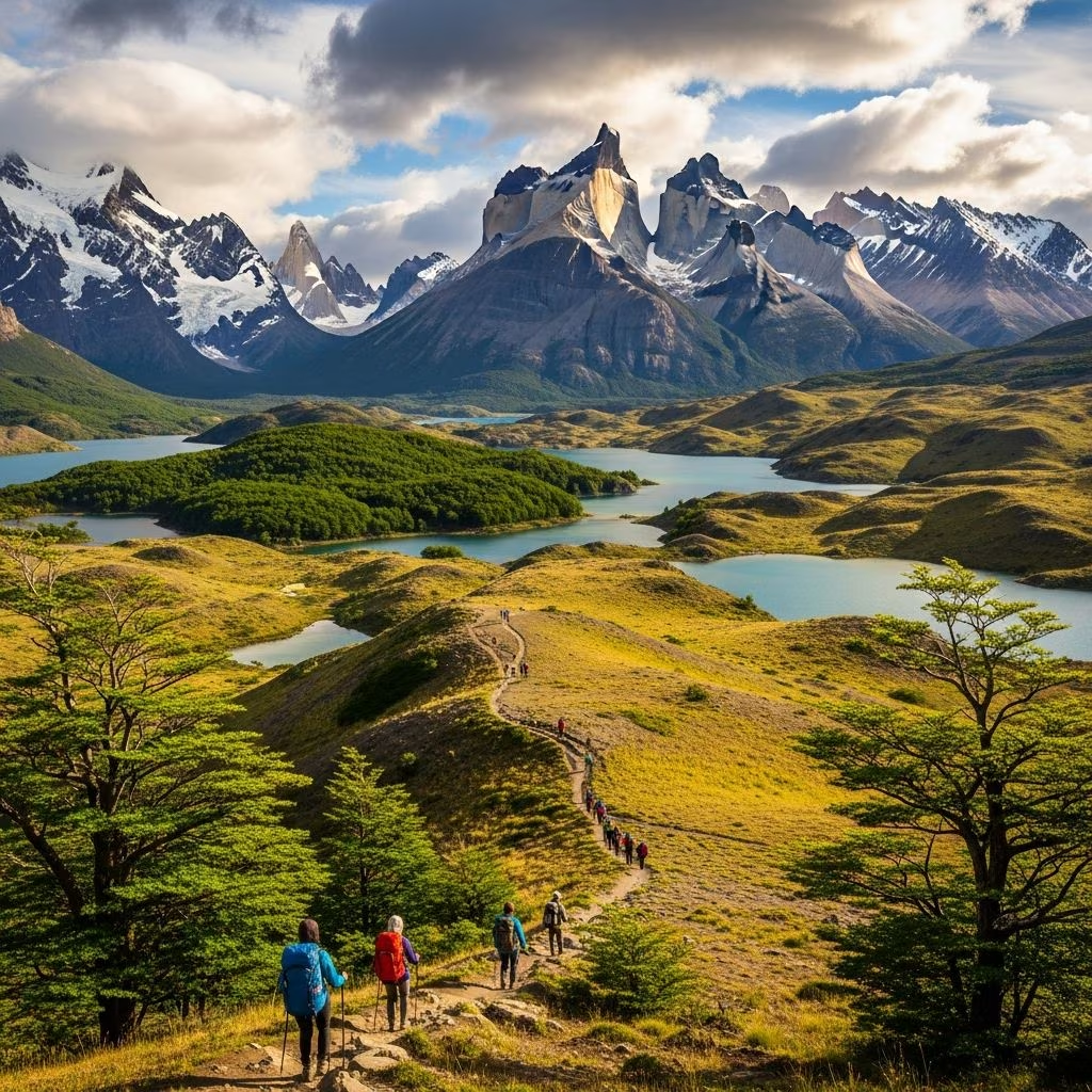
Complete guide to Patagonia's top trekking destinations, from day hikes around El Chaltén to multi-day expeditions in Torres del Paine and Tierra del Fuego.
 Travel Essentials
The mountainous regions of southern South America represent some of the world’s most pristine and dramatic landscapes for outdoor enthusiasts. Encompassing vast stretches of Patagonia across Argentina and Chile, as well as the remote territory of Tierra del Fuego, this area offers an unparalleled collection of trekking opportunities that range from accessible day walks to challenging multi-day expeditions. Whether you’re seeking towering granite peaks, turquoise glacial lakes, or solitary mountain wilderness, the trails in this region deliver experiences that attract adventurers from every corner of the globe.
The town of El Chaltén serves as the primary hub for accessing numerous trails in the northern Patagonian region. Located within Parque Nacional Los Glaciares in Argentina, this compact settlement has earned its reputation as a trekking capital due to its concentration of well-maintained pathways and its proximity to iconic geographical features. The town’s strategic location at the base of dramatic mountain terrain provides an ideal starting point for both novice hikers and experienced mountaineers.
Farther south in Chile, the Torres del Paine National Park stands as another major destination for serious trekkers seeking extended wilderness experiences. This park encompasses over 242,000 hectares and is renowned for its distinctive granite spires, pristine rivers, and expansive ice fields. Meanwhile, Tierra del Fuego, located at the southernmost tip of South America, offers a different character of trekking—characterized by beech forests, remote mountain ranges, and views across the Beagle Channel.
One of the region’s most celebrated single-day hikes involves ascending to the viewpoint overlooking the base of Mount Fitz Roy, known locally as Cerro Chaltén. This moderate-difficulty route covers approximately 25 kilometers (15.5 miles) on a round-trip basis and typically requires 8 to 10 hours to complete. The well-marked trail begins from the northern end of El Chaltén’s main street and winds through native ñire woodlands—a species of southern beech indigenous to Patagonia.
Hikers progressing along this route encounter several transitional landscapes before reaching their destination. The path leads past the striking turquoise waters of Laguna Capri, a smaller alpine lake that offers photographic opportunities and a convenient rest stop. Beyond this point, the trail traverses boggy terrain that can be challenging during wet conditions. The journey continues to Campamento Poincenot, a popular bivouacking location for climbers attempting to scale Fitz Roy itself.
The final ascent toward the viewpoint demands the most effort, with elevation gains concentrated in the upper portions of the hike. However, the payoff justifies the exertion—the vista of Fitz Roy’s granite faces illuminated by morning or evening light represents one of the most photographed mountain scenes in the Southern Hemisphere. Optimal conditions occur on days with minimal wind, which can make the exposed upper sections hazardous.
An alternative or complementary day hike from El Chaltén leads to another glacial lake beneath a different set of iconic peaks. This route typically requires 8 hours of walking time and covers approximately 23 kilometers in a loop configuration. The moderate difficulty rating makes it accessible to reasonably fit hikers without specialized mountaineering experience.
One of South America’s most famous trekking routes traces a path shaped like the letter W through Torres del Paine National Park in Chilean Patagonia. This 74-kilometer (46-mile) one-way trek typically occupies 3 to 5 days and begins at Refugio Grey, concluding at the Las Torres viewpoint. Hikers encounter three distinct valleys during this journey, each presenting its own aesthetic and technical challenges.
Accommodation flexibility on the W route allows trekkers to choose their preferred travel style. Traditional camping at designated sites along the route suits budget-conscious travelers and those seeking authentic wilderness experiences. Alternatively, a network of mountain refugios (bunk hut accommodations) provides weatherproof shelter and hot meals. A relatively new option involves glamping—luxury camping with enhanced amenities—though this represents the premium option. Regardless of accommodation choice, advance booking is essential, as the park’s renowned popularity means facilities fill months before peak season.
The directional approach matters strategically. Hiking west to east while camping allows trekkers to consume most of their food supplies during the less demanding initial stages, reducing load weight during the steeper climbs toward the granite towers that give the park its name. The granite spires themselves form the route’s most iconic landmark, rising nearly vertically from the landscape and creating an unforgettable visual impression.
For trekkers seeking a more comprehensive Patagonian experience, the complete circuit loop through Torres del Paine stretches 110 kilometers (68 miles) and typically requires 6 to 10 days to traverse. Beginning at Serón campsite, this longer route incorporates the W route while extending the journey through additional terrain and crossing higher mountain passes.
The most technically demanding section involves crossing the John Gardner Pass, which reaches an elevation of 1,220 meters (4,002 feet). This crossing demands careful navigation and appropriate fitness levels, as weather conditions in Patagonia can change rapidly and dramatically affect mountain passage viability. Upon summiting Gardner Pass, trekkers experience a remarkable vista as the Grey Glacier ice field unfolds below—described as resembling a vast, frozen river.
Like the W route, the circuit accommodates multiple travel styles, with the option to camp throughout or utilize the refugio network. The combination of technical mountain passes, expansive glacier views, and diverse terrain makes the circuit route a premier choice for serious trekkers.
The southernmost Argentine city of Ushuaia functions as the gateway for exploring Tierra del Fuego’s trekking opportunities. Several accessible day hikes originate from this location, ranging from moderate walks to challenging mountain expeditions. The Laguna Esmeralda hike represents one of the more accessible options, leading to a pristine glacial lake with distinctive turquoise coloration nestled within the Susana and Martial mountain ranges. This walk suits hikers of moderate fitness levels and provides stunning views across the Beagle Channel.
More challenging day hikes from Ushuaia include the Vinciguerra route, which originates from Andorra Valley and demands substantial cardiovascular fitness. This demanding ascent rewards successful climbers with panoramic mountain vistas and a genuine sense of accomplishment. The Carabajal hike offers similar difficulty levels and rewards with comparable scenery.
The Ojo del Albino Glacier represents another full-day objective, forming a complete loop through the mountains that leads to the frozen cliff face of this glacier formation. The variety of difficulty levels available from a single base location makes Ushuaia an ideal headquarters for trekkers with varying experience levels.
Across the Beagle Channel on Navarino Island, Chile’s southernmost permanently inhabited territory hosts a demanding long-distance trekking route. The Dientes del Navarino circuit loops around the distinctive pinnacles of the mountain range after which it’s named. This wilderness experience demands wild camping capabilities, excellent navigation skills, and preparation for exposed terrain on exposed ridgelines.
The route functions best when hiked in a clockwise direction and requires at least one additional companion for safety considerations. The combination of technical terrain, remote location, and challenging weather patterns makes this trek suitable only for experienced mountain travelers. However, those with appropriate skills discover extraordinary solitude and untrammeled mountain scenery rarely encountered elsewhere.
Trekking conditions in this region vary dramatically depending on season. The austral summer months—December through February—provide the most favorable conditions, with warmer temperatures, longer daylight hours, and more stable weather patterns. November and March offer shoulder-season opportunities with fewer crowds, though conditions can be less predictable. Winter months bring snow, shorter daylight, and extreme weather that makes most routes significantly more challenging or impassable.
| Trek Name | Distance | Duration | Difficulty | Best Season |
|---|---|---|---|---|
| Laguna de Los Tres | 25 km round trip | 8-10 hours | Moderate | Dec-Mar |
| W Route (Torres del Paine) | 74 km one way | 3-5 days | Moderate | Nov-Mar |
| Circuit Route (Torres del Paine) | 110 km loop | 6-10 days | Moderate | Nov-Mar |
| Dientes del Navarino | Variable | 5-7 days | Challenging | Dec-Feb |
| Laguna Esmeralda (Tierra del Fuego) | Variable | 4-6 hours | Moderate | Nov-Apr |
Due to environmental protection policies and management strategies, certain accommodations and camping locations in Torres del Paine require advance reservations. These bookings often fill several months before peak season, necessitating early planning for popular route segments. Private refugios and camping operators maintain online booking systems that allow international trekkers to secure locations from remote locations.
Ground transportation to trailheads varies by location. El Chaltén remains accessible by bus from larger regional centers. Torres del Paine National Park has established access roads and shuttle services for visitors. Tierra del Fuego hikes typically depart from Ushuaia, accessible by domestic flights or long-distance bus services.
Day hikes like Laguna de Los Tres demand moderate fitness—the ability to walk continuously for several hours with elevation gain. Multi-day treks require greater endurance and acclimatization to extended physical exertion on consecutive days. High-altitude trekking like the Dientes del Navarino circuit requires substantial fitness and mountaineering experience.
Layered clothing is essential due to rapid weather changes. Waterproof jackets and pants, insulating layers, sturdy hiking boots, and sun protection are fundamental. Multi-day expeditions require lightweight camping equipment, water treatment methods, and energy-dense food supplies. Weather-protective gear assumes heightened importance given Patagonia’s notorious wind conditions.
Day hikes from El Chaltén use well-marked trails navigable without guides. Longer expeditions, particularly the Dientes del Navarino circuit, benefit greatly from guide services for safety and navigation. Torres del Paine routes remain self-guided for experienced trekkers, though guides enhance interpretation and safety during challenging sections.
Weather changes occur rapidly and can create dangerous conditions on exposed terrain. River crossings, particularly during high-flow periods, present technical challenges. Altitude, though not extreme, requires acclimatization. Wildlife encounters remain rare but possible—informed travelers respect the region’s fauna.
These pristine environments demand respectful visitor behavior. Leave-no-trace principles apply universally—pack out all waste, camp only in designated areas, and follow established trail routes to prevent erosion. The regions’ delicate ecosystems support unique plant and animal communities found nowhere else on Earth. Responsible trekking ensures these landscapes remain available for future generations.
The combination of dramatic mountain scenery, diverse trekking options, and accessible infrastructure makes Patagonia and Tierra del Fuego premier destinations for adventure travelers seeking meaningful wilderness experiences in one of the world’s most spectacular regions.
