

 Travel Essentials
 Travel Essentials

Discover Edinburgh's authentic character by walking through its diverse neighborhoods, from Victorian tenements to volcanic peaks and urban green spaces.
 Travel Essentials
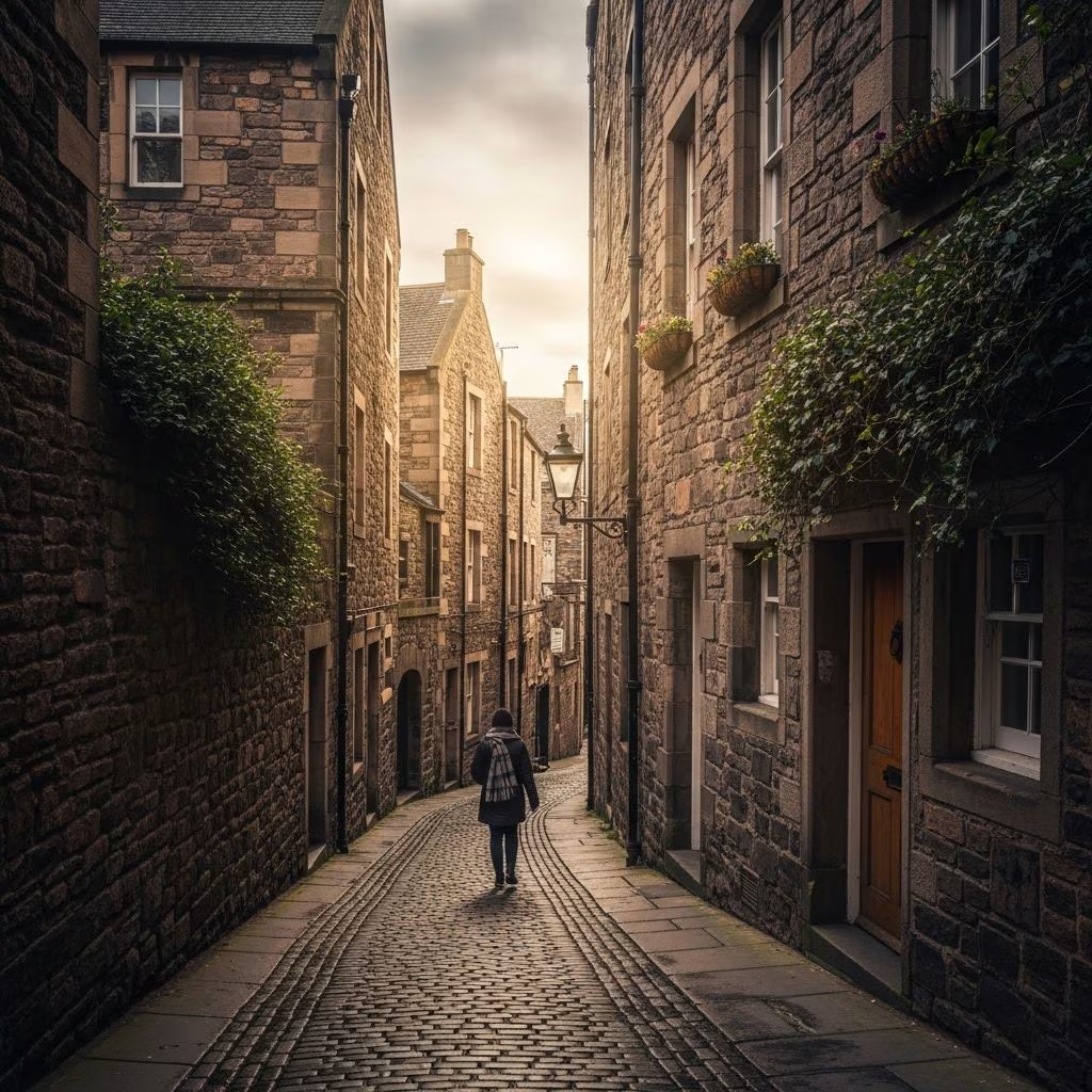
Edinburgh’s true character emerges not from guidebook highlights alone, but through deliberate exploration on foot. The Scottish capital rewards walkers with unexpected perspectives—sudden glimpses of volcanic mountains between tenement buildings, quiet lanes connecting bustling commercial streets, and neighborhoods where locals gather without tourist crowds. This walking guide introduces visitors and residents alike to routes that reveal how the city’s architecture, geography, and community life interweave.
The city’s compact geography and dramatic topography make pedestrian exploration particularly rewarding. Edinburgh’s famous hills—particularly Arthur’s Seat rising above Holyrood—create natural waypoints and viewing platforms that organize walking itineraries. The Victorian tenement flats that characterize many neighborhoods provide architectural continuity while housing independent businesses that reflect local tastes rather than international chains.
Walking enables gradual transitions between distinct neighborhoods that might blur together when viewed from vehicles. A pedestrian route naturally incorporates discovery—noticing shop frontages, overhearing conversations, observing how different districts transition architecturally and socially. This slower pace aligns with how Edinburgh locals navigate their own city, prioritizing substance over speed.
Beginning from Easter Road, walkers enter a neighborhood that feels removed from city-center congestion despite its proximity. This district showcases Edinburgh’s characteristic Victorian housing stock—dense tenement buildings that housed working-class residents during the industrial era and now attract professionals seeking authentic urban living.
Independent cafes and specialized retailers line Easter Road and its surrounding streets. These establishments typically feature local ownership and merchandise reflecting neighborhood demographics rather than homogenized corporate branding. Coffee shops offering handcrafted pastries and locally-roasted beverages serve as natural rest points, allowing walkers to observe neighborhood rhythms.
From Easter Road, the walking route curves southward through Abbeyhill, where residential streets gradually transition toward the volcanic landscape that dominates southeastern Edinburgh. This zone represents the meeting point between dense urban development and dramatic natural geography—a recurring theme throughout Edinburgh’s landscape.
Edinburgh’s topography presents both challenge and reward for pedestrian explorers. Abbey Mount exemplifies the city’s dramatic elevation changes—a steep climb that seems improbable within an urban setting yet provides access to unexpected views and landscape transitions.
The effort of ascending Aberdeen Mount yields views of Arthur’s Seat, the extinct volcanic peak that dominates Edinburgh’s skyline. This 251-meter mountain creates a striking visual moment when first glimpsed between buildings—the sudden appearance of primal geology amidst urban density. Experienced walkers recognize that Edinburgh’s most memorable moments often require physical effort and persistence.
Queen’s Drive circles Arthur’s Seat’s perimeter, offering an alternative to direct ascent. This route accommodates various fitness levels while providing access to the volcanic landscape. St Margaret’s Loch, positioned on Arthur’s Seat’s lower slopes, attracts waterfowl including notably territorial swans. The contrast between pastoral lakeshore scenery and adjacent residential blocks epitomizes Edinburgh’s characteristic juxtaposition of nature and urbanization.
The walk from northeast neighborhoods toward Arthur’s Seat crosses multiple architectural and chronological zones. Medieval Old Town closes and narrow wynds give way to Georgian New Town terraces, followed by Victorian tenements, and finally modern residential blocks surrounding the volcanic landscape.
This progression reflects Edinburgh’s expansion across several centuries. Each layer represents distinct planning philosophies, economic conditions, and architectural fashions. Walking through these zones sequentially provides tangible understanding of how cities evolve rather than static historical knowledge.
The contrast between sheer rock faces and surrounding residential development creates Edinburgh’s distinctive visual character. Few major cities contain active volcanic geology so prominently positioned within urban boundaries. This geological heritage influences not only landscape but also cultural identity—Edinburgh recognizes its dramatic geography as a defining characteristic distinguishing it from other British cities.
While the Easter Road to Arthur’s Seat route provides excellent introduction to northeastern Edinburgh, the city contains numerous other pedestrian-friendly corridors serving different interests and fitness levels.
The Water of Leith towpath offers significant distance options through established green corridors. This riverine route traverses both urban and suburban zones, with particularly scenic sections between Dean Village and Stockbridge. The consistent presence of water creates contemplative walking conditions—an advantage for those seeking meditative outdoor time.
The Union Canal provides another water-level alternative, beginning at Fountainbridge in the city center and extending into peripheral green areas. The towpath accommodates various speeds and fitness levels while maintaining separation from vehicular traffic. Narrow boats, leafy embankments, and occasional cafes punctuate the walking experience.
For visitors prioritizing historical sites, the Royal Mile connects Edinburgh Castle at the summit with the Palace of Holyroodhouse at lower elevation. This processional route historically served coronation ceremonies and state occasions. The surrounding Old Town closes and narrow streets retain medieval character despite heavy tourist presence.
Edinburgh’s circumnavigation walk extends 45 miles across multiple sections, circumscribing the city’s outer boundaries. This ambitious route provides quiet alternatives to city-center walking, threading through suburban, post-industrial, and rural hinterland zones. Experienced walkers completing the full circuit gain comprehensive understanding of how Edinburgh sprawls and what landscape types characterize its periphery.
The Lothian-90 walk covers 90 miles across West, Mid, and East Lothian—the broader region surrounding Edinburgh. This multi-day expedition requires advanced fitness and planning but offers immersion in Scottish lowland landscapes beyond urban areas.
Such extended routes appeal to dedicated walkers seeking challenge, endurance testing, and comprehensive landscape exposure. They contrast sharply with neighborhood strolls focused on accessible discovery within limited geographic areas.
South Queensferry, positioned north of Edinburgh along the Forth estuary, offers waterside walking combining coastal scenery with historical significance. The iconic Forth Rail Bridge dominates views from various positions along coastal paths. Dalmeny Estate loop walks provide countryside character accessible within 30 minutes from the city center.
Portobello Beach and Newhaven Pier provide alternative waterside walks emphasizing maritime character over volcanic geology or Victorian architecture. These routes appeal to visitors seeking seaside experiences without traveling to distant coastal destinations.
| Walking Distance | Estimated Duration | Difficulty Level | Best Season |
|---|---|---|---|
| 1-2 miles | 30-45 minutes | Easy | Year-round |
| 2-4 miles | 45-90 minutes | Moderate | Spring-Fall |
| 5+ miles | 2+ hours | Challenging | Late spring-Early fall |
| 45+ miles | Multiple days | Very challenging | Extended warm season |
Edinburgh’s weather patterns significantly influence walking comfort and safety. Spring through early autumn typically provide optimal conditions with longer daylight hours and milder temperatures. Winter routes require consideration of reduced daylight and occasional icy conditions on steep hills.
Public transportation integration enhances walking flexibility. Most neighborhoods remain within 15-20 minutes of central transit hubs, allowing walkers to contract or expand routes based on available time or emerging fatigue. Bus systems connect peripheral walking zones to the city center, enabling partial routes without requiring return walks.
Appropriate footwear matters considerably on routes featuring steep elevation changes and varied terrain. While casual sneakers suffice for flat urban routes, volcanic hills and muddy rural sections benefit from proper hiking footwear providing ankle support and grip.
Local routes typically connect residential neighborhoods and independent businesses rather than major attractions. They traverse zones where residents conduct daily activities rather than zones designed for visitor consumption. Such routes reveal authentic neighborhood character including architectural details, local commerce preferences, and community gathering spaces.
Edinburgh’s dramatic topography means routes can shift from flat to steep within short distances. A 2-mile route might feel more strenuous than a 4-mile relatively flat route. Routes incorporating Arthur’s Seat or similar volcanic peaks demand considerably more physical effort than water-level towpath walks.
Most urban neighborhood routes remain accessible throughout the year, though winter weather occasionally impacts hillside routes. Coastal and rural routes may present challenging conditions during storms or after heavy rainfall. Spring through autumn generally provide optimal walking conditions without weather constraints.
Neighborhood routes naturally include cafes serving local communities. Independent coffee shops, traditional pubs, and casual restaurants punctuate most routes. Water-based routes including Union Canal and Water of Leith include periodic cafes positioned to serve walkers and cyclists.
Yes—Edinburgh offers routes ranging from completely flat urban walks to strenuous volcanic peak ascents. Walkers can select routes matching current fitness, time availability, and interest preferences. Most longer routes allow shortening by exiting at intermediate transit access points.
Rather than following predetermined routes exclusively, walkers gain maximum enjoyment by adapting suggested paths based on emerging interests. Noticing interesting shop frontages, street art, or architectural details justifies deviation from planned routes. Discovery—rather than completing specific distance targets—should guide walking pace and decisions.
Combining multiple shorter routes across different visits builds comprehensive neighborhood familiarity over time. This approach aligns with how longtime residents develop their cities—through gradual, repeated exposure rather than comprehensive single expeditions.
Photography enthusiasts should recognize that certain routes offer superior photographic opportunities at particular times. Arthur’s Seat views shift throughout the day as lighting angles change. Golden hour—the period shortly before sunset—transforms ordinary scenes into dramatic compositions.
Edinburgh rewards pedestrian exploration through its compact geography, dramatic natural features, and vibrant neighborhood character. Walking enables discovery impossible through motorized transportation—revealing how neighborhoods transition architecturally, where locals source daily necessities, and how geography continues shaping urban development centuries after geological formation.
The routes described here represent starting points rather than definitive prescriptions. Each walker develops personal preferences through repeated exposure to different neighborhoods and seasons. Such exploration transforms Edinburgh from tourist destination into lived experience—the distinction between visiting a city and knowing it.
