

 Travel Essentials
 Travel Essentials

Discover Big Sur's stunning coastline, state parks, beaches, and Highway 1 stops. Plan your perfect road trip with hikes, lodging, and dining recommendations.
 Travel Essentials
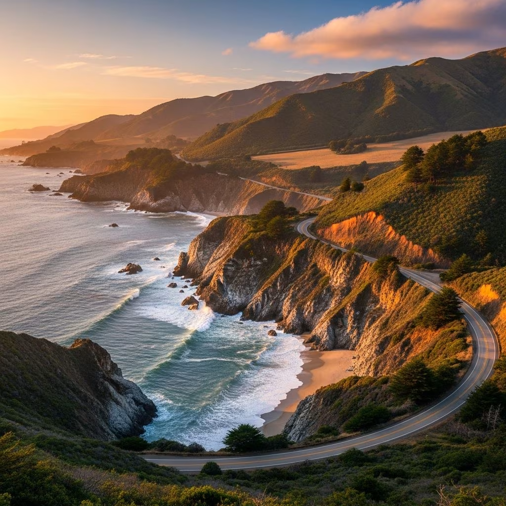
Big Sur stretches along California’s dramatic Pacific Coast Highway, offering a 90-mile expanse of untouched wilderness where towering redwoods meet crashing waves. This rugged region captivates with its blend of state parks, hidden beaches, and panoramic vistas, making it a must-visit for road trippers and nature enthusiasts.
Renowned for its undeveloped shoreline, Big Sur derives its name from the Spanish ‘el sur grande,’ meaning ‘the big south,’ positioned 25 miles south of Monterey. The area features steep mountains plunging into the ocean, creating one of the most scenic drives in the U.S. along Highway 1. Visitors flock here for outdoor adventures, from hiking through ancient forests to spotting marine life, with peak seasons from April to October offering mild weather and wildflower blooms.
Its isolation enhances the allure—no public transit means a car is essential, turning every journey into an intimate exploration of nature’s raw power. Whether you’re chasing sunsets at purple-sand beaches or wandering fern-lined trails, Big Sur delivers serenity amid grandeur.
Start in Monterey or Carmel-by-the-Sea, just north, accessible from San Francisco International Airport (about 2.5 hours away). Head south on Highway 1, California’s iconic Pacific Coast Highway, known for its narrow, winding path with sheer drop-offs and limited pullouts. Allow 4-6 hours for the full 90-mile traverse to San Simeon, factoring in stops, as closures from landslides can occur—check Caltrans updates before departing.
Best times: Early fall for fewer crowds or spring for calla lilies and superbloom wildflowers. Book campsites or lodges six months ahead, especially in Pfeiffer Big Sur State Park, dubbed ‘mini Yosemite’ for its redwood groves and creeks. Fuel up in Carmel, as gas stations are sparse within Big Sur.
This flexible 3-day loop covers 60-70 miles, with options to extend for camping or whale watching in winter.
Big Sur’s landmarks define California dreaming. Bixby Creek Bridge, 15 miles south of Carmel, is an architectural marvel from 1932, spanning a chasm with ocean views that demand a photo stop—park on the south side for the classic shot. Nearby, McWay Falls in Julia Pfeiffer Burns State Park tumbles 80 feet directly onto a sandy beach, a rare ‘ocean waterfall’ best viewed from an overlook trail.
| Park | Highlights | Trail Difficulty | Entry Fee |
|---|---|---|---|
| Point Lobos State Natural Reserve | Cypress trees, sea otters, coastal trails | Easy to moderate | $10/vehicle |
| Pfeiffer Big Sur State Park | Redwoods, Pfeiffer Falls, river views | Easy (Nature Trail) to strenuous | $10/vehicle |
| Andrew Molera State Park | Bluffs Trail, beach access, meadows | Easy | $10/vehicle |
| Garrapata State Park | Waterfalls, beaches, wildflowers | Moderate | Free |
Point Lobos offers well-signed trails amid Monterey cypress, ideal for beginners with ocean panoramas. Garrapata shines in spring with lily valleys and creek-side hikes leading to secluded coves.
Pfeiffer Beach steals the show with its violet sand from manganese garnet, framed by the Keyhole Arch rock formation—perfect for sunsets. Access via a narrow, 2-mile road off Highway 1 (no RVs); $12 fee. Sand Dollar Beach, in Los Padres National Forest, spans 0.5 miles with picnic spots and day-use fees, great for families.
Beaches here are wild—strong currents mean no swimming; focus on lounging and exploring.
Big Sur boasts over 100 miles of trails through redwood canopies and bluff edges. Beginners love Pfeiffer’s 0.5-mile Nature Trail, a self-guided loop with creek crossings. Ewoldsen Trail (4.5 miles) weaves past redwoods to a canyon overlook, while Partington Cove Trail (2 miles) descends to a hidden cove with a tunnel to the sea.
Moderate options include Andrew Molera’s 2-mile Creamery Meadow Trail over the Big Sur River and Valley View Trail for 360-degree vistas. Advanced hikers tackle Buzzard’s Roost or Pfeiffer Falls’ 2-mile loop to a 60-foot cascade. Always pack water, as facilities are minimal.
Options range from luxury resorts to primitive campsites. Camp in Pfeiffer Big Sur State Park—sites book fast, with redwood-shaded spots near the river. Ventana Big Sur offers glamping tents with ocean views, while Treebones Resort features yurts and sushi-to-go.
Budget picks: Big Sur Lodge cabins or Kirk Creek Campground on bluffs. Luxury: Post Ranch Inn’s cliffside rooms with infinity pools. No chain hotels—embrace the rustic vibe.
Fresh seafood and farm-to-table fare dominate. Nepenthe offers cliffside burgers with panoramic views; Big Sur Roadhouse serves wood-fired pizzas. For picnics, grab provisions in Carmel. Treebones’ oceanfront sushi and organic eateries like Fernwood Resort highlight local ingredients.
Don’t miss Henry Miller Memorial Library events, blending literature with light bites amid redwoods.
Drive cautiously—narrow roads, no shoulders. Electric vehicles: Sparse chargers, plan ahead.
Yes, with Highway 1 fully reopened post-repairs, expect prime conditions for exploration[10].
3-5 hours straight, but allocate a full day for stops.
No—sites fill months ahead; dispersed camping limited.
Spring/fall for mild temps and fewer crowds.
Leashed in developed areas; restricted on trails/beaches.
Extend north to 17-Mile Drive in Pebble Beach for Lone Cypress views ($10.50 fee) or south to Hearst Castle’s opulent tours. Monterey Bay Aquarium pairs perfectly for families.
Big Sur isn’t just a destination—it’s a reset, where highway curves reveal endless ocean, inviting you to slow down and breathe in the wild California coast.
