

 Travel Essentials
 Travel Essentials

Explore a comprehensive guide to reaching Colombia's pre-Columbian Teyuna ruins through the Sierra Nevada jungle, covering preparation, logistics, and what to expect.
 Travel Essentials
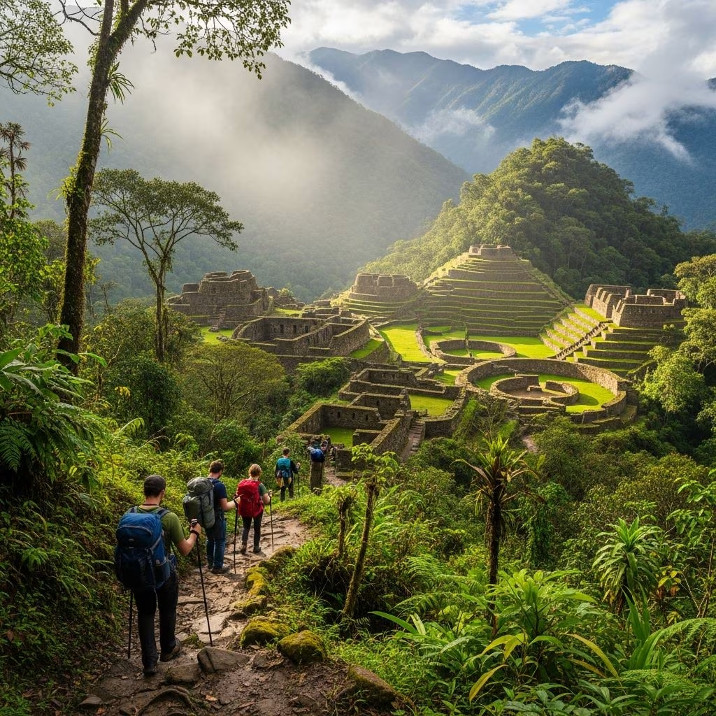
Deep within Colombia’s northwestern mountains lies one of South America’s most captivating archaeological treasures. The journey to reach this ancient site represents far more than a simple hiking expedition—it is an immersion into the heart of pristine jungle terrain, encounters with indigenous communities who maintain ancestral traditions, and a physical test that separates casual walkers from dedicated adventurers. This extensive guide equips you with the knowledge needed to navigate this transformative experience successfully.
The ruins known locally as Teyuna, or more commonly referred to as Ciudad Perdida (Lost City), stand as testimony to sophisticated Pre-Columbian engineering and urban planning. Constructed approximately eight centuries before the Spanish arrived in the Americas, this settlement emerged around 800 AD as a thriving center of the Tairona civilization. The site remained hidden from the outside world until its rediscovery in the 1970s, earning its designation as the “lost city.” Approximately 2,000 stone structures have been catalogued within the archaeological complex, suggesting a population that once numbered in the thousands.
The location within the Sierra Nevada de Santa Marta mountain range was no accident. The Tairona people strategically positioned their settlements to maximize access to resources while maintaining defensible positions. The elevation and geographical features created a self-contained ecosystem that supported agriculture, trade, and cultural development. Today, the Kogui and Wiwa indigenous peoples maintain their presence in the Sierra Nevada, continuing traditions descended from the original Tairona inhabitants.
The expedition typically spans four days and three nights, though variations of three to six days are available depending on fitness levels and personal preferences. The journey covers approximately 44 kilometers through diverse terrain, with cumulative elevation changes exceeding 3,600 feet. Most trekkers report that the four-day option provides the optimal balance between physical challenge and recovery time.
The route begins in one of several gateway towns, with the primary departure point being Mamey. From here, the trail winds through jungle terrain, crosses multiple river systems via suspension bridges, and climbs through various ecosystems ranging from lush lowland vegetation to alpine grasslands. The expedition concludes with the most iconic segment—ascending 1,200 individual stone steps carved into the mountainside, leading directly to the central plaza of the archaeological site.
The initial day typically involves approximately four to six hours of hiking, though the intensity varies considerably. Most departures occur early in the morning from accommodation in the gateway town. After collecting provisions and meeting your guide team, the ascent begins almost immediately, with sustained elevation gain that can feel challenging even for experienced hikers. The first day pushes through 1,300 feet of vertical climbing to reach the first significant waypoint, where local families often operate small refreshment stations offering tropical fruits and beverages.
Overnight accommodation on day one typically occurs at a basic camp featuring dormitory-style sleeping arrangements with mosquito protection. Meals are prepared on-site and designed to provide substantial nutrition for the following day’s exertion. Many trekkers report that this first evening involves significant adjustment to the humidity, insect presence, and basic amenities.
The second day presents a different physical challenge than day one. Rather than sustained climbing, this segment involves navigating along ridge lines with rolling elevation changes—local guides frequently describe these sections as “Colombian flats” despite the continued undulating terrain. The day’s hiking covers over 10.5 miles, requiring sustained effort across varying topography. Waypoints include Mono Pecas and Mumake Camp, where the midday meal occurs at a location typically featuring a swimming opportunity. Rivers and natural water sources provide cooling relief and the psychological boost of aquatic recreation amid physically demanding hiking.
Day three begins with pre-dawn departures, typically between 5:00 and 6:00 AM. The short forty-five minute hike to the archaeological site represents the culmination of multi-day preparation. Upon arrival, trekkers join hundreds of fellow visitors in ascending the famous 1,200 stone steps, an experience often described as simultaneously awe-inspiring and physically punishing. The final vertical ascent, combined with the emotional weight of reaching the destination, creates an intensity that distinguishes this final segment from earlier portions of the trek.
Time at the archaeological site typically allows three to four hours for exploration, guided interpretation, and photography before the return journey begins. The descent from Teyuna retraces the incoming route but presents different physical challenges. The 2,300-foot descent over several hours requires careful foot placement and sustained attention to footing. Most trekkers report that the downward journey feels more technical and physically demanding than the ascent, despite gravity providing assistance.
Adequate preparation significantly enhances the trek experience and reduces injury risk. Recommended training protocols should span 8-12 weeks prior to departure and emphasize cardiovascular endurance, lower body strength, and elevation acclimation.
Arrive in Colombia 2-3 days before your scheduled trek to acclimate to tropical climate conditions and establish baseline hydration. Initial elevation exposure to Santa Marta or nearby towns provides physiological adjustment before entering the mountains.
Successful trekking depends significantly on appropriate equipment selection. The tropical rainforest environment requires protection from precipitation, insects, and challenging terrain.
| Equipment Category | Recommended Items |
|---|---|
| Footwear | Waterproof hiking boots with ankle support, lightweight trail shoes for camp use |
| Clothing | Moisture-wicking shirts, lightweight rain jacket, quick-dry pants, extra socks |
| Protection | Insect repellent (DEET-based), sunscreen, first aid kit, blister treatment supplies |
| Hydration | Reusable water bottle or hydration pack (3-liter capacity minimum), electrolyte tablets |
| Sleep System | Lightweight sleeping bag rated for 60-70°F, sleeping pad for insulation |
Most trekking companies provide accommodation and meals throughout the expedition, significantly reducing individual packing requirements. Personal items should be consolidated into a backpack no larger than 25-30 liters to maintain comfort and prevent excessive strain during long hiking days.
The trek passes through territories inhabited and maintained by the Kogui people, who continue to practice traditions descended from their Tairona ancestors. These interactions represent one of the trek’s most meaningful dimensions, though they require thoughtful approach and genuine respect.
Approaching these encounters with humility and recognition of your guest status substantially enriches the experience for both visitors and community members.
Several established trekking companies operate along standardized routes from gateway towns. Tours typically include transportation to the starting point, all meals during the expedition, camp accommodations with basic amenities including beds and mosquito protection, guide services, and return transportation. Typical costs range from $600 to $1,000 USD depending on group size and operator selection. Independent trekking without official guides is not permitted due to archaeological site protections and trail management regulations.
Booking should occur 2-4 weeks in advance to secure dates and allow for any necessary visa or health documentation preparation. Many operators accept online reservations with deposit requirements. The wet season (May-November) typically experiences heavier rainfall but involves fewer trekkers and lower prices. The dry season (December-April) offers more predictable weather but includes substantially increased trail traffic.
While not technically a high-altitude trek, reaching approximately 5,000 feet elevation can trigger mild altitude-related symptoms in unaccustomed individuals. More significant health concerns include mosquito-borne illnesses and gastrointestinal challenges from unfamiliar water sources and food preparation conditions.
The sustained physical exertion, heat exposure, and elevation combine to increase caloric demands substantially. Camp meals typically provide 4,000-5,000 calories daily to meet actual energy expenditure. Supplementary snacks like energy bars or trail mix prove valuable for maintaining energy levels during extended hiking segments.
The moment of reaching Teyuna justifies the multi-day exertion. The site itself comprises dispersed stone platforms, ceremonial structures, and residential foundations arranged on terraced mountainsides. The central plaza, reached after ascending the final stone steps, represents the primary gathering point where trekkers congregate and guides provide historical interpretation.
The physical layout reveals sophisticated urban planning adapted to challenging terrain. Drainage systems, residential groupings, and ceremonial spaces suggest a complex society organized around religious and administrative centers. The 2,000 catalogued structures indicate substantial population concentration and extended occupation spanning centuries.
Atmospheric conditions at the site frequently include cloud coverage that obscures distant views, a phenomenon related to the Sierra Nevada’s role as a moisture condenser for regional weather systems. Early morning or late afternoon visits occasionally provide clearer visibility of surrounding mountains and valleys.
December through April offers more stable weather patterns, though July-August provides an alternative dry window. May through November features increased rainfall but significantly fewer trekkers and lower costs.
The Ciudad Perdida trek ranks as moderate-to-difficult for average fitness levels. It presents less technical difficulty than mountaineering but demands greater sustained aerobic effort than many day hikes.
Children as young as ten have successfully completed the trek, while trekkers in their seventies regularly participate. The key factor is cardiovascular fitness rather than absolute age.
Yes, five and six-day options spread hiking segments across additional days, reducing daily distances and elevating difficulty. These options suit those with limited fitness or those prioritizing cultural immersion over schedule efficiency.
Guides and porters can arrange for individual return to base towns. Most operators include insurance provisions for medical evacuation if necessary, though helicopter rescue in the remote Sierra Nevada remains exceptionally rare.
