

 Travel Essentials
 Travel Essentials

A comprehensive guide to the Colorado River Headwaters Byway, featuring scenic routes, outdoor activities, seasonal highlights, and travel recommendations.
 Travel Essentials
The Colorado River Headwaters Scenic Byway represents one of Colorado’s most captivating driving routes, stretching 80 miles through some of the state’s most dramatic mountain terrain. This National Scenic Byway, officially designated in 2005, connects Grand Lake to State Bridge, following a river that begins as a modest mountain stream and eventually becomes one of the western United States’ most critical water sources. For travelers seeking a combination of natural beauty, recreational opportunities, and accessible wilderness exploration, this route offers an unparalleled experience that showcases the Colorado River from its pristine origins.
The byway commences at Grand Lake, a historic resort community situated on the shores of Colorado’s largest natural lake, positioned just outside Rocky Mountain National Park’s boundaries. From this starting point, travelers head westward through several charming mountain towns before concluding their journey at State Bridge, where the road transitions into gravel terrain through the spectacular Upper Gore Canyon. The total distance of approximately 80 miles can be completed in approximately two to three hours of driving time, though most visitors benefit from allocating five to six hours to fully appreciate the scenery and explore secondary attractions along the way.
The primary route follows US Highway 34 westward from Grand Lake for approximately 43 miles, then transitions to Colorado Highway 1 (also known locally as Trough Road) for the final 25 miles to reach State Bridge. This well-maintained route is accessible via standard two-wheel-drive vehicles during most of the year, making it convenient for families and casual travelers. The highway generally parallels the Colorado River throughout the journey, providing consistent access to water views and numerous pullout opportunities for photography and rest.
Several mountain communities punctuate the scenic byway, each offering distinctive character and amenities for travelers. Moving from east to west, visitors encounter Granby, Hot Sulphur Springs, Parshall, and Kremmling before reaching the final destination at State Bridge. These towns serve as convenient waypoints for fuel, food, accommodations, and supplies, while also providing cultural insights into the region’s mining and ranching heritage.
State Bridge represents the eastern terminus and merits special attention as the journey’s conclusion point. This small community attracts younger outdoor enthusiasts and river sports aficionados due to its prime location along a particularly gentle section of the Colorado River. The State Bridge Lodge, one of the area’s earliest structures, functions simultaneously as both a traditional lodging establishment and a renowned live music venue, featuring performances from both nationally recognized and local artists against a backdrop of river views.
Kremmling serves as a central hub for visitors and is surrounded by three distinct national forests, making it an ideal base for extended exploration. The town’s strategic location provides access to numerous reservoirs, ranch lands, and river access points for both day trips and extended stays.
The byway’s most striking feature is its dramatic elevation change of 1,700 feet from beginning to end, creating the impressive geological narrative visible throughout the drive. This significant elevation drop translates into increasingly rugged terrain as travelers progress westward, with the landscape transforming from expansive meadows and open valleys into narrow, dramatic canyons carved by the river through ancient rock formations.
The terrain surrounding the byway reveals several distinct ecological zones. The upper elevations feature lush meadows and aspen groves typical of Colorado’s high country, while lower elevations showcase red rock gorges and narrow canyon walls composed of Precambrian gneiss and schist from the Gore Range. These geological features provide visual evidence of millions of years of erosion and river action, offering informal geology lessons to observant travelers.
The Gore Canyon section represents the byway’s most dramatic geological feature, where the Colorado River drops 68 feet per mile for three consecutive miles. This section creates the most challenging commercially-rafted stretch in Colorado and possibly the entire United States, demonstrating the river’s tremendous power in this confined canyon environment.
The Colorado River Headwaters Byway provides access to diverse recreational pursuits suitable for various skill levels and interests. The river itself offers world-class opportunities for fishing, rafting, and canoeing throughout different sections. Grand Lake, Shadow Mountain Reservoir, and Lake Granby represent prime destinations for boating, fishing, and water-based recreation, with facilities and access points clearly marked along the route.
Water Sports and Fishing
Wildlife Viewing and Nature Observation
Windy Gap Reservoir, situated near Granby, offers exceptional wildlife viewing opportunities where elk herds, coyotes, and diverse bird species can be observed in their natural habitat. The reservoir’s accessible shoreline provides multiple vantage points for photography and peaceful contemplation of the region’s abundant fauna.
Thermal Experiences
Hot Sulphur Springs, positioned along the byway route, provides access to natural hot springs where visitors can experience the therapeutic benefits of geothermal waters. These natural thermal features have attracted visitors for generations and continue to offer a unique wellness experience that complements outdoor recreation.
The byway remains accessible throughout the calendar year, though different seasons present distinct advantages and character. Summer and early fall are considered optimal periods, offering warm temperatures, clear skies, and fully accessible trails and recreational facilities. These seasons provide ideal conditions for water sports, hiking, and general sightseeing.
Summer Season (June-August) showcases verdant meadows, wildflower displays, and peak water flow in the river due to snowmelt from higher elevations. Water temperatures become suitable for comfortable rafting and kayaking experiences.
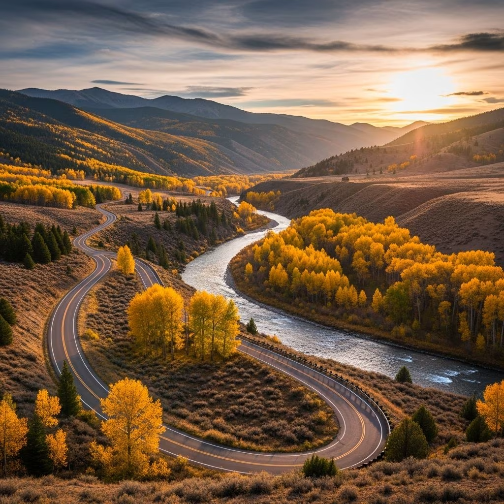
Fall Season (September-October) transforms the landscape with aspen trees displaying brilliant golden and orange foliage against evergreen forests. Cooler temperatures and reduced crowds make this period particularly attractive for photography and contemplative travel.
Winter Season (November-March) converts Grand Lake and surrounding areas into a winter recreation destination. Snowshoeing, cross-country skiing, and snowmobiling become primary activities, with approximately 130 miles of groomed snowmobile trails accessible in the region. Winter enthusiasts find the landscape transformed into a snow-covered wonderland offering peaceful solitude and unique photographic opportunities.
Spring Season (April-May) brings moderate temperatures and rapid snowmelt that increases river flow and creates favorable conditions for rafting and fishing. Spring wildflowers begin emerging as temperatures warm.
The Colorado River Headwaters Byway carries significant historical designation as one of 13 National Scenic Byways recognized within Colorado. This official designation reflects the route’s importance in preserving and celebrating the region’s natural heritage. The historical structures encountered along the route, including the State Bridge Lodge and various ranches, represent the region’s ranching and mining heritage, providing tangible connections to frontier Colorado.
While the byway traverses only 80 miles of the Colorado River, the complete river system extends approximately 1,320 to 1,450 miles from its mountain origins to the Colorado River Delta near the Gulf of California. This relatively short drive provides access to one of North America’s most critical water resources. Downstream from the byway’s terminus, the Colorado River transforms into a mighty waterway that irrigates vast agricultural regions and generates hydroelectric power for millions of residents across southwestern states including Utah, Wyoming, California, Arizona, New Mexico, and Nevada.
Understanding this contrast between the river’s modest mountain stream appearance at its headwaters and its continental significance downstream adds profound meaning to the byway experience. Visitors travel alongside the same water molecule pathway that eventually shapes landscapes hundreds of miles away and sustains ecosystems and human populations across vast regions.
Accessibility and Road Conditions
The byway utilizes maintained paved highways throughout most of its length, with the final section transitioning to well-maintained gravel road through Upper Gore Canyon. Standard vehicles with regular clearance can navigate this route comfortably during non-winter months. Winter travel may require additional caution due to snow accumulation, though the road typically remains passable with appropriate vehicles.
Duration and Pacing
While the drive itself requires only two hours for direct point-to-point travel, fully experiencing the byway warrants five to six hours minimum. Travelers planning to engage in recreational activities, explore communities, or visit specific attractions should allocate eight or more hours. Multi-day visits allow exploration of surrounding national forests and wilderness areas accessible from the main byway route.
Facilities and Services
The communities along the route provide conventional travel services including gasoline, restaurants, groceries, and accommodations ranging from budget options to upscale resorts. Grand Lake and Kremmling offer the most extensive service offerings, while smaller communities provide basic necessities. Planning ahead during peak seasons ensures availability of preferred accommodations.
Q: What is the best time to visit the Colorado River Headwaters Byway?
A: Summer and fall offer optimal conditions with warm weather, full accessibility, and clear skies. However, spring provides favorable water conditions for rafting, while winter offers unique snowmobile and skiing opportunities for cold-weather enthusiasts.
Q: Is the entire byway accessible by regular vehicles?
A: Yes, standard two-wheel-drive vehicles can complete the drive during most of the year. The final gravel section remains well-maintained and accessible to ordinary vehicles, though winter driving may require additional precautions.
Q: Are fishing licenses required?
A: Colorado fishing regulations require appropriate state fishing licenses for all anglers. Licenses can be obtained through Colorado Parks and Wildlife offices or online prior to arrival.
Q: What are the water conditions for rafting?
A: Water conditions vary seasonally based on snowmelt and precipitation. Spring and early summer typically provide higher water levels suitable for diverse rafting experiences. Professional outfitters can advise on current conditions and appropriate trip difficulty levels.
Q: Are there camping facilities along the byway?
A: Numerous national forest campgrounds and private RV facilities operate throughout the region. Grand Lake, Kremmling, and surrounding areas offer both developed campgrounds and dispersed camping options on national forest land.
