

 Travel Essentials
 Travel Essentials

Comprehensive guide to Copenhagen's public transportation including metro, S-trains, buses, harbor buses, and cycling options with practical tips for visitors.
 Travel Essentials
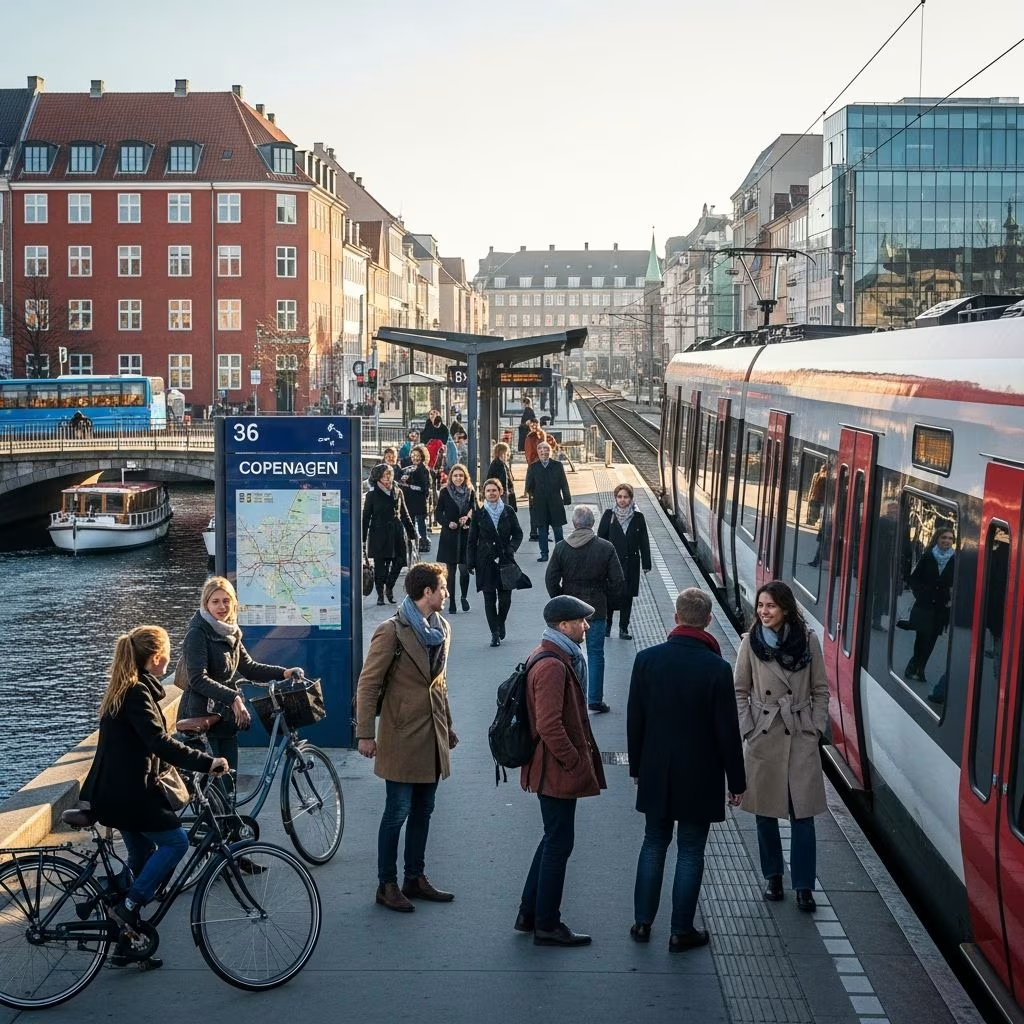
Copenhagen stands as one of Europe’s most sophisticated and accessible urban transportation networks, offering visitors and residents multiple efficient ways to explore this vibrant Scandinavian capital. Whether you arrive by plane, plan day trips to surrounding regions, or simply need to traverse the city’s diverse neighborhoods, understanding the available transit options ensures smooth navigation and maximum enjoyment of your Copenhagen experience.
Most international visitors begin their Copenhagen journey at Copenhagen Airport (CPH), located on Amager Island approximately 8 kilometers southeast of the city center. The airport’s convenient proximity to downtown means travelers can reach their accommodations in under 15 minutes using rapid transit connections.
The Metro M2 line provides the quickest airport-to-city connection, departing directly from Terminal 3 with a journey time of approximately 13-15 minutes to reach central locations like Kongens Nytorv. Modern driverless trains arrive every 1.5 to 2 minutes during peak travel hours, ensuring minimal wait times regardless of your arrival schedule.
Alternatively, S-train regional services connect the airport to Copenhagen Central Station in roughly 15 minutes, offering comfortable seating, charging ports, and onboard facilities for passengers preferring a more relaxed journey. Both options accept standard transit tickets, with a 24-hour City Pass covering airport travel starting at 80 DKK.
Copenhagen’s metro represents the city’s most modern transportation backbone, comprising four fully automated lines operating continuously throughout the day and night. This round-the-clock availability distinguishes Copenhagen’s system from many comparable European cities, ensuring reliable transport even during late-night outings.
During peak morning and evening commute hours, metro trains depart every 2-4 minutes, creating one of the world’s highest-frequency rapid transit systems. Off-peak service maintains a generous schedule with trains arriving every 3-6 minutes on weekdays and 6-minute intervals on weekends. Even during late-night hours after 1 AM on Friday and Saturday, trains continue operating with 7-15 minute spacing, while other weeknights maintain 20-minute intervals.
The system’s pristine station environments, modern facilities, and driverless train technology reflect Copenhagen’s commitment to transportation excellence. All stations feature clear signage, passenger information displays, and accessible design accommodating travelers with mobility requirements.
Denmark’s national rail operator DSB manages the S-tog network, providing commuter and tourist access throughout greater Copenhagen and beyond. These hybrid urban-suburban trains fill a crucial transportation niche, connecting the metro system’s coverage gaps while offering amenities suited to longer journeys.
Six S-train lines (A, B, C, E, F, and H) serve the Copenhagen metropolitan region with varying frequency patterns. The express F line operates every 5 minutes during daytime hours, while lines A, B, C, and E maintain 10-minute intervals, and lines H and Bx run every 20 minutes. Unlike the metro’s 24/7 operation, S-trains run from 5 AM to 12:30 AM, accommodating the vast majority of passenger needs.
Regional S-train services extend far beyond city limits, connecting Copenhagen to Denmark’s provincial cities and towns. These longer-distance trains feature passenger amenities including seating configurations with tables, USB charging ports, and restroom facilities absent from metro cars. Bicycles may be transported on S-trains during specified hours, though peak-time bicycle travel may require additional tickets.
Copenhagen’s extensive bus system complements rapid transit infrastructure, providing essential coverage through residential neighborhoods and connecting areas where trains cannot efficiently serve. Multiple bus categories serve different transportation functions throughout the city and surrounding regions.
| Bus Type | Service Area | Frequency | Operating Hours |
|---|---|---|---|
| A-Buses (1A-9A) | Central Copenhagen | High-frequency service | All day and night |
| CityLine (5C) | Central Copenhagen | Frequent departures | All day and night |
| S-Buses | Suburban areas | Express service | Early morning to late night |
| N-Buses | Throughout metro area | Night service | When trains not operating |
A-buses provide the primary daytime bus coverage across Copenhagen’s compact center, with the CityLine bus (5C) offering additional arterial service connecting major districts. These high-frequency services run continuously, supporting spontaneous travel without strict adherence to published schedules. Express S-buses traverse longer routes with fewer stops, benefiting travelers comfortable with less frequent but speedier service options.
When conventional public transit ceases operation late at night, Copenhagen’s N-bus network activates, maintaining reliable connections between neighborhoods and late-night venues. This transition ensures visitors need not depend on taxis or rideshare services during Copenhagen’s vibrant nightlife hours.
Copenhagen’s picturesque waterfront inspired development of harbor buses—yellow ferries zigzagging between eleven stops along the city’s canal system. These distinctive vessels provide both practical transportation and leisure cruising experiences, allowing passengers to appreciate Copenhagen’s maritime character while traveling between neighborhoods.
Two complementary harbor bus routes serve different waterfront segments: Havnebus 991 travels southward toward Teglholmen district, while Havnebus 992 ventures northward to Orientkaj station. Both routes accept standard transit tickets, making them convenient alternatives to land-based transportation when waterfront scenery and unique perspectives enhance the journey.
Copenhagen’s transportation infrastructure continues evolving, with the Greater Copenhagen Light Rail system extending regional connectivity. Currently operating between Ishøj and Rødovre municipalities, this system will expand during summer 2026 to connect Ishøj with Lyngby-Taarbæk Municipality, offering seamless transfers to S-trains and buses. Five-minute daytime frequencies and universal bicycle accommodation make light rail an increasingly attractive option for metropolitan area travel.
Beyond motorized transit infrastructure, Copenhagen’s world-renowned cycling network represents perhaps the city’s most distinctive transportation element. Dedicated bicycle lanes permeate virtually every neighborhood, with infrastructure designed to safely accommodate cyclists of all experience levels.
Visitors unfamiliar with Copenhagen cycling should understand that bicycles function as legitimate transportation modes rather than recreational activities. Rush-hour cycling volumes rival motor vehicle traffic, creating visible cycling culture unmatched by most international cities. Bicycle rental services operate throughout Copenhagen, offering daily rentals at reasonable rates for visitors wishing to experience this quintessential Copenhagen travel method.
S-trains and light rail systems permit free bicycle transportation during off-peak hours, though peak-time bicycle travel may require supplementary tickets. This integration enables multi-modal journeys combining cycling with rapid transit for efficient metropolitan travel.
Copenhagen employs a unified ticketing system spanning all public transportation modes, simplifying visitor navigation and reducing confusion. Multiple payment and pass options accommodate varying travel patterns and visitor durations.
City Pass represents the most popular visitor option, covering 24, 48, 72, 96, or 120-hour unlimited travel across all public transport. Both City Pass variants include airport connectivity, though the smaller version covers zones 1-4 (central Copenhagen), while the large version extends through zones 1-99 (entire metropolitan region). City passes offer exceptional value for tourists planning comprehensive city exploration.
Copenhagen Card represents an alternative pass combining public transport access with museum and attraction admission benefits. The DISCOVER version includes all transportation types throughout the capital region, bundling cultural experiences with unlimited mobility.
Individual ticket purchases remain available for single journeys or casual travelers, with tickets purchasable at metro stations, from machines, or through smartphone applications. This flexibility ensures visitors can choose payment methods matching their travel patterns without unnecessary commitment to pass purchases.
Effective transit navigation requires access to reliable journey planning resources. The official Public Transport website provides comprehensive route information, real-time departure data, and disruption notifications. Mobile applications enable on-the-go journey planning, ticket purchases, and navigation without reliance on printed materials.
A recently developed transit map integrating S-trains, metro, local and regional railways, and upcoming light rail provides comprehensive visual reference for route planning and geographic context. This integrated mapping approach simplifies understanding connections between transport modes, essential for visitors unfamiliar with Copenhagen’s layout.
Copenhagen’s transportation culture reflects broader Danish values emphasizing cleanliness, punctuality, and environmental responsibility. Visitors accustomed to less well-maintained transit systems often remark on Copenhagen’s orderliness and attention to passenger comfort.
Although buses occasionally experience minor timing variability, this represents an exception rather than standard practice within Copenhagen’s generally reliable system. Most services maintain excellent schedule adherence, particularly metro and S-train operations.
During peak commuting hours, particularly weekday mornings and evenings, major routes experience crowding requiring patience and spatial awareness. Visiting popular attractions during off-peak hours (mid-afternoon on weekdays or early morning) significantly enhances comfort when using public transit.
The Metro M2 line provides the quickest connection, covering the distance in approximately 13-15 minutes with trains departing every 1.5-2 minutes.
The metro operates round-the-clock, while S-trains run 5 AM to 12:30 AM. Night buses (N-buses) provide coverage during late-night hours when trains cease operation.
Yes, bicycles travel free on S-trains and light rail during off-peak hours, though peak-time bicycle travel may require additional tickets.
City Pass provides unlimited travel across all transport modes for 24-120 hour periods, with pricing starting at 80 DKK for airport-inclusive coverage.
Copenhagen maintains one of Europe’s most efficient networks with excellent schedule adherence, particularly for metro and S-train services.
