

 Travel Essentials
 Travel Essentials

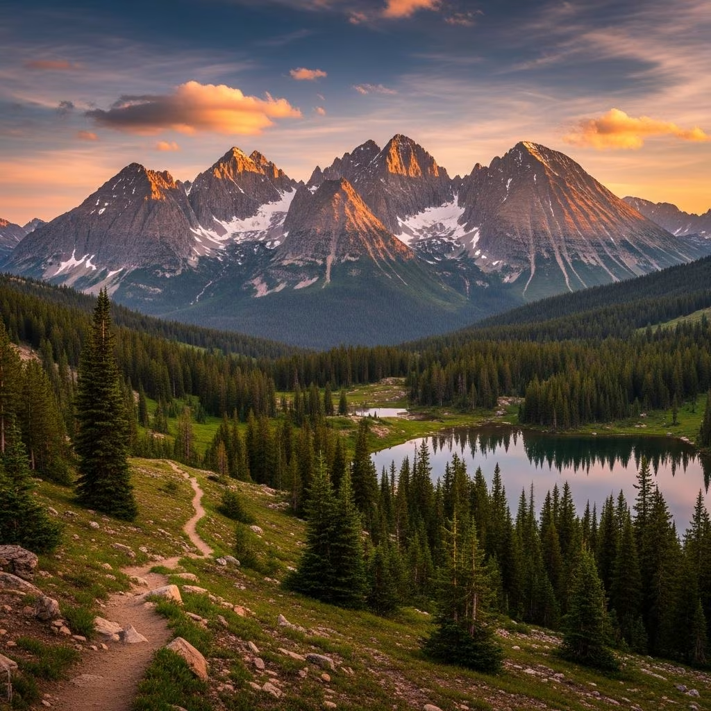
Explore the Crazy Mountains in central Montana—a rugged 136,000-acre wilderness featuring 40 alpine lakes, 100+ miles of trails, and dramatic 7,000-foot elevation gains.
 Travel Essentials
Rising dramatically from the surrounding plains approximately 15 miles northwest of Big Timber, the Crazy Mountains represent one of Montana’s most striking geographic features. This expansive wilderness encompasses 136,547 acres and stands as a distinctive island range in central Montana, characterized by nearly vertical peaks, sawtooth ridges, and remarkable geological drama. The range elevates approximately 7,000 feet above the Yellowstone River Valley, creating a landscape that commands attention from vast distances across the prairie due to its sudden vertical emergence from relatively flat terrain.
The Crazy Mountains display distinctive geological characteristics that set them apart from other Montana ranges. The mountain chain rises from an elevation floor of 5,590 feet to its highest point, Crazy Peak, which reaches 11,214 feet above sea level. The approximately 30-by-15-mile expanse creates what geographers classify as an island range—a mountain system surrounded by lower-elevation terrain rather than connected to larger mountain chains.
The terrain throughout the Crazy Mountains is notoriously rugged, featuring maze-like configurations of steep peaks and knife-edge ridges that challenge even experienced mountaineers. These dramatic formations result from geological processes that have carved deep valleys and created spectacular vertical relief across the landscape. The wilderness encompasses portions of both the Gallatin and Lewis & Clark national forests, though the area technically remains classified as a roadless zone rather than an officially designated wilderness area.
Accessing the Crazy Mountains presents unique challenges due to the range’s geographic isolation. The entire mountain complex is surrounded by private land, creating restrictions on public access. However, two primary public access corridors provide entry into the wilderness:
For detailed information and current conditions, the Gallatin National Forest Big Timber District Office can provide assistance at (406) 932-5777.
The Crazy Mountains feature an extensive network of trails exceeding 100 miles in total length, offering options ranging from moderate day hikes to challenging multi-day expeditions. The trail system provides access to alpine lakes, mountain passes, and panoramic viewpoints throughout the wilderness.
| Trail Name | Distance | Difficulty | Best Season | Key Features |
|---|---|---|---|---|
| Cottonwood Lake Trail | 10 miles round-trip | Strenuous | Summer months | High alpine lake, old jeep road section, minimal crowds |
| Crazy Peak Summit | Variable distance | Strenuous | Summer/early fall | 11,214-foot elevation gain, panoramic views, technical scrambling |
| Trapper Lake Trail | 7.5 miles round-trip | Strenuous | Summer/fall | 1,800-foot elevation gain, forest scenery, wildlife viewing, quieter experience |
| Crazy Mountains Crossing | Multi-day point-to-point | Strenuous | Summer/early fall | Showcases entire range, mountain goat habitat, spectacular scenery |
The Crazy Peak summit hike presents the most ambitious undertaking for visitors seeking the ultimate challenge. Starting from the Crazy Mountains Trailhead located approximately 30 miles west of Harlowton, the route climbs steadily through forested areas and meadows, gaining over 4,000 feet in elevation. The well-marked trail eventually becomes steep and rocky during its final approach to the summit. On clear days, the panoramic views extend for miles in all directions, rewarding hikers with vistas that encompass the surrounding mountains, valleys, and distant terrain.
For those preferring less crowded experiences, the Trapper Lake Trail offers a compelling alternative. This 7.5-mile route winds through thick forests of lodgepole pine and fir, crossing multiple streams fed by snowmelt from higher elevations. The relative isolation of this trail, combined with outstanding scenic beauty, makes it ideal for visitors seeking solitude while encountering the range’s natural features.
While hiking dominates visitor activities, the Crazy Mountains support diverse recreational pursuits throughout the year:
The Crazy Mountains support a diverse wildlife community adapted to high-elevation and mountainous habitats. Mountain goats inhabit the steeper terrain, making appearances throughout certain sections of the range. Visitors frequently encounter elk herds, particularly during early morning or evening hours. Mule deer and bighorn sheep also populate various elevations, creating wildlife viewing opportunities for observant visitors. Black bears inhabit forested areas, requiring visitors to practice proper food storage and wilderness safety protocols.
The vegetation transitions from lodgepole pine and fir forests at lower elevations to alpine meadows and sparse vegetation approaching the highest peaks. This ecological diversity supports varied wildlife communities and creates visually compelling landscapes throughout the seasonal cycle.
The Crazy Mountains remain technically accessible year-round, but practical conditions vary dramatically by season. Summer months (July through September) provide optimal hiking conditions with snow-free trails and stable weather patterns. Early fall offers continued accessibility with slightly cooler temperatures and fewer insects.
Spring and early summer present variable conditions as snowmelt can create swollen streams and muddy trails. Winter transforms the landscape into a snow-covered wilderness suitable primarily for experienced backcountry skiers and winter mountaineers. Visitors should consult current conditions before planning trips during shoulder seasons.
For visitors preferring to experience the Crazy Mountains from a vehicle rather than on foot, the Crazy Mountains Backcountry Drive offers an alternative perspective. This route follows primarily gravel roads connecting the small Montana towns of Two Dot and Melville, providing superb views of the mountain range from multiple vantage points. The drive showcases the dramatic prairie landscape at the mountain base and the visible vertical relief that makes the Crazy Mountains such a distinctive geographic feature when viewed from the surrounding plains.
The route includes sections of paved highway and scenic gravel roads, with notable stops including Lebo Lake and the historic Melville church. A northern side-trip provides additional viewpoints of the mountains and surrounding grassland prairie. This option accommodates visitors seeking mountain scenery without the physical demands of backcountry hiking.
Essential preparations for Crazy Mountains adventures should include:
Visitors should recognize that the Crazy Mountains present genuine challenges requiring honest assessment of personal fitness levels and experience. Routes such as Crazy Peak summit and the Crazy Mountains Crossing are not suitable for casual or beginning hikers. Physical preparation, proper equipment, and realistic expectations significantly enhance safety and enjoyment.
Summer and early fall (July through September) offer the most reliable conditions with snow-free trails and stable weather patterns. June can include residual snow at higher elevations.
Crazy Peak represents a strenuous undertaking appropriate only for experienced hikers. The elevation gain exceeds 4,000 feet, and the final approach involves steep, rocky terrain requiring scrambling ability.
Yes, trails like Trapper Lake and Cottonwood Lake receive fewer visitors than the most popular routes, offering solitude while maintaining scenic quality.
Beginners can enjoy the range using lower-elevation trail sections and moderate-difficulty routes, though many popular trails demand significant fitness and experience levels.
No, visitors appreciate the alpine lakes for scenery, backpacking campsites, and water access regardless of fishing participation. Fishing licenses and adherence to Montana regulations apply if angling.
