

 Travel Essentials
 Travel Essentials

Explore Desert View Drive's scenic overlooks, ancient ruins, and panoramic river views on this ultimate guide to Grand Canyon's eastern South Rim adventure.
 Travel Essentials
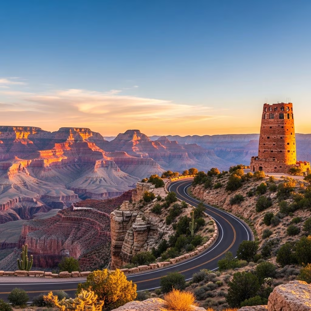
Stretching 23 miles along the South Rim of Grand Canyon National Park, Desert View Drive (Arizona State Route 64) delivers one of the most awe-inspiring road trips in the American Southwest. This route connects Grand Canyon Village to the park’s East Entrance, passing through dramatic landscapes, ancient archaeological sites, and viewpoints that capture the canyon’s vast scale and vibrant geology. Open year-round to private vehicles (weather permitting), it’s an essential drive for visitors seeking panoramic vistas of the Colorado River and layered rock formations without strenuous hikes.
Desert View Drive stands out for its accessibility and diversity. Private cars navigate easily, with ample parking at six formal viewpoints, four picnic spots, five unmarked pullouts, and key attractions like the Tusayan Pueblo. The drive typically takes 2-4 hours with stops, allowing time to absorb the canyon’s majesty from elevations around 7,000 feet. It’s shuttle-accessible via the free Kaibab Rim Route, making it family-friendly.
The journey begins at Mile Marker 241.5, near the South Entrance Road junction east of Grand Canyon Village. Head east toward the rising sun for optimal lighting on the canyon walls. Key stops unfold progressively, each offering unique perspectives.
| Mile Marker | Stop Name | Highlights | Access & Tips |
|---|---|---|---|
| 241.5 | Starting Point | Junction with South Entrance Road | Shuttle or vehicle access |
| 246 | First Pullout | Views of Mather and Yaki Points; birding hotspot | Easy parking; steps to rim |
| Varies | Shoshone Point Trailhead | 2-mile roundtrip to cliff-edge rock formation | Unmarked dirt lot; moderate hike |
| Mid-route | Grandview Point | Historic trailhead; Hance Rapid, Unkar Delta views | Steep trail warning; ¼-mile rim walk |
| Near End | Navajo Point | Highest South Rim elevation; broad panoramas | Short path to overlook |
| End (Mile 264.5) | Desert View | Watchtower, river bend, services | Full amenities |
The drive’s first highlight, reachable by car or orange-line shuttle, frames the canyon with Mather Point and Yaki Point in sight. At 7,096 feet, this spot showcases Douglas fir forests against red rock contrasts. Spring and fall bird migrations make it ideal for nature enthusiasts.
An unmarked dirt parking area leads to a 1-mile one-way trail (2 miles roundtrip) culminating at a striking rock perch on the rim. This less-crowded gem rewards with 360-degree views, perfect for picnics or photography without the masses.
Elevation peaks here with sweeping sights of the Colorado River’s eastern bends. The Grandview Trail, originating from 1893 mining operations (Last Chance Copper Mine), drops steeply 3,000 feet—suited only for seasoned hikers due to sun exposure and winter ice. Visible below: Hance Rapid’s whitewater fury, Unkar Delta’s ancestral Puebloan history, and rare Grand Canyon Supergroup strata.
As the South Rim’s highest vantage (7,461 feet), this stop near Desert View offers west- and north-facing panoramas. A brief walk from parking reveals layered cliffs and distant horizons, embodying the canyon’s boundless depth.
The route’s crescendo at the East Entrance features the iconic Desert View Watchtower, a 1932 Mary Colter-designed stone tower mimicking ancestral Puebloan architecture. Climb for 360-degree vistas of the river’s dramatic western bend. Adjacent services include a market, snack bar, restrooms, and the Tusayan Pueblo museum (open Thu-Mon, 8am-4pm).
This National Register site, just off the drive, preserves a 14th-century ancestral Puebloan village. A self-guided trail and small museum detail life in the canyon’s rim communities, with artifacts from excavations. It’s a poignant reminder of human history amid natural spectacle.
Spring (Mar-May) and fall (Sep-Nov) offer mild weather and fewer crowds. Summers bring intense heat (full sun on trails); winters may see snow closures. Start early for golden-hour light and parking.
RVs fit most areas, but check for shuttle-only zones. Fuel up before entering; gas available at Desert View. Entry fees: $35/vehicle (7 days).
Four designated areas provide shaded tables. Stock groceries in Tusayan or Flagstaff. Desert View offers quick bites and souvenirs.
Desert View Drive exposes 2 billion years of Earth’s history in vivid strata. The Supergroup—tilted, colorful layers visible mainly here—contrasts the canyon’s classic Kaibab limestone rims. Spot California condors soaring, mule deer grazing rims, and seasonal migrants like warblers.
Combine with Rim Trail hikes (paved to Hermit Rest) or South Kaibab Trail descents. Exit east via US-89 through Navajo Nation to Page (Antelope Canyon) or west to Hermits Rest. Multi-day: Camp at Desert View or nearby Kaibab Forest.
23 miles (37 km) one-way from Grand Canyon Village to East Entrance.
Yes, unless snow closes it temporarily.
Yes, with parking at all major viewpoints.
Desert View and Grandview Point offer the most striking river bends.
Kaibab Rim Route covers early sections from Visitor Center.
Pets allowed in vehicles/pullouts but not on trails or in buildings.
Grand Canyon’s fragility demands mindful visitation. Follow Leave No Trace: pack out trash, avoid off-trail roaming, and support conservation via park donations. Over 5 million annual visitors underscore the need for stewardship.
