

 Travel Essentials
 Travel Essentials

Explore Great Sand Dunes National Park's massive sand formations, the tallest in North America at 750 feet, offering hiking, seasonal beaches, and diverse ecosystems in Colorado's San Luis Valley.
 Travel Essentials
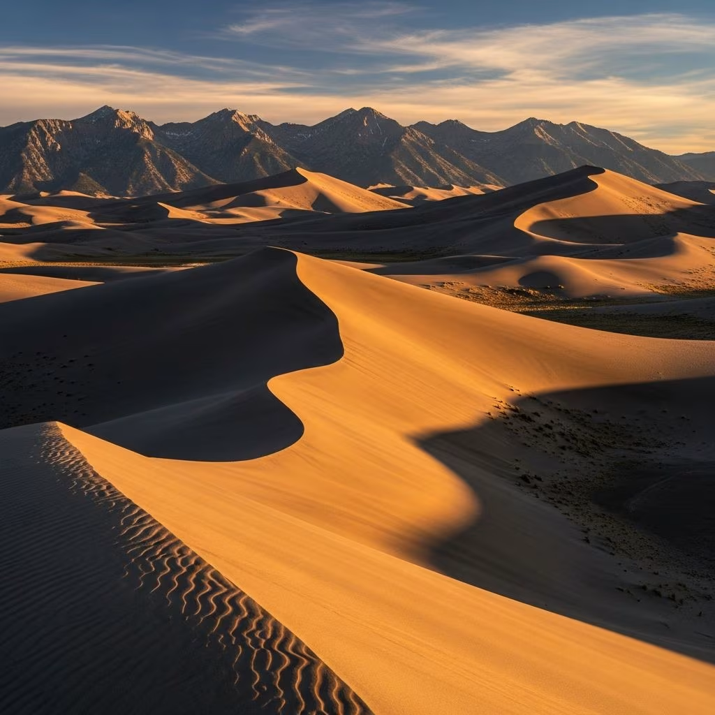
Nestled in the vast San Luis Valley of southern Colorado, Great Sand Dunes National Park and Preserve boasts the tallest sand dunes on the continent, with peaks soaring up to 750 feet (229 meters) above the valley floor. This 30-square-mile dunefield, backed by the dramatic Sangre de Cristo Mountains, creates a surreal landscape that draws adventurers, nature lovers, and families year-round.
These immense dunes formed over thousands of years through a unique interplay of wind, water, and ancient lake sediments. During the last Ice Age, massive floods carried sand and silt into the San Luis Valley basin from surrounding mountain ranges. As the ancient Lake Alamosa dried up, prevailing southwesterly winds pushed the loose grains eastward, piling them against the steep eastern slopes of the Sangre de Cristo Mountains. Occasional northeasterly storms added layers, sculpting the dunes into their current star-shaped and pyramid-like forms.
The dunefield covers approximately 30 square miles (78 square kilometers) and holds an estimated 5 billion cubic meters of sand, making it the largest in the Western Hemisphere by height, though not by area. The sand varies in color and texture: darker, fine volcanic grains from the distant San Juan Mountains mix with lighter, coarser sediments from the Sangre de Cristos, creating rippled patterns that shift slowly across the surface.
Within the park, several standout dunes challenge hikers with their scale and steepness. No formal trails exist, allowing free exploration, but certain peaks offer rewarding summits with panoramic views.
Hiking these dunes is notoriously strenuous—each step sinks into loose sand, demanding more energy than mountain trails of similar length. Walking along ridge tops provides firmer footing, and long pants with boots prevent sand from entering shoes.
One of the park’s most magical features is Medano Creek, which transforms the dune base into a seasonal beach from late spring to early summer. Fed by snowmelt from the Sangre de Cristos, the creek flows shallowly across the sand (ankle to knee-deep), perfect for splashing, sandcastle building, and kite flying. Peak flow occurs in April-June, creating waves up to 18 inches high on windy days.
By mid-summer, the creek often recedes into braided channels or disappears entirely, exposing firm sand for easier dune access. Visitors should check current conditions via the park’s website, as water levels vary yearly based on snowfall.
The park operates 24/7 year-round, but timing optimizes comfort and safety. Summer highs rarely exceed 80°F (27°C) at the 8,200-foot elevation, though dune surfaces can hit 150°F (66°C) midday—stick to mornings or evenings to avoid burns and afternoon thunderstorms with lightning.
| Season | Weather & Creek | Activities | Pros | Cons |
|---|---|---|---|---|
| Spring (Apr-Jun) | Mild 50-75°F; creek at peak | Beach play, early hikes | Water fun, fewer crowds | Muddy access, bugs |
| Summer (Jul-Aug) | 70-80°F days; creek low/dry | Dune climbing, stargazing | Long days, ranger programs | Hot sand, storms |
| Fall (Sep-Oct) | 40-70°F; dry dunes | Hiking, photography | Cool temps, fall colors | Shorter days, wind |
| Winter (Nov-Mar) | 20-50°F; snow on dunes | Sledding, skiing nearby | Solitude, unique views | Cold, limited access |
Winter brings sledding opportunities on the dunes (use park-approved sleds only), while fall offers golden aspens and crisp air for photography.
Access the main dunefield via CO Highway 150, north from US 160 or west from CO 17. Key facilities include the Dunes Parking Lot (with restrooms), Visitor Center (exhibits, ranger talks), and Pinyon Flats Campground (reservations advised). Entrance fees are $25 per vehicle for 7 days; America the Beautiful passes accepted.
Essential Tips:
Unique wildlife includes seven endemic insect species adapted to the harsh sands, plus tracks from kangaroo rats, beetles, and elk. Look for colorful sand grains and wind-sculpted ripples.
Dune hiking isn’t the only thrill. Sandboarding and sledding (rentals at Oasis Store outside park) let you slide down slopes at speeds up to 40 mph. Evening stargazing reveals the park’s International Dark Sky status, with ranger-led programs. Nearby, Zapata Falls trail offers a short hike to an ice cave, and alpine roads lead to 13,000-foot passes.
Fishing in Medano Creek targets trout during flows, while birders spot sandhill cranes in the valley. For multi-day trips, backpack into the preserve’s backcountry dunes or mountains (permits required).
Designated a national park in 2004, the 330-square-mile preserve protects not just dunes but wetlands, forests, and alpine tundra. Human impact is minimal—pack out trash, avoid digging trenches, and tread lightly to prevent erosion. Climate change poses threats via altered snowmelt and invasive plants, underscoring the need for responsible visitation.
Absolutely—its otherworldly dunes, seasonal creek, and mountain backdrop make it a top U.S. park for unique experiences.
2-4 hours round-trip; start early to beat heat.
No lifeguards; water is shallow but currents can form—supervise children.
Yes, leashed; boots recommended for paw protection.
May-June for creek play; September for hiking without crowds.
Great Sand Dunes offers endless discovery in a compact, accessible package. Whether splashing in seasonal waters or summiting giants, this Colorado icon delivers awe-inspiring adventures amid North America’s tallest sands.
