

 Travel Essentials
 Travel Essentials

Comprehensive guide to Greenland's massive ice sheet, exploring its geological history, current dynamics, and profound implications for sea level rise and climate systems.
 Travel Essentials
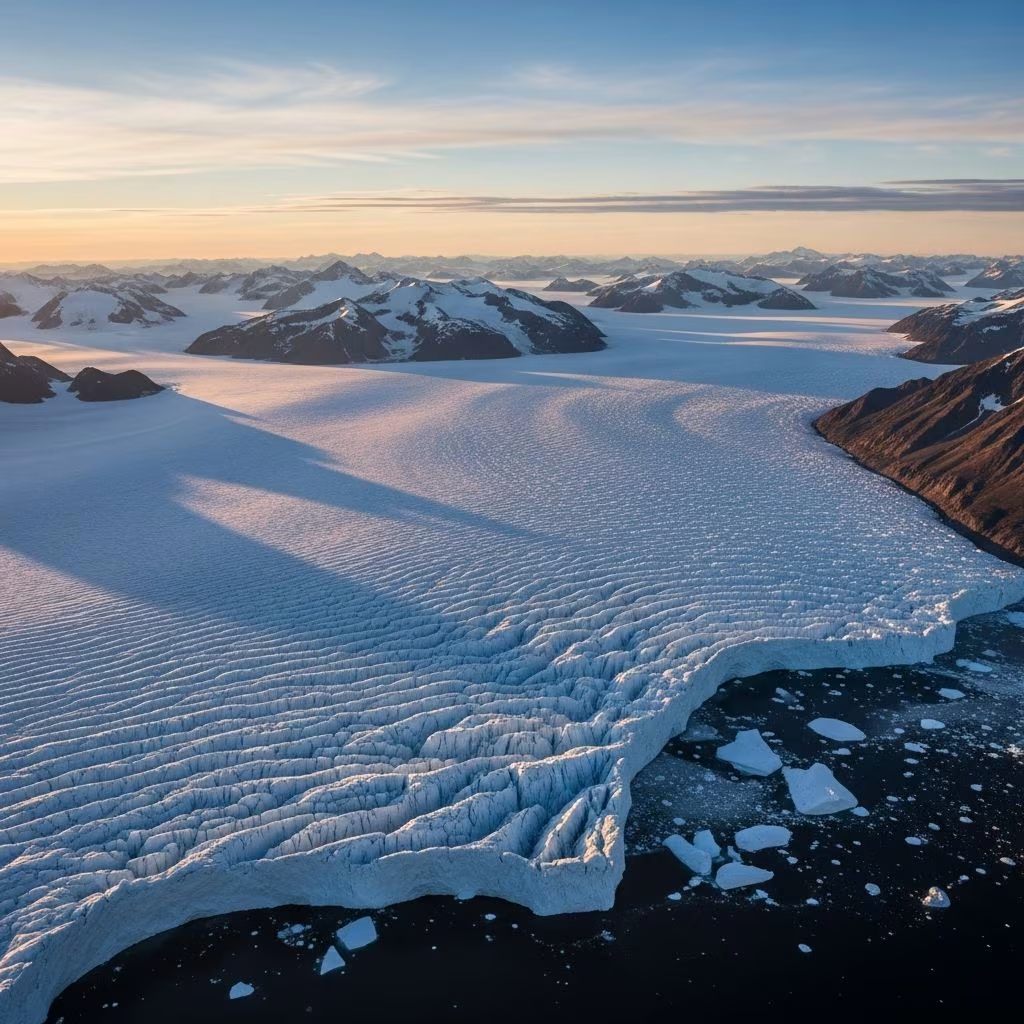
Greenland’s ice sheet stands as one of Earth’s most commanding geographical features and a critical indicator of planetary climate health. Spanning approximately 1.7 million square kilometers and covering nearly 80 percent of the island’s landmass, this frozen expanse represents the second-largest body of ice on our planet. Located between the Atlantic and Arctic Oceans, the ice sheet extends from latitude 71°N northward, dominating the Arctic region’s physical and climatic characteristics. Yet this ancient formation faces unprecedented challenges, with contemporary ice loss occurring at rates unmatched in at least the past 12,000 years. Understanding this massive ice mass—from its deep geological origins to its modern transformation—proves essential for comprehending global climate dynamics and future sea level change.
The Greenland ice sheet’s history stretches across vast geological timescales, revealing a dynamic system that has repeatedly grown and contracted in response to planetary climate shifts. Evidence from deep-sea sediment cores and ice analysis suggests that major glaciation in Greenland has persisted for at least 18 million years. However, the formation of a unified ice sheet covering most of the island occurred more recently—approximately 2.6 million years ago—when atmospheric carbon dioxide concentrations dropped sufficiently low to enable widespread ice accumulation. During the Pliocene epoch, just 3 million years ago, the island’s ice remained confined primarily to its highest mountain peaks in the eastern and southern regions, demonstrating how dramatically climate fluctuations have shaped ice extent over geological time.
The most substantial ice deposits visible today formed during a particularly cold period spanning 188,000 to 130,000 years ago, when an ice age gripped the Northern Hemisphere. Subsequently, the ice sheet expanded dramatically during the final Pleistocene glacial advance, reaching its maximum extent approximately 24,000 years ago—at that time, it covered an area 40 percent larger than its current footprint. Even within the relatively recent past, the ice sheet has experienced dramatic transformations. Evidence from sediment samples retrieved from the Labrador Sea indicates that nearly all southern Greenland ice melted approximately 400,000 years ago during a warm interglacial period. This geological record demonstrates that ice sheets, despite their apparent permanence, undergo profound reorganization in response to relatively modest climate variations.
The physical dimensions of Greenland’s ice sheet are staggering, with profound implications for sea level change. The ice sheet averages 1,673 meters in thickness, though considerable regional variation exists across its expanse. In the central portions, ice thickness frequently exceeds 3,000 meters, creating an enormous reservoir of frozen water that has accumulated over millennia. Recent advances in remote sensing technology and bathymetric mapping have unveiled the underlying topography, revealing a saucer-like basin beneath much of the ice sheet, with substantial portions sitting at or below current sea level.
The ice mass does not remain static but flows continuously outward from the interior through interconnected drainage systems. Outlet glaciers and ice streams transport ice toward coastal regions, where some formations terminate in glacial ice tongues that extend into the ocean. This constant movement represents a fundamental characteristic of ice sheet dynamics—the system operates as a massive, slow-moving hydrological network, channeling ice from accumulation zones toward regions of melting and calving. The volume of ice contained within this system is extraordinary, with the total potential for sea level rise if all Greenland ice melted calculated at 7.4 meters globally. This figure underscores why climate scientists regard the ice sheet’s behavior as a critical indicator of planetary warming trajectories.
Perhaps paradoxically, the ice sheet that threatens modern coastal communities also preserves one of our most valuable records of past climate. Scientists extract cylindrical ice cores from deep within the ice sheet, obtaining samples that extend back thousands of years. Analysis of approximately 100,000-year records obtained from 3-kilometer-long ice cores drilled between 1989 and 1993 into Greenland’s summit revealed evidence of geologically rapid climate shifts and potential tipping points in Earth’s climate system. These frozen archives contain far more than ancient ice; they are repositories of atmospheric history.
The information encoded within ice cores proves remarkably diverse and illuminating:
This analytical approach transforms the ice sheet from a static geographical feature into a time machine, enabling researchers to construct detailed paleoclimate records that inform our understanding of natural climate variability and anthropogenic climate change.
The historical perspective provided by ice cores and geological records creates a sobering contrast with current conditions. The ice sheet is now warmer than at any point during the past 1,000 years, and ice loss is occurring at the fastest rate in at least 12,000 years. These twin indicators suggest that human-induced climate change has fundamentally altered the ice sheet’s dynamics in ways unprecedented during the entirety of recorded human civilization.
Recent measurements quantify the scale of this transformation with striking clarity. Between September 2021 and August 2022, the Greenland ice sheet experienced a total mass change of -146 gigatonnes, equivalent to approximately 0.4 millimeters of global sea level rise. This figure marked the 25th consecutive year of net ice loss, establishing an unbroken streak of annual decline. More remarkably, satellite data analysis reveals that glacial retreat has caused the ice sheet to lose approximately one-fifth more mass than previously estimated by scientists, indicating that earlier models underestimated the rate of ice sheet deterioration.
The mechanisms driving this acceleration operate on multiple fronts:
The Jakobshavn Isbrae glacier on Greenland’s western coast exemplifies this rapid transformation, having retreated substantially between 1985 and 2022, losing approximately 97 billion tons of ice during that 37-year period.
While Greenland’s ice loss represents a regional Arctic phenomenon, its consequences reverberate across planetary climate systems and human civilization. The ice sheet’s potential contribution to sea level rise constitutes its most direct global impact. If the entire ice sheet melted completely, global mean sea levels would rise approximately 7.4 meters, though more recent analyses suggest the figure could reach as high as 23 feet under certain melt scenarios. Even incremental ice loss produces measurable sea level rise, with the 146 gigatonnes lost during 2021-2022 contributing 0.4 millimeters—a seemingly modest figure that accumulates over time and disproportionately affects low-lying coastal communities.
Current ice loss rates suggest that Greenland contributes approximately 286 gigatonnes of ice annually to ocean systems, a figure that has accelerated considerably over the past two decades. This mass addition to the ocean occurs through two primary mechanisms: surface melting and runoff into the ocean, and calving of icebergs from glacier termini. Both processes are accelerating, with evidence suggesting that ice loss from outlet glaciers has intensified dramatically compared to conditions just 25 years ago.
The implications for human societies prove profound and troubling. Coastal erosion, saltwater inundation of agricultural lands, increased flooding of urban infrastructure, and displacement of populations all follow inevitably from even modest sea level rise. Small island nations and densely populated delta regions face existential threats, while wealthy coastal cities worldwide confront costly adaptation challenges. The Greenland ice sheet thus transforms from a remote Arctic curiosity into a matter of acute geopolitical and humanitarian significance.
Understanding the ice sheet’s behavior requires sophisticated measurement technologies and international scientific collaboration. Satellite-based remote sensing provides continuous monitoring of ice sheet surface characteristics, including albedo (brightness) measurements that indicate melt intensity and surface conditions. Ground-based measurements, airborne surveys, and satellite gravimetry collectively paint a detailed picture of ice mass changes. These monitoring systems revealed that despite anomalously cold temperatures in some regions during 2022, the ice sheet still experienced unprecedented melt events, underscoring the system’s overall warming trajectory.
Future ice sheet behavior will depend critically on cumulative greenhouse gas emissions and the magnitude of climate warming that occurs over coming decades. Feedback mechanisms—such as reduced albedo from surface darkening and destabilization of marine ice sheet margins—introduce nonlinearity into projections, suggesting that ice loss could accelerate rather than proceed at steady rates. The ice sheet represents a potential tipping point in the climate system, meaning that modest additional warming could trigger threshold behavior leading to rapid, irreversible ice loss.
The ice sheet averages 1,673 meters in thickness, with central regions frequently exceeding 3,000 meters, making it one of Earth’s largest freshwater reservoirs.
Complete melting of the Greenland ice sheet would raise global sea levels by approximately 7.4 to 23 feet, depending on which analysis is consulted.
The unified ice sheet covering most of Greenland formed approximately 2.6 million years ago, though major glaciation has existed for at least 18 million years.
Current loss rates reach approximately 286 gigatonnes annually, with outlet glaciers retreating six to seven times faster than rates observed 25 years ago.
Ice cores preserve atmospheric composition, temperature variations, volcanic eruptions, and even human industrial impacts through multiple physical and chemical indicators spanning thousands of years.
Greenland’s ice sheet embodies the complexity of Earth’s climate system and the vulnerability of vast environmental systems to relatively rapid warming. Its formation over millions of years, preservation of ancient climate records, and current acceleration toward unprecedented ice loss collectively illustrate how natural systems respond to changing conditions. The ice sheet’s future trajectory will substantially influence global sea level, ocean circulation patterns, and the habitability of coastal regions worldwide. Continued scientific monitoring and climate mitigation represent essential responses to this fundamental environmental challenge.
