

 Travel Essentials
 Travel Essentials

Comprehensive guide to navigating Portland using TriMet buses, MAX Light Rail, streetcars, and bike infrastructure without a personal vehicle.
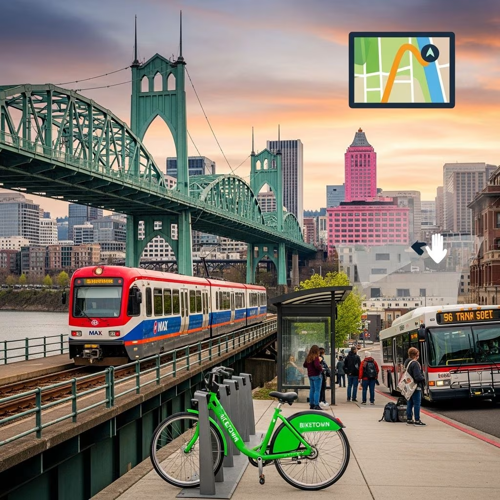 Travel Essentials
Portland, Oregon has cultivated a reputation as one of America’s most walkable and transit-friendly cities. Whether you’re a visitor exploring the Pacific Northwest or a new resident settling into the Rose City, understanding your transportation options can transform how you experience this vibrant urban landscape. The city’s commitment to sustainable mobility means you can accomplish virtually everything without owning or renting a car, making it an ideal destination for travelers seeking authentic urban exploration.
The foundation of Portland’s car-free accessibility rests on TriMet, the regional transit authority that manages multiple interconnected transportation systems. Rather than forcing commuters to choose between modes, TriMet has designed its fare structure so that tickets work across all platforms. This integration creates seamless transfers between buses, light rail, and streetcars, allowing you to move fluidly throughout the metropolitan area using a single payment method.
The genius of Portland’s approach lies in its recognition that different neighborhoods and destinations require different transit solutions. Downtown professionals might rely primarily on the MAX Light Rail, while residents exploring neighborhood boutiques might prefer the leisurely pace of the streetcar. Meanwhile, outer neighborhoods remain connected through extensive bus networks that feed into the rapid transit system.
The MAX (Metropolitan Area Express) Light Rail serves as the circulatory system of Portland’s public transportation network. This system consists of five color-coded lines—Blue, Red, Green, Yellow, and Orange—that collectively span more than 60 miles of track with approximately 94 stations serving the broader metropolitan region. All five lines converge in downtown Portland, creating a central hub where passengers can easily transfer between different routes.
The Red Line carries particular significance for visitors, as it connects downtown Portland directly to Portland International Airport, eliminating the need for expensive airport shuttles or rental car arrangements. The Blue Line extends westward to Beaverton and Hillsboro, while the Orange Line serves the South Waterfront neighborhood and connects to the northern community of Milwaukie. The Green and Yellow lines provide additional coverage patterns that ensure comprehensive regional connectivity.
Operational reliability defines the MAX experience. Trains typically operate from approximately 4:00 AM until midnight daily, with frequent service runs occurring every 15 minutes or less during peak hours. This frequency means passengers rarely need to check schedules in advance—simply arriving at the platform often guarantees minimal wait times. Station infrastructure includes ticket machines, real-time arrival information displays, and accessibility features designed to accommodate all users.
MAX stations feature clear wayfinding signage and logical layouts that orient new riders quickly. Unlike some transit systems, Portland’s stations offer intuitive design that minimizes confusion about which platform serves which destination. Each station displays route maps and upcoming train arrival times, empowering passengers to make informed decisions about their journey timing.
The system’s airport connectivity deserves special emphasis for travelers. The Red Line provides direct service from downtown to Portland International Airport, transforming airport access from a transportation hassle into a straightforward transit experience. This single feature has reduced reliance on car rentals and rideshare services for countless visitors over the years.
While the MAX Light Rail captures much attention, TriMet’s extensive bus network functions as the true workhorse of Portland transportation. The system operates 75 distinct bus lines throughout the Portland metropolitan area, with routes carefully designed to connect neighborhoods not served by the MAX while feeding passengers into light rail stations for longer-distance journeys.
Bus route organization emphasizes accessibility through the “Frequent Service” designation. These routes, marked with green signs at stops, operate every 15 minutes or less throughout the day, eliminating the anxiety of missing a connection. Frequent Service routes typically concentrate in central Portland, Pearl District, and major neighborhood corridors where demand justifies higher-frequency operations.
The TriMet website and mobile applications provide interactive schedules and real-time bus tracking capabilities. The agency’s dedicated tracker app lets you see details for every bus stop in the city, displaying current vehicle locations and precise arrival estimations. This technological infrastructure transforms bus travel from a guessing game into a predictable, plannable experience.
Portland’s commitment to multimodal transportation shines through bus design. Most TriMet buses include bike racks on their fronts, enabling riders to combine cycling with transit for expanded geographic reach. This integration acknowledges that many Portlanders maintain flexible transportation strategies, cycling to stations and then boarding transit for longer distances.
Bus stops throughout the city feature weather shelters in many locations, seating areas, and posted route information. The stops mark themselves visibly, preventing the frustrating experience of uncertain waiting locations that plagues riders in less organized transit systems.
For visitors seeking a quintessentially Portland transportation experience, the Portland Streetcar offers both practical utility and nostalgic charm. Operating three distinct lines across approximately 16 miles of track, the streetcar provides essential connectivity within the downtown core and adjacent neighborhoods while maintaining a distinctive character that defines Portland’s urban identity.
The North-South (NS) Line represents the streetcar system’s original route, connecting Portland State University in the south through downtown and the Pearl District toward the Nob Hill neighborhood in the northwest. This single line touches some of Portland’s most distinctive neighborhoods, making it an excellent introduction to the city’s cultural character. The route’s accessibility to museums, galleries, restaurants, and independent boutiques makes it particularly valuable for visitors interested in neighborhood exploration.
The A Loop and B Loop lines introduced additional capacity and coverage when completed. These routes traverse the distinctive Tilikum Crossing Bridge, connecting the Pearl District and inner eastside neighborhoods with downtown and South Waterfront. The A Loop operates clockwise while the B Loop moves counterclockwise, allowing passengers to choose directional preferences based on their destination.
Streetcars run approximately every 15 to 20 minutes, providing reliable frequency without excessive wait times. Operating hours typically run from 5:30 AM to 11:30 PM in the city center, offering coverage throughout most active hours of the day. The streetcar’s leisurely pace compared to the MAX actually enhances the experience for neighborhood exploration, allowing passengers to observe storefronts, street art, and urban details that blur past on faster transit modes.
TriMet fare tickets work on the Portland Streetcar, though dedicated streetcar-only passes offer slightly lower costs for those riding exclusively on this mode. Ticket machines operate at each platform, providing flexible payment options for occasional riders unfamiliar with the broader TriMet system.
Portland’s unified fare system eliminates confusion about payment across different transit modes. A single ticket or pass works on buses, the MAX Light Rail, and the Portland Streetcar, with transfers remaining valid for 2.5 hours from purchase time. This generous transfer window enables logical trip planning where passengers might ride a bus to a MAX station, travel several stops by light rail, then transfer to a streetcar to reach their final destination—all on a single fare payment.
The Hop Fastpass system represents Portland’s modern answer to transit payment, offering both physical cards and mobile app functionality. Contactless technology enables quick boarding without fumbling for exact change or paper tickets. Riders can purchase physical Hop cards at local retailers or activate virtual cards through the smartphone application, then reload funds online, through the app, or at convenient retail locations throughout the city.
All-day passes provide economical options for visitors planning intensive transit usage, while streetcar-only passes accommodate those focusing exploration on downtown neighborhoods. The flexibility of Portland’s fare options accommodates various travel patterns and budgets, from occasional transit users to daily commuters.
Successfully navigating Portland without a car requires understanding journey planning resources available through TriMet. The agency’s website features a customized trip planner tool where you input origin and destination addresses, then receive step-by-step directions indicating which transit mode to use, where and when to catch service, and expected travel times.
This technology transforms Portland transit from intimidating to approachable, even for first-time visitors or those unfamiliar with urban transit systems. The trip planner typically presents multiple route options, allowing passengers to choose based on preferences for speed, frequency, or specific neighborhoods they want to explore along the way.
Beyond official TriMet resources, numerous third-party applications provide transit information with varying features and user interfaces. These tools aggregate TriMet data alongside rideshare options, bike-share information, and walking directions, creating comprehensive mobility dashboards. Visitors arriving in Portland benefit from exploring several applications to identify which interface and features align with their personal preferences.
While public transit forms Portland’s backbone for car-free mobility, bicycling and pedestrian infrastructure complete the transportation ecosystem. Portland’s extensive bike lane network—one of the most comprehensive in North America—provides safe cycling routes connecting neighborhoods and feeding into transit stations. Many Portlanders combine cycling with transit strategically, biking to MAX stations and then riding light rail for longer distances, an approach that extends geographic reach beyond what either mode provides independently.
Electric scooter rentals and bike-sharing programs add flexibility for short trips or visitors reluctant to rent traditional bicycles. Downtown Portland’s walkability means that many neighborhood destinations remain accessible entirely on foot, with careful urban design ensuring comfortable pedestrian experiences even along busier commercial corridors.
Portland’s transit system connects passengers to distinctive attractions that showcase the city’s unique character. The MAX Blue Line serves the Oregon Zoo, making family outings accessible without parking hassles. The Red Line’s airport connection eliminates transportation anxiety for arriving and departing travelers. The streetcar routes provide direct access to the Pearl District’s galleries and boutiques, the South Waterfront’s parks and institutions, and downtown’s cultural venues.
The Portland Aerial Tram, while technically separate from the TriMet system, extends transit options for visitors to South Waterfront and Marquam Hill, offering aerial views of Portland and the surrounding landscape that create memorable experiences beyond basic transportation function.
For travelers interested in exploring beyond Portland’s urban core, TriMet connections extend into the surrounding region. The WES commuter rail line serves weekday travel between Wilsonville and Beaverton, connecting to MAX stations and enabling access to suburban employment centers and attractions. This regional integration means day trips to areas like the Oregon Coast or Mount Hood become feasible without car rental, though service frequency differs from frequent urban transit.
The Hop card provides excellent value for regular usage, with discounted fares compared to purchasing individual tickets. All-day passes offer good options for visitors planning intensive transit usage in a single day. TriMet frequently offers promotional pricing, so checking the agency website for current deals ensures maximum savings.
Yes, TriMet buses feature front-mounted bike racks accommodating multiple bicycles, while MAX Light Rail cars include designated bike storage areas. This integration supports multimodal trips where cyclists extend their range by combining pedal power with rapid transit.
The MAX Light Rail typically operates from 4:00 AM to midnight, while bus service varies by route. Frequent Service bus lines run extended hours, with some routes operating nearly 24 hours. Streetcars typically run from 5:30 AM to 11:30 PM. Checking specific route information ensures accurate timing for your journey.
The MAX Red Line provides direct service from Portland International Airport to downtown Portland, eliminating the need for expensive airport shuttles or rideshare services. The journey takes approximately 40 minutes, providing a scenic and economical introduction to Portland for arriving visitors.
TriMet’s public transportation system ranks among the nation’s most accessible, with MAX light rail lines featuring particular accessibility infrastructure. Streetcars also provide accessible boarding, while bus routes include kneeling features that lower vehicle height for easier boarding. Detailed accessibility information is available through TriMet’s website for trip planning that accommodates specific accessibility requirements.
