

 Travel Essentials
 Travel Essentials

Discover must-have packing items for the challenging 55km Laugavegur Trail, from waterproof clothing to hut accommodations and river-crossing strategies amid Iceland's dramatic highlands.
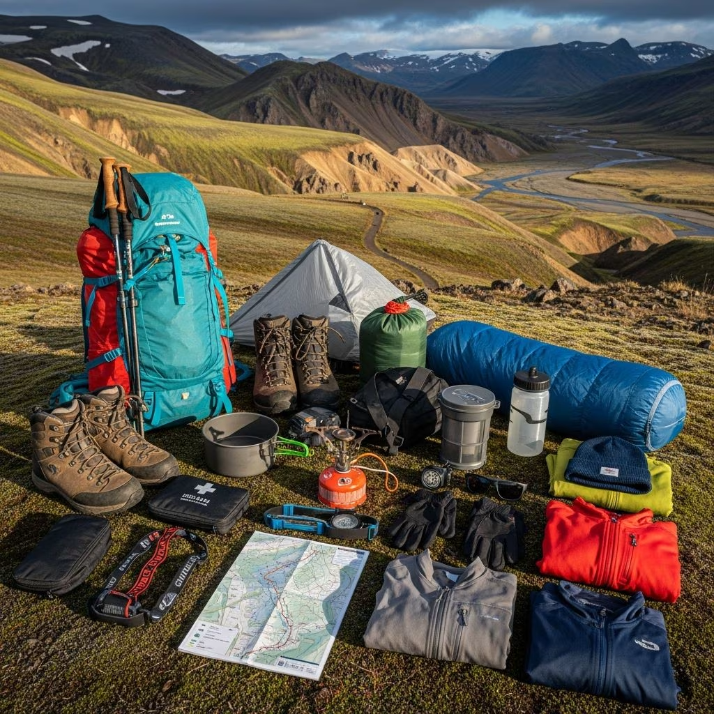 Travel Essentials
The Laugavegur Trail stands as Iceland’s premier multi-day hiking route, spanning 55 kilometers through the southern highlands from Landmannalaugar’s vibrant geothermal zones to Thórsmörk’s lush valleys. Hikers face rapid weather shifts, river fords, steep ascents up to 1,110 meters, and diverse terrains including obsidian fields and snow patches, demanding meticulous packing for 4-6 days of self-supported trekking.
This moderate-to-hard trek tests endurance with daily hikes of 10-17 kilometers, elevation gains, and unpredictable conditions best tackled from late June to early September when highland roads open. Extending via Fimmvörðuháls to Skógafoss adds volcanic ridges and waterfalls, pushing total distance to 70+ kilometers. Preparation hinges on lightweight, durable gear suited to wind, rain, and temperatures from 0°C to 15°C.
Iceland’s highlands deliver sudden storms, requiring a versatile three-layer clothing strategy: base for moisture wicking, mid for insulation, and outer for waterproofing.
Additional items include wool hats, buff neck gaiters, and heavy-duty gloves for icy descents near Álftavatn lake. Quick-dry hiking pants with zip-off legs adapt to variable conditions, while two pairs of merino socks prevent blisters on rocky paths.
River crossings like Bratthálskvísl demand waterproof boots with aggressive lugs for grip on slick stones and mud.
| Feature | Recommendation | Why It Matters |
|---|---|---|
| Gore-Tex Lining | Yes | Keeps feet dry during 10+ fords per day |
| Sole Type | Vibram or equivalent | Grip on wet lava and scree |
| Weight | Under 1.5kg/pair | Reduces fatigue over 55km |
| Break-In | Essential | Prevents blisters on steep sections |
Complement with sturdy gaiters to block debris and camp shoes like Crocs for hut evenings. Trekking poles are non-negotiable for stability on uneven ground and stream jumps.
A 50-65L pack with hip belt and adjustable frame distributes 12-15kg loads (including food, tent if wild camping). Features like roll-top closures and external pockets aid quick access to rain gear during sudden squalls. Test-pack at home to ensure balance during long carries to Emstrur.
Huts at Hrafntinnusker, Álftavatn, Hvanngil, and Thórsmörk offer bunks but book 6-12 months ahead via Ferðafélag Íslands. For flexibility:
Earplugs and eye masks combat crowded, noisy huts shared with 20-50 hikers.
Carry 4-6 days of high-calorie meals (4,000+ kcal/day) as no resupplies exist. Focus on dehydrated packets, nuts, bars, and instant oats weighing under 2kg total.
A 2-3L hydration bladder or Nalgene bottles suffice, treating highland stream water with tablets or filters—avoid sulfur-tainted sources near Stórihver. Stove like Jetboil with 500g fuel canister for group cooking.
Marked trails reduce needs, but fog and snow demand backups.
Compass and paper map from Ferðafélag Íslands guidebook as fail-safes.
Compact kit for blisters, cuts, and altitude woes:
Know hypothermia signs and hut locations; solo hikers should share itineraries.
This optional Day 5 crosses glaciers to Skógafoss, adding microspikes for ice, extra snacks for 1,000m climbs, and crampons if guided. Huts like Baldvinsskáli provide shelter amid Eyjafjallajökull views.
| Category | Items | Weight (kg) |
|---|---|---|
| Worn | Boots, socks, base layer, pants, jacket, poles | 3.5 |
| Clothing | Spare layers, rain gear, hat/gloves | 1.8 |
| Sleep | Bag, pad, liner | 2.0 |
| Cook/Food | Stove, fuel, 5-day rations | 3.2 |
| Tech/Safety | Maps, headlamp, first aid, sat device | 1.5 |
| Misc | Pack, water, hygiene | 2.0 | Total | 14.0 |
Expect $800-1,500 for quality gear; rent packs and tents in Reykjavik to save. Prioritize REI or local shops for tested items. Bus transport from Reykjavik costs $100-200 round-trip.
North to south from Landmannalaugar starts with tough climbs and rivers when water levels are lower.
Huts suffice if booked, but tent for overflow or wild spots; permits required.
3-4L capacity, refill from streams with treatment.
No, restricted in highlands.
Independent for fit hikers; guided for first-timers amid weather risks[10].
This gear blueprint ensures safety and enjoyment on Laugavegur’s kaleidoscopic landscapes, from steaming vents to glacier vistas. Train with loaded hikes and monitor weather via vedur.is.
