

 Travel Essentials
 Travel Essentials

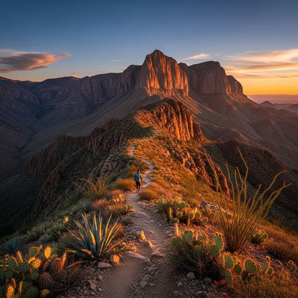
Explore the iconic Lost Mine Trail in Big Bend National Park: a 4.8-mile moderate hike with 1,100 ft elevation gain, panoramic views of mountains, canyons, and desert, ideal for day trippers seeking natural beauty.
 Travel Essentials
The Lost Mine Trail stands out as one of the most rewarding day hikes in Big Bend National Park, delivering a perfect blend of accessibility and awe-inspiring scenery. This 4.8-mile round-trip journey climbs steadily through diverse ecosystems, culminating in panoramic vistas that capture the park’s rugged essence. Hikers often rank it as their top choice due to its manageable difficulty and jaw-dropping payoffs, making it suitable for families, casual adventurers, and seasoned trekkers alike.
Big Bend National Park spans over 800,000 acres of desert, mountains, and river landscapes in West Texas, and the Lost Mine Trail exemplifies its alpine side. Unlike the arid lowlands, this path transports you into a cooler, forested realm within the Chisos Mountains, where oak and pine provide shade and contrast sharply with the surrounding basin. The trail’s allure lies in its progression: starting gently amid grasslands, ascending through switchbacks, and ending at a rocky overlook with unobstructed views into Juniper Canyon and beyond.
Many visitors describe the hike as transformative, shifting from enclosed woodlands to expansive horizons. The sense of accomplishment at the summit, paired with sights of jagged peaks like Casa Grande, creates lasting memories. Wildlife sightings, such as black bears in distant valleys, add thrill without close encounters. Its popularity stems from this low-barrier entry to high-reward experience, though crowds peak during peak seasons.
This out-and-back trail measures 4.8 miles total, with a 1,100-foot elevation gain over 2.4 miles one way. Rated moderate by the National Park Service, it suits those comfortable with steady inclines but challenges beginners due to length and final steep sections. Average completion time is three hours, factoring in rests and photos.
| Feature | Details |
|---|---|
| Total Distance | 4.8 miles (round trip) |
| Elevation Gain | 1,100 feet |
| Difficulty | Moderate |
| Estimated Time | 3 hours |
| Best Time | Early morning or late afternoon |
| Pets Allowed | No |
The path begins with immediate but gradual climbing, weaving through trees for the first 1.8 miles. Around the one-mile mark, benches offer prime spots to gaze over ridges into valleys framed by sharp peaks. Midway, glimpses of Juniper Canyon tease the finale. The upper half intensifies with switchbacks—crucial for erosion control—leading to a flat ridge and final rocky scramble to the endpoint.
Locate the trailhead at mile 5 on Chisos Basin Road, about 1.2 miles east of the Chisos Basin Visitor Center and 5.1 miles south of the intersection with Grapevine Springs Road. The narrow, winding road prohibits large RVs or trailers; high-clearance vehicles are recommended for safety. Parking is limited—often full by mid-morning—so arrive before 8 AM or after 4 PM. No fees apply beyond park entrance ($30 per vehicle, valid 7 days).
No restrooms exist at the trailhead or along the route, so plan accordingly. Cell service is spotty; download offline maps.
Miles 0-1: The Woodland Ascent
From the parking lot, the well-maintained single-track trail climbs gently, shaded by madrones and junipers. Grassy meadows give way to forested slopes, with occasional westward views through foothills. This shaded intro eases you in, building anticipation.
Miles 1-1.8: Ridge Crest and First Vistas
The path crests a ridge, revealing benches overlooking a vast valley. Sharp peaks encircle you, and on clear days, Mexico’s Sierra del Carmen range shimmers distantly. This is a popular turnaround for families with young kids, but pressing on rewards further.
Miles 1.8-2.4: Switchbacks to Summit
Steep switchbacks demand focus—stay on trail to protect fragile soil. Emerge onto a rocky plateau with sheer drops; a massive boulder at the end invites daring climbers for 360-degree panoramas of Casa Grande Peak, the Chisos Basin, and desert expanses.
Big Bend’s remoteness amplifies preparation’s importance. Carry 2-3 liters of water per person (more in heat), high-energy snacks, and a first-aid kit. Layer clothing for variable mountain microclimates—cool mornings, warm afternoons. Sturdy boots handle loose rock; trekking poles aid steep sections.
Hydration prevents heat-related issues; symptoms like dizziness warrant immediate descent. Inform someone of your plans.
Fall (Oct-Nov) and spring (Feb-Apr) offer mild temps (50-70°F) and wildflowers. Summer heat exceeds 90°F—avoid midday hikes. Winter brings crisp air but possible ice on switchbacks. Monitor forecasts; sudden storms can slick rocks.
Monsoon season (Jul-Sep) risks flash floods in canyons below, though the trail itself drains well. Sunrise/sunset hikes amplify drama, with golden light illuminating peaks.
The trail’s woodland-grassland transition hosts unique biodiversity. Birds like acorn woodpeckers and juncos flit about; mammals include deer, foxes, and occasional black bears foraging valleys. Plants range from desert-adapted pinyon pines to lush ferns near seeps.
Respect Leave No Trace: tread lightly to preserve this fragile habitat. The Chisos ecosystem supports rare species, thriving due to protected status.
| Trail | Distance | Elevation Gain | Highlights | Difficulty |
|---|---|---|---|---|
| Lost Mine | 4.8 mi | 1,100 ft | Panoramic ridges, shade | Moderate |
| Burro Mesa | ~7 mi | Minimal | Desert canyons | Easy |
| South Rim | 12-14 mi | 2,000 ft | Basin overlooks | Strenuous |
Lost Mine contrasts desert treks with alpine vibes, ideal for half-day efforts versus multi-hour epics.
Yes, for ages 8+; the first mile’s benches make it family-friendly, but full length suits fit children.
Not recommended due to steep drops and wildlife; dusk offers sunsets but requires headlamps.
No—pack all you need; seasonal seeps unreliable.
Very popular; parking fills fast. Weekdays quieter.
Spectacular—westward glow over desert, but descend before dark.
Whether chasing epic photos, family bonding, or quiet reflection, the Lost Mine Trail delivers Big Bend’s magic in digestible form. Its blend of challenge, shade, and vistas ensures repeat visits. Plan wisely, respect nature, and prepare for views that redefine wilderness.
