

 Travel Essentials
 Travel Essentials

Explore Nevada's Basin and Range: rugged mountains, vast valleys, unique geology, wildlife, and top spots for hiking, stargazing, and off-road exploration.
 Travel Essentials
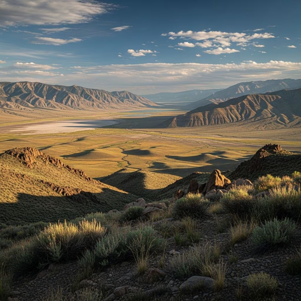
The Basin and Range province defines much of Nevada’s interior, creating a striking mosaic of towering mountain ranges separated by expansive, flat valleys. This vast region, spanning nearly the entire state, offers travelers a glimpse into one of North America’s most dynamic geological landscapes, where ancient tectonic forces have sculpted the earth into a series of parallel ridges and depressions.
Nevada’s Basin and Range formed through extensional tectonics, a process that began around 17 million years ago during the Miocene epoch. The Earth’s crust here stretched dramatically—up to 100% in some areas—thinning and fracturing along normal faults. This uplift elevated mountain blocks while adjacent basins subsided, producing the characteristic alternating pattern of highs and lows.
Unlike folded mountain ranges elsewhere, these are fault-block mountains, with steep escarpments on their flanks. The Sierra Nevada to the west acts as a rain shadow, blocking moisture and fostering the arid conditions that dominate today. Within the Great Basin section, which encompasses most of Nevada, internal drainage means rivers and streams rarely reach the sea, instead pooling into playas or sinking into the ground.
Key features include alluvial fans—cone-shaped deposits where mountain streams meet valleys—playas (dry lake beds), salt flats, and inselbergs (isolated rock hills). The topography creates microclimates, from cooler highlands to scorching basins, supporting diverse ecosystems despite the dryness.
The Great Basin, the northern core of the Basin and Range, covers nearly all of Nevada, plus parts of Utah, Idaho, and Oregon. It’s an endorheic region where water doesn’t escape to oceans, leading to unique saline lakes and vast deserts. Driving east-west across Nevada means repeatedly ascending ranges and descending into basins, a rhythmic journey that can span hundreds of miles.
Central Nevada exemplifies this: long north-south ridges like the Toiyabe, Toquima, and Hot Creek ranges frame broad valleys. Elevations vary wildly—the highest peaks top 12,000 feet, while basins dip below sea level in places like Death Valley’s edge.
Despite the harsh climate, life thrives in adapted forms. Sagebrush steppe dominates valleys, giving way to pinyon-juniper woodlands on slopes and bristlecone pine groves at higher altitudes. These ancient trees, some over 5,000 years old, cling to rocky ridges.
Mammals include pronghorn antelope sprinting across open plains, mule deer in canyons, and elusive mountain lions. Birds like golden eagles soar overhead, while ground-dwellers such as jackrabbits and kangaroo rats evade predators. Reptiles, including sidewinders and chuckwallas, bask on sun-warmed rocks. Spring wildflowers transform deserts after rare rains.
Nevada’s Basin and Range brims with protected areas showcasing its essence.
For off-road enthusiasts, gravel roads link remote ranges, offering solitude. Mountain biking thrives on singletracks, while backpacking reveals hidden springs.
The varied landscape supports year-round pursuits:
| Activity | Best Spots | Season |
|---|---|---|
| Hiking & Backpacking | Basin and Range NM, Great Basin NP | Spring-Fall |
| Off-Highway Vehicles | Garden Valley, Seaman Range | Year-round (avoid wilderness) |
| Climbing & Bouldering | Worthington Mountains | Fall-Spring |
| Stargazing | Remote basins statewide | Clear nights year-round |
| Wildlife Viewing | Alluvial fans, playas | Dawn/Dusk |
Summer heat demands early starts; winters bring snow to peaks for skiing at places like Lee Canyon.
Native peoples, including Paiute, Shoshone, and Western Shoshone, inhabited these lands for millennia, leaving rock art, tools, and villages. Basin and Range NM protects sites like Shooting Gallery, with panels depicting bighorn sheep and hunters.
European explorers like Jedediah Smith and John C. Frémont traversed in the 1800s, mapping for settlers. The Comstock Lode sparked mining booms, scarring ridges with adits and tailing piles—remnants visible today. Ranches and ghost towns dot valleys, telling tales of boom-and-bust cycles.
Access via US-50 (“Loneliest Road”) or NV-318/375 through eastern Nevada. Fuel up in sparse towns like Ely or Tonopah; carry water, spares, and maps—cell service vanishes.
Camp primitively or at developed sites; pack out waste. Respect wilderness areas barring OHVs. Visit in shoulder seasons to dodge extremes.
Efforts like the 2015 monument designation safeguard biodiversity and cultural sites amid mining pressures. Climate change threatens water sources and species; responsible tourism sustains this pristine wilderness.
Tectonic extension thinned the crust, uplifting fault-block mountains and subsiding basins.
No—the Great Basin is the hydrological subset with internal drainage, overlapping much of Nevada’s Basin and Range.
Spring (March-May) or fall (Sept-Nov) for mild weather and wildflowers.
Yes, highways like US-50; gravel tracks access remoter spots—high-clearance recommended.
Pronghorn, deer, eagles, lizards, and wild horses roam freely.
