

 Travel Essentials
 Travel Essentials

Explore Pico do Fogo, the highest mountain and most active volcano in the Cape Verde Islands, its eruption history, and impact on local communities.
 Travel Essentials
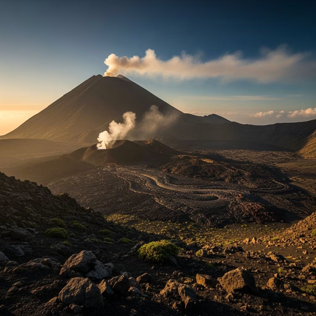
The Cape Verde archipelago, located approximately 600 kilometers off the western coast of Africa, is home to a remarkable geological feature that defines the landscape and cultural identity of the region: Pico do Fogo. This stratovolcano stands as the highest mountain in the entire Cape Verde Islands chain, reaching an elevation of 2,829 meters (9,281 feet) above sea level. The name itself reflects its nature and dominance—Pico do Fogo translates from Portuguese as “Peak of Fire,” a fitting designation for a volcano that remains the youngest and most geologically active mountain system in the archipelago.
Fogo, the island upon which this volcano resides, derives its name from the Portuguese word for “fire.” Originally christened São Filipe by early Portuguese settlers in the 15th century, the island was renamed following the catastrophic eruption of 1680, which served as a transformative event in the island’s history. The renaming underscores the profound influence that volcanic activity has exerted on the island’s identity and the consciousness of its inhabitants across centuries.
The geological origins of Pico do Fogo extend deep into Earth’s history. The volcano’s development commenced approximately 4.5 million years ago and progressed through four distinct evolutionary stages. This extended formation process created the complex volcanic architecture that characterizes the mountain today. The volcano represents a manifestation of the African Plate’s movement over a geological hotspot, a phenomenon that has shaped the entire archipelago, with younger volcanic formations concentrated at the western reaches of the island chain.
Since human settlement of Fogo island in the 15th century, Pico do Fogo has demonstrated its volatile nature through more than thirty documented eruptions. This frequency positions the volcano among the most active in the Atlantic Ocean region, making it a subject of considerable scientific interest and concern for local populations.
The most powerful recorded eruption in modern history occurred in 1680, an event of such magnitude and destructiveness that it prompted mass emigration from the island. This eruption, along with subsequent events in 1785, 1799, 1847, 1852, 1857, and 1951, established a pattern of intermittent but regular volcanic activity. Among these historical events, the eruption of 1847 stands as the only recorded instance where seismic activity directly resulted in fatalities, with earthquakes claiming several lives during that particular event.
| Year | Characteristics | Primary Impact |
|---|---|---|
| 1680 | Strongest eruption in recorded history | Mass emigration from island |
| 1951 | Major lava flows and emissions | Widespread land damage |
| 1995 | Subsidiary vent eruption | Community displacement |
| 2014 | Largest eruption in 63 years | Destruction of villages, evacuation of residents |
On November 23, 2014, at approximately 10:00 a.m. local time, Pico do Fogo awakened from nearly two decades of quiescence, initiating what would become the most substantial eruption since 1951. The preceding days had witnessed escalating seismic signals, with recorded earthquake activity intensifying notably beginning at 8:00 p.m. on the evening of November 22nd, providing warning signs of the impending volcanic activity.
During this eruption, lava fountained from a fissure opening on the west-southwest flank of Pico do Fogo. The molten rock advanced across the landscape at considerable velocity, measured between 15 and 20 meters per hour, creating lava flows that ultimately stretched across approximately 4 kilometers of terrain. The eruption column rose to heights of around 6 kilometers, with volcanic ash visible from the island of Santiago, approximately 90 kilometers to the west.
The crater area known as Chã das Caldeiras, located within the volcano’s caldera (a depression approximately 9 kilometers wide with walls rising nearly one kilometer), was home to approximately 1,000 residents when the eruption commenced. Despite initial reluctance to abandon their homes and livelihoods, residents were eventually successfully evacuated from the danger zone. The eruption destroyed an extensive infrastructure of approximately 170 buildings over the course of 77 days of continuous volcanic activity.
The village of Portela, situated within Chã das Caldeiras, experienced complete devastation, with lava flows entirely consuming the settlement and destroying its entire housing stock. The sole road providing access to the crater area was similarly overrun by lava, severing the primary transportation link to isolated communities. Approximately 2 square kilometers of agricultural land, including vineyards that constituted an economically significant crop for the region, were consumed or rendered unusable by volcanic deposits.
Scientific monitoring during the 2014-2015 eruption revealed substantial sulfur dioxide emissions, detected through satellite-based atmospheric sensors monitoring the region. These gaseous emissions, along with the visible lava fountains and ash emissions, created spectacular visual phenomena that characterized the eruption. By December 21, 2014, gas emissions had intensified again, causing the eruption plume to ascend approximately 800 meters. Additional damage during this phase of activity included the destruction of vineyard holdings, agricultural fields, and approximately a dozen residential structures.
The eruption maintained continuous activity through the winter months. By February 8, 2015, the Observatório Vulcanológico de Cabo Verde (OVCV) confirmed the cessation of eruption activity, with sulfur dioxide emissions becoming almost completely undetectable. This marked the conclusion of an eruption episode that had fundamentally altered the landscape of Fogo island and significantly impacted the lives of thousands of residents.
Pico do Fogo represents a stratovolcano, a classification that distinguishes it from other volcanic types through specific structural and compositional features. Stratovolcanoes are characterized by their steep-sided conical shape and are composed of alternating layers of lava, volcanic ash, and rock fragments. This composition creates both the visually striking appearance and the potential for explosively violent eruptions.
The eruptions associated with Pico do Fogo typically achieve a Volcanic Explosivity Index (VEI) rating of 2, indicating moderate explosive activity. The 2014 eruption, despite being the largest in over six decades, remained consistent with this historical pattern, demonstrating Strombolian-style eruption characteristics—a term describing volcanic behavior involving frequent but relatively moderate explosions, similar to activity observed at Italy’s Mount Stromboli.
Among the multiple volcanic islands comprising the Cape Verde archipelago, Pico do Fogo holds the distinction of being the only currently active volcano. The broader archipelago resulted from the African Plate’s continuous eastward movement over a geological hotspot, creating a chain of progressively older volcanic formations. This geological mechanism explains why younger, more active volcanism concentrates at the western extremity of the island chain, with Fogo representing the western terminus of this progression.
The island itself spans approximately 25 kilometers in diameter, with much of its surface dominated by the Chã Caldera, the large depression containing the primary settlement areas and agricultural zones. This crater-based topography significantly influences human settlement patterns and land use practices on the island.
The continued monitoring and study of Pico do Fogo remains essential for understanding volcanic processes and protecting the residents of Fogo island. The Observatório Vulcanológico de Cabo Verde maintains surveillance systems designed to detect seismic precursors and atmospheric changes that might signal renewed volcanic activity. These monitoring efforts contribute to scientific knowledge while providing practical early-warning capabilities for local emergency management.
The economic implications of volcanic activity on Fogo extend beyond immediate destruction. The loss of agricultural land, particularly vineyards that represent traditional crops with cultural and economic significance, has long-term consequences for island communities. Simultaneously, the dramatic volcanic landscape and active volcano represent potential attractions for scientific tourism and educational programs.
Pico do Fogo embodies the dynamic geological processes continuously reshaping Earth’s surface. The volcano stands as testimony to the power of internal planetary forces, the resilience of human communities facing natural hazards, and the ongoing scientific quest to understand and predict volcanic behavior. For the people of Fogo island, the mountain represents both their home’s defining feature and a constant reminder of the geological forces that shaped their past and will inevitably influence their future.
