

 Travel Essentials
 Travel Essentials

Explore Pictured Rocks National Lakeshore: 42 miles of colorful cliffs, beaches, forests, and adventures along Lake Superior in Michigan's Upper Peninsula.
 Travel Essentials
Stretching 42 miles along the southern shore of Lake Superior in Michigan’s Upper Peninsula, Pictured Rocks National Lakeshore captivates visitors with its vibrant sandstone cliffs rising up to 200 feet, pristine beaches, lush forests, and cascading waterfalls. Established in 1966 as the nation’s first national lakeshore, this 73,236-acre protected area offers unparalleled opportunities for hiking, boating, kayaking, and wildlife viewing year-round.
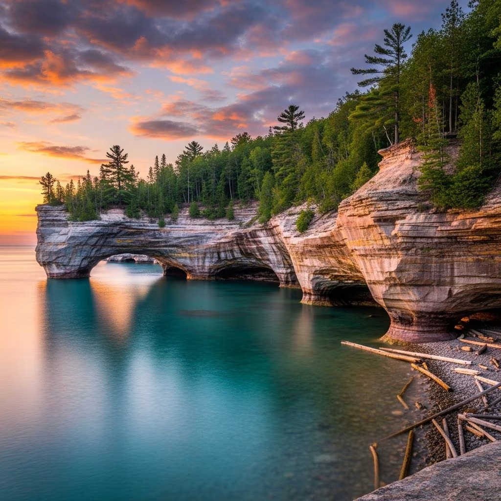
The hallmark of Pictured Rocks is its 13- to 15-mile stretch of multicolored sandstone cliffs northeast of Munising, stained by minerals like iron, copper, manganese, and limonite seeping through groundwater. These hues create a palette of reds, oranges, greens, and browns, sculpted by waves, ice, and wind into arches, caves, and formations resembling turrets or profiles.
Key geological features include:
Beyond the cliffs, the lakeshore boasts massive sand dunes like the Grand Sable Dunes, rising 300 feet, and expansive beaches such as Twelvemile Beach, perfect for agate hunting and serene walks.
Human presence in the Pictured Rocks area dates back over 10,000 years, with the Anishinaabe (Ojibwe) people as the original inhabitants who continue to steward and use the land. French fur traders arrived in the 1600s, followed by Euro-American loggers, trappers, and shippers in the 1800s, leaving behind lighthouses like Au Sable Light Station and maritime artifacts.
Congress designated the area on October 15, 1966, to preserve its unique shoreline for public enjoyment, inspiration, and education. Today, managed by the National Park Service with about 22 year-round staff, it welcomed over 1.3 million visitors in 2021.
Folklore ties the cliffs to Ojibwe legends, inspiring awe similar to Longfellow’s Song of Hiawatha, which romanticized the region’s mystique.
Pictured Rocks offers diverse pursuits tailored to all skill levels and seasons. No entrance fee applies year-round, making it accessible for spontaneous visits.
Over 100 miles of trails wind through hardwood forests of hemlock, spruce, fir, and jack pine, home to deer, black bears, hares, grouse, and waterfowl.
| Trail Name | Length & Difficulty | Highlights |
|---|---|---|
| Chapel-Mosquito River Loop | 10 miles, Moderate | Cliff views, beaches, forests |
| Log Slide Overlook | 1.5 miles, Easy | 300-ft dune panorama |
| North Country Trail Segment | Variable, Strenuous | Long-distance scenic route |
| Au Sable East Trail | 4 miles, Moderate | Lighthouse, shipwrecks |
Pro tip: Early mornings yield the best light for cliff photography from clifftop vistas.
Boat tours from Munising provide the premier way to experience the cliffs’ full scale against Lake Superior’s Caribbean-blue waters. Kayaking offers intimate paddles into sea caves, while shipwreck tours reveal submerged history. Winter ice climbing on frozen formations attracts adventurers.
Pristine shores yield agates, fossils, and driftwood. Spot migratory birds or marine life from dunes.
Each season transforms Pictured Rocks:
Enter from Munising (west) or Grand Marais (east) via H-58. Camp at sites like Hurricane River or Twelvemile Beach; no reservations needed for some. Visitor centers in both towns offer maps and exhibits on shipwrecks.
Getting There:
Pack layers, bug spray, sturdy shoes, and bear spray. Cell service is spotty; download maps.
Diverse habitats support black bears, deer, foxes, eagles, and Piping Plovers on beaches. The NPS protects against erosion, invasive species, and overuse, emphasizing Leave No Trace principles.
Boat or kayak tours from Munising offer the most comprehensive views of the colorful formations.
No, Pictured Rocks is free to enter year-round.
Yes, on leashes in most areas, but not on beaches during Piping Plover season (May-August).
Yes, at designated campgrounds; backcountry permits required for some sites.
Black bears, deer, birds; maintain distance and store food properly.
Capture magic at Miners Castle at sunset, Log Slide for dune vistas, or Chapel Loop for forested frames. Water-level shots from boats highlight textures best.
Pictured Rocks National Lakeshore stands as a testament to natural artistry and preservation, inviting adventurers to immerse in its timeless allure along Lake Superior.
