

 Travel Essentials
 Travel Essentials

A comprehensive guide to South Carolina's lesser-known coastal destinations, featuring barrier islands, historic sites, and tranquil beach communities along the scenic U.S. Route 17.
 Travel Essentials
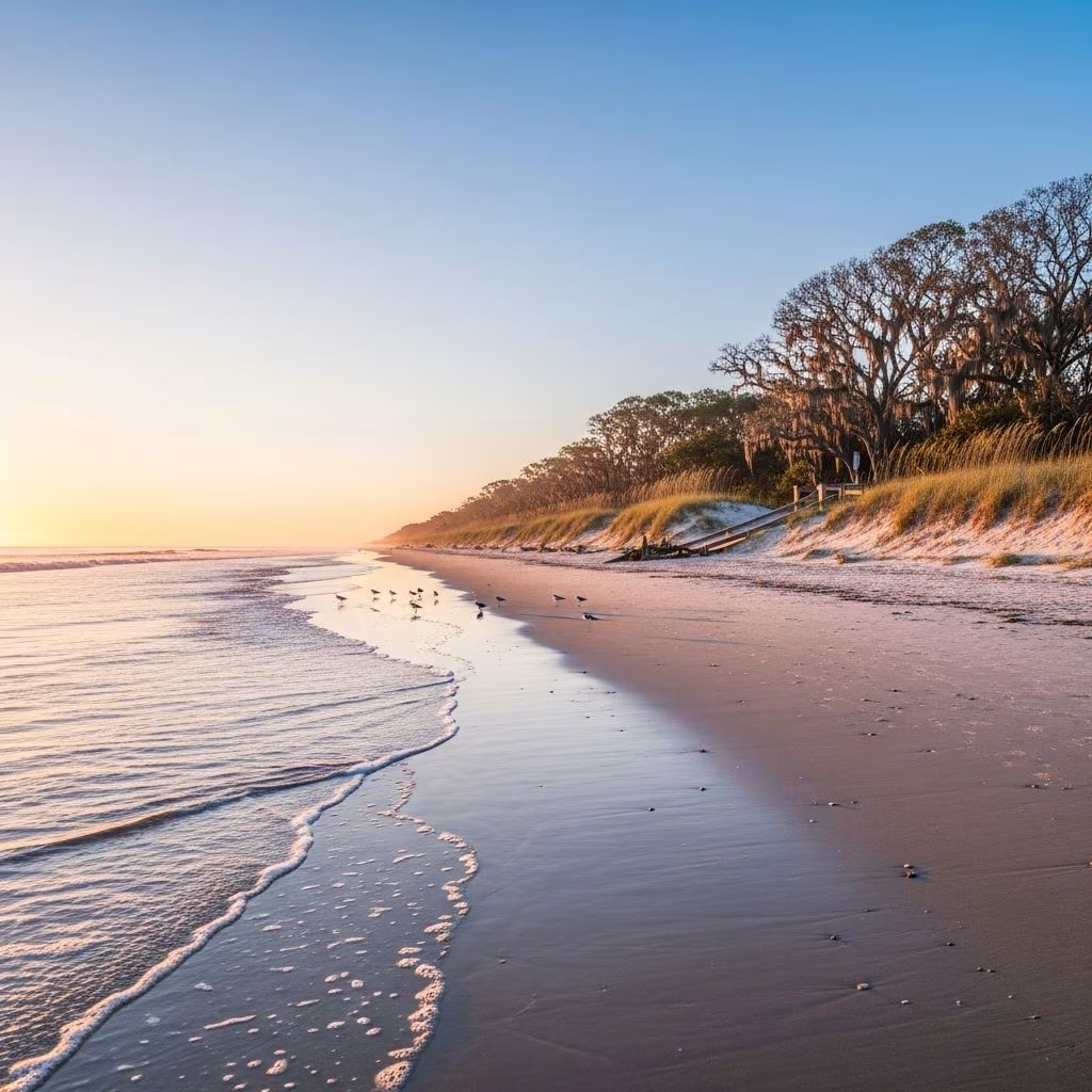
South Carolina’s coastline stretches for over 2,900 miles when including its barrier islands and waterways, yet many visitors remain unaware of the remarkable destinations that lie beyond the well-trodden beaches of Myrtle. The state’s coastal region offers a compelling blend of natural beauty, cultural heritage, and authentic small-town charm that attracts those seeking a more contemplative travel experience. From the Grand Strand extending through the northern reaches to the intricate network of barrier islands dotting the Lowcountry, this portion of the Atlantic seaboard presents opportunities for exploration that cater to various interests and travel styles.
The landscape that characterizes South Carolina’s shoreline reflects centuries of geological processes and human settlement patterns. The northern coastal region, commonly referred to as the Grand Strand, transitions seamlessly into what locals call the Hammock Coast as travelers move southward toward Charleston. Beyond Charleston, the terrain becomes increasingly maritime in character, with numerous tidal rivers, salt marshes, and barrier islands creating a complex ecosystem that has sustained human communities for thousands of years.
The tidal marshes that define much of South Carolina’s coastal environment are among the most productive ecosystems on Earth. These salt marshes, dominated by cordgrass and other halophytic vegetation, serve as crucial nurseries for commercially important fish species and provide essential habitat for waterfowl and wading birds. The interplay between land and water creates a landscape that feels distinctly different from the continental United States, influenced by Atlantic weather patterns and the warming effects of the Gulf Stream.
Exploring South Carolina’s coastal treasures benefits from a structured approach that allows sufficient time for each destination while maintaining geographic coherence. A five-day journey beginning in North Myrtle Beach and concluding in Beaufort county provides adequate opportunity to experience the region’s diverse attractions without excessive driving. The expedition can be conducted moving southward or arranged as a circuit depending on individual preferences and scheduling constraints.
The journey begins in North Myrtle Beach and the Pawleys Island vicinity, where visitors encounter the first of many protected natural areas and heritage sites. Heritage Shores Nature Preserve offers an accessible introduction to the region’s ecological systems through elevated boardwalks that minimize environmental impact while providing intimate views of native flora and fauna. The preserve’s proximity to Cherry Grove marsh facilitates observation of tidal processes and the bird species that depend on coastal wetlands.
For those with interest in sporting pursuits, several championship golf courses in the area reflect the architectural legacy of renowned designers. These recreational facilities often showcase the interplay between human design and natural topography characteristic of coastal development.
Murrells Inlet represents a transitional zone between larger beach destinations and smaller, more intimate communities. The inlet’s designation as the Seafood Capital of South Carolina reflects its historical importance as a fishing center and its contemporary role as a culinary destination. The working waterfront environment provides visitors with opportunities to observe ongoing commercial fishing operations and purchase fresh seafood directly from local vendors.
Huntington Beach State Park adjacent to Murrells Inlet combines recreational opportunities with cultural heritage appreciation. The park’s three miles of shoreline accommodate various activities while Atalaya Castle, a National Historic Landmark, preserves the architectural ambitions of early twentieth-century patrons of the arts.
Brookgreen Gardens, located mere minutes from the castle, demonstrates how private collections of sculpture can be integrated into naturalistic settings. The gardens contain hundreds of artworks positioned throughout landscaped grounds, creating an open-air museum experience that combines aesthetic appreciation with environmental education.
Pawleys Island embodies the characteristics of a successful small-scale beach resort that has maintained its character across multiple generations of development. The island’s most recognizable product—the rope hammock—represents a crafting tradition extending back more than a century, with contemporary artisans continuing to produce these practical and decorative items using traditional techniques.
The architectural heritage preserved in Pawleys Island includes numerous historic inns and accommodations housed in structures dating to the nineteenth century. These preserved buildings provide both practical lodging and tangible connections to the region’s past, allowing guests to experience historical environments while maintaining contemporary comfort standards.
The scenic expanse between Pawleys Island and Charleston, known as the Hammock Coast, extends through Georgetown County and represents one of South Carolina’s most visually compelling regions. The designation reflects both the landscape’s actual characteristics—including wooded areas and agricultural lands—and its historical economic base in agricultural production and maritime commerce.
Georgetown occupies a significant position in both South Carolina’s economic history and contemporary cultural landscape. As one of the state’s oldest port cities, Georgetown developed through commerce in rice, indigo, and other commodities that shaped the region’s demographic and social structures. The waterfront district preserves much of this maritime heritage while contemporary businesses and restaurants occupy historic structures.
The town’s compact geography facilitates walking-based exploration, allowing visitors to appreciate architectural details and street-level commercial activity simultaneously. Public access to the waterfront through parks and public spaces provides opportunities for observation of contemporary maritime activities alongside historical interpretation.
Charleston represents the region’s largest urban center and serves as a natural hub for coastal exploration. The city itself contains numerous museums, historic sites, and restaurants that warrant extended visitation, but the surrounding barrier islands provide contrasting experiences emphasizing natural systems and quieter recreational opportunities.
Bulls Island, the largest barrier island within Cape Romain National Wildlife Refuge, extends approximately seven miles and encompasses diverse habitats including maritime forests, salt marshes, and sandy beaches. The island’s Boneyard Beach displays dramatic examples of coastal erosion, with fallen tree trunks creating sculptural formations along the shoreline. Accessibility via ferry service and guided excursions democratizes access to this otherwise remote environment, allowing visitors without private watercraft to experience its ecological and aesthetic qualities.
Capers Island, located approximately fifteen miles north of Charleston, represents another exceptional barrier island preserve managed for conservation purposes while permitting limited recreational use. The island supports populations of nesting sea turtles and numerous migratory bird species, making it an important site for ornithological observation and study.
Morris Island, distinguished by its historically significant lighthouse, presents a different aesthetic character shaped by its proximity to Charleston Harbor and ongoing erosion processes. The island’s elevation provides vantage points for observing maritime traffic while its beaches remain productive venues for shell collecting and wildlife observation.
The southern portion of this coastal expedition encompasses Beaufort County and its network of sea islands, each with distinct characteristics reflecting varied historical trajectories. Dataw Island, potentially inhabited for as many as ten thousand years, carries archaeological and cultural significance extending far beyond its contemporary recreational functions. Historical records and archaeological evidence document both Native American habitation and subsequent European settlement, providing layered narratives of human occupation and adaptation to coastal environments.
Lady’s Island and adjacent areas preserve landscapes shaped by centuries of agricultural activity, particularly indigo cultivation during the eighteenth and nineteenth centuries. Contemporary land use patterns, including continued farming by descendents of enslaved agricultural workers, represent ongoing connections between present communities and historical economic systems.
The ruins of St. Helena Chapel of Ease provide archaeological evidence of mid-eighteenth-century religious and social practices among plantation-owning families. The contrast between this structure and the Mary Jenkins Praise House, where enslaved individuals gathered for worship, illustrates the segregated religious practices that characterized the colonial and antebellum periods.
These historical sites, considered together with the contemporary communities that have maintained cultural continuity across generations, provide opportunities for comprehensive understanding of the region’s complex past and its ongoing relevance to present-day residents.
South Carolina’s barrier islands display remarkable diversity in terms of accessibility, development patterns, and ecological characteristics. Some islands remain accessible only by water, preserving relatively undeveloped conditions that reflect pre-twentieth-century environmental states. Others support established residential and commercial communities, balancing development pressures against conservation imperatives.
| Island Name | Location | Access Method | Primary Characteristics |
|---|---|---|---|
| Bulls Island | Cape Romain NWR, north of Charleston | Ferry service | Pristine beaches, maritime forest, wildlife refuge |
| Waites Island | North of North Myrtle Beach | Kayak tours | Research facility, kayak access, ecological focus |
| Capers Island | 15 miles north of Charleston | Boat or kayak tours | State heritage preserve, bird populations |
| Morris Island | Charleston Harbor mouth | Boat and kayak tours | Historic lighthouse, shell collecting |
| Daufuskie Island | Near Hilton Head | Ferry from Hilton Head | Secluded beaches, historic landmarks |
The Lowcountry’s ecological systems depend on complex interactions between freshwater and saltwater environments, with tidal fluctuations creating dynamic conditions that support specialized plant and animal communities. The salt marshes that characterize much of the coastal landscape depend on regular tidal inundation, and any disruption to these hydrological patterns threatens the species that depend on marsh resources.
Modern conservation efforts focus on protecting remaining undeveloped barrier islands while managing recreational use in ways that minimize environmental degradation. The establishment of wildlife refuges and state heritage preserves reflects recognition that these environments require active management to maintain their ecological and cultural values.
The timing of coastal exploration influences both the visitor experience and environmental conditions encountered. Spring months, particularly April and May, offer pleasant temperatures and the aesthetic appeal of azalea blooms in cultivated gardens throughout the region. Summer conditions bring increased heat and humidity alongside peak tourist seasons, while fall weather typically provides comfortable temperatures with reduced crowds. Winter months offer solitude and opportunities for observing migratory bird populations, though water temperatures become prohibitive for swimming.
The coastal region maintains good transportation infrastructure along U.S. Route 17, which historically connected coastal communities and continues to serve as the primary north-south thoroughfare through the region. This historic highway provides thematic continuity to the expedition, as many destinations and communities derive their character from their positioning along this traditional trade route.
Accommodations range from modern resort facilities to historic inns housed in architecturally significant structures. The variety of lodging options permits visitors to select experiences matching their preferences regarding contemporary amenities versus historical authenticity.
South Carolina’s coastal communities maintain distinctive culinary traditions reflecting both the region’s agricultural heritage and its maritime resources. Seafood-centered menus dominate restaurant offerings in working waterfront communities, with preparation methods often reflecting traditional techniques adapted to contemporary contexts. Local breweries and beverage producers complement food-focused establishments, creating dining scenes that attract both casual visitors and serious food enthusiasts.
Spring (April-May) and fall (September-October) provide optimal weather conditions with comfortable temperatures and manageable crowds. Summer offers beach swimming but brings higher tourist volumes and intense heat.
Most remote islands require ferry service or private watercraft for access. Numerous outfitters and tour operators provide guided excursions, making visitation feasible without personal boat ownership.
Common sightings include dolphins, various heron species, egrets, pelicans, and during appropriate seasons, sea turtles. Over 290 bird species have been documented across the barrier island system.
Several state parks and heritage areas provide camping facilities. Edisto Beach State Park offers fully furnished cabins and camping sites suitable for extended stays.
A five-day journey provides adequate time for meaningful exploration of primary destinations. Longer trips allow for deeper engagement with individual communities and natural areas.
