

 Travel Essentials
 Travel Essentials

Comprehensive guide to Sydney's public transport network including trains, buses, ferries, light rail, and metro systems with practical tips for efficient travel.
 Travel Essentials
Sydney’s sprawling layout around the harbour creates a unique transportation landscape that rewards visitors who take time to understand the system. The city’s public transport network combines multiple modes of travel, each serving distinct routes and purposes across the metropolitan area. While driving presents challenges due to traffic congestion and parking costs, the integrated transit infrastructure offers a reliable and economical alternative for exploring this vibrant Australian city.
Before boarding any public transport in Sydney, you’ll need to establish a payment method. The system operates on a tap-and-go principle that streamlines the boarding process across all transport modes.
The fare structure operates on distance-based zones, with the system automatically calculating charges when you tap off at your destination. Daily fare caps ensure that multiple trips won’t exceed the cost of a full day pass, making this system advantageous for tourists taking numerous journeys in a single day.
Sydney’s rail infrastructure comprises both traditional train lines and the newer automated metro system, each offering distinct advantages for different travel scenarios.
The suburban rail network represents the backbone of Sydney’s public transport system, connecting the city centre to distant suburbs and regional destinations. These services operate from approximately 5am to midnight, with extended coverage during evening hours through night services. The City Circle loop provides convenient access to major attractions, and express trains connect the centre to outlying areas including the Blue Mountains, Newcastle, and Kiama.
Key advantages of train travel include predictable scheduling, air-conditioned carriages, and the ability to cover significant distances quickly. However, the network has geographic limitations, particularly regarding access to northern and eastern beaches such as Manly and Bondi, which rely on alternative transport modes.
The recently expanded Sydney Metro system represents Australia’s most significant public transport infrastructure project in recent decades. This driverless rail network operates under the harbour and through the city, offering journey times that dramatically exceed conventional trains. Travel from Barangaroo to North Sydney takes merely three minutes via metro, while the complete journey from Sydenham in the inner west to Chatswood requires only 22 minutes.
The metro network’s futuristic design and operational efficiency have generated considerable enthusiasm among Sydney residents. Once fully completed, the system will comprise 46 stations strategically positioned throughout the metropolitan area. Access points integrate seamlessly with existing train stations and dedicated metro facilities, enabling straightforward connections between transport modes.
Most train lines operate with 10-minute intervals during daytime hours, reducing to 15-20 minute gaps during off-peak periods. Night services between midnight and 4:30am operate less frequently but ensure round-the-clock connectivity. The City Circle route provides continuous loops around central Sydney, offering flexibility for tourists exploring the downtown core.
Ferries represent the quintessential Sydney travel experience, combining transportation with scenic harbour views. The ferry network connects major destinations including Circular Quay, Barangaroo, Milsons Point, and Manly, providing water-based alternatives to road travel.
Ferry services operate throughout the day with varying frequencies depending on the route and time of day. Peak hours see services departing every 10-15 minutes on popular routes, while off-peak periods feature extended intervals. Express ferries reduce journey times on longer routes, making them competitive with bus alternatives for specific destinations.
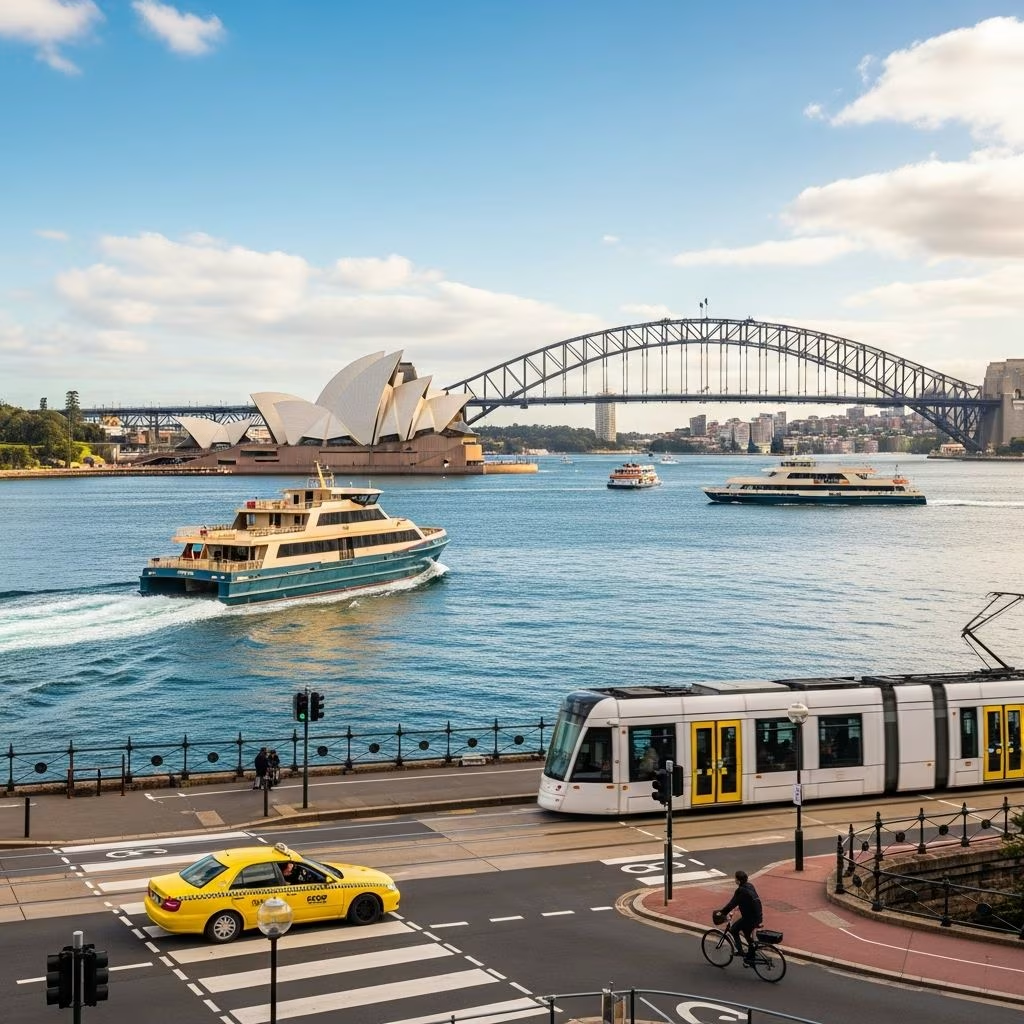
The ferry experience offers unique perspectives on Sydney Harbour and the iconic Opera House, Harbour Bridge, and waterfront architecture. Many tourists prioritize ferry travel specifically for the journey itself, recognizing its value beyond simple point-to-point transportation. Typical ferry fares range from $7-$15 depending on distance, with daily caps ensuring economical multiple-journey days.
The light rail system provides modern, air-conditioned transport through inner-city areas where traditional trains don’t directly serve. These sleek trams operate with frequent scheduling and represent a comfortable alternative for shorter-to-medium distance travel.
The L1 Dulwich Hill line extends from Central Station westward through Chinatown and Darling Harbour, passing the Star Casino, Sydney Fish Market, Glebe, and Leichhardt before reaching Dulwich Hill. This 45-minute journey operates with 7-15 minute frequency, providing regular connections throughout the route.
The L2 Randwick line connects Circular Quay through the city centre to Central Station, then branches eastward through Surry Hills toward the Sydney Cricket Ground and Randwick. The L3 line provides additional eastern suburban coverage with connections at Circular Quay.
Light rail excels for accessing areas like Darling Harbour, Chinatown, Moore Park, and the Cricket Ground without requiring lengthy walks from traditional train stations. The modern infrastructure features air conditioning, wheelchair accessibility, and low-floor entry systems that accommodate passengers with mobility challenges. Journey times compete favourably with buses while providing greater comfort and reliability.
Typical light rail fares range from $3-$6 depending on distance, making this an economical choice for inner-city exploration. The visual experience differs from enclosed train carriages, allowing passengers to observe neighbourhoods and street-level activity throughout their journey.
Transport for NSW operates an extensive bus network that extends far beyond the rail infrastructure’s reach, connecting residential areas, regional destinations, and coastal locations. This comprehensive coverage makes buses essential for accessing Sydney’s beaches and outer suburbs.
The bus network divides into categories based on service type and stopping patterns. Express routes, identified by M or E prefix designations, offer limited stops and faster journey times compared to regular services. L-designated routes provide similar express functionality with fewer intermediate stops. Standard numbered routes serve more frequent stops, enabling access to local neighbourhoods.
Operating hours extend from approximately 4:30am until midnight, with less frequent NightRide services replacing most train services during overnight hours between midnight and 4:30am. Selected routes operate 24 hours daily, ensuring round-the-clock connectivity for shift workers and late-night travellers.
Several bus routes merit particular attention for tourist itineraries. The B-Line express service from Wynyard efficiently connects to Northern Beaches destinations, ideal for surf enthusiasts and beach visitors. Route 389 provides scenic connections from Darling Harbour toward Bondi Junction, passing through diverse neighbourhoods. Coastal express routes serve Bondi and Coogee beaches, enabling easy access from the city centre.
Major bus hubs concentrate services at key locations including Wynyard Park, Railway Square near Central Station, the Queen Victoria Building vicinity, and Circular Quay. Regional coach services operated by commercial operators like Firefly Express and Greyhound depart from Eddy Avenue in front of Central Station, connecting Sydney to destinations throughout regional New South Wales.
Sydney Airport, located approximately 10-15 kilometres south of the city centre, maintains multiple transport connections enabling efficient transfers to downtown accommodation and attractions.
The T8 Airport and South line offers the fastest connection from the airport’s domestic and international terminals to Central Station in just 10-15 minutes. Services operate approximately every 10 minutes throughout the day, making this the most reliable option for independent travellers. The train provides direct access to the City Circle, enabling straightforward connections to harbour ferries at Circular Quay and retail destinations near Town Hall Station.
Taxi ranks operate at both terminal buildings, offering conventional taxi service despite variable journey times of 20-30 minutes depending on traffic conditions. Rideshare services including Uber and local alternatives maintain dedicated pickup areas with clear signage directing passengers to collection zones. Private car hire companies operate rental facilities accessible from terminal areas, enabling self-drive options for those comfortable navigating Sydney’s roads.
Different Sydney neighbourhoods warrant distinct transport approaches based on their location and available infrastructure.
The CBD demonstrates pedestrian-focused planning with walkable distances between major attractions. However, strategic use of trains, light rail, and ferries efficiently connects more distant destinations within the downtown core. The City Circle loop provides convenient access to key attractions including shopping precincts, museums, and waterfront areas.
Circular Quay serves as a major transport interchange connecting trains, ferries, and light rail. The picturesque location near the Opera House and Harbour Bridge makes this area easily accessible via multiple modes. Water taxi services complement ferry routes, offering flexible point-to-point connections for exploring the harbour.
Express trains from Central Station connect to outer suburbs including Newtown, Cronulla, Penrith, and Olympic Park. The regional rail network enables intercity travel to Newcastle and Blue Mountains destinations, extending Sydney’s transport reach into surrounding regions.
| Transport Mode | Best For | Typical Fare | Journey Time Factor | Coverage Area |
|---|---|---|---|---|
| Train | Long distances, outer suburbs | $4-$8 local, $18 airport | Fast and predictable | Comprehensive rail network |
| Metro | Rapid inner-city travel | Included in Opal fare | Fastest option | Growing network under development |
| Ferry | Scenic harbour travel | $7-$15 | Slower but scenic | Harbour destinations only |
| Light Rail | Inner-city neighbourhoods | $3-$6 | Moderate speed | Central and eastern suburbs |
| Bus | Beach access, local exploration | $2-$5 | Variable with traffic | Most comprehensive coverage |
Opal cards, contactless credit cards, debit cards, and major mobile wallet systems all function across trains, buses, ferries, and light rail without requiring different payment methods.
Most modern light rail and metro vehicles feature low-floor entry and wheelchair accessibility. However, some older train stations lack elevators; checking accessibility information before travel is advisable.
Standard services operate until midnight, with NightRide bus services providing overnight connectivity until 4:30am. Selected routes operate 24-hour service.
Yes, daily fare caps ensure that multiple journeys using trains, buses, ferries, and light rail won’t exceed a maximum daily charge when using Opal or contactless payment.
Contactless credit cards offer tap-and-go convenience without Opal card requirements, automatically applying daily fare caps for occasional users.
