

 Travel Essentials
 Travel Essentials

An exploration of Earth's largest desert regions, from polar expanses to subtropical dunes, featuring distinctive characteristics and geographical significance.
 Travel Essentials
Deserts represent some of Earth’s most extraordinary and expansive landscapes, covering approximately one-third of the planet’s land surface. These arid regions display remarkable diversity in their climate, terrain, and ecological characteristics. From scorching subtropical plains to frozen polar regions, deserts showcase nature’s ability to create breathtaking environments under extreme conditions. Understanding these vast landscapes reveals the complexity of Earth’s geographical features and the unique ecosystems that thrive within them.
Deserts are commonly categorized based on their temperature characteristics and precipitation patterns. The primary distinction separates polar deserts from non-polar varieties, each possessing distinct environmental attributes. Polar deserts, found in Earth’s extreme northern and southern regions, experience sub-zero temperatures throughout much of the year despite receiving minimal precipitation. Non-polar deserts, conversely, are further subdivided into subtropical, cold winter, and cool coastal categories, reflecting their climate variations and seasonal temperature fluctuations.
A fundamental characteristic defining all deserts is precipitation levels rather than temperature alone. Most deserts receive less than ten inches of annual rainfall, creating the arid conditions that prevent substantial vegetation growth and support specialized wildlife adapted to harsh environments.
Contrary to popular perception, Earth’s most expansive deserts are not the sun-scorched dunes of popular imagination but rather the frozen expanses of polar regions. These immense territories, while appearing inhospitable, technically qualify as deserts due to their minimal precipitation and specific climatic conditions.
The Antarctic Desert stands as Earth’s largest desert by surface area, encompassing the entire Antarctic continent at approximately 5.5 million square miles. This colossal region represents the planet’s most extreme environment, where temperatures plummet far below freezing and wind speeds regularly exceed hurricane force. Despite its icy appearance and frozen landscapes, Antarctica receives minimal precipitation, primarily as snow rather than rain. The continent’s designation as a desert reflects this precipitation scarcity rather than any absence of water in solid form.
The Antarctic plateau remains virtually untouched by human civilization, serving as a critical research destination for climate scientists and polar explorers. Its vast ice sheets contain irreplaceable records of Earth’s climatic history spanning hundreds of thousands of years.
The Arctic Polar Desert represents the second-largest desert globally, covering approximately 5.4 million square miles across portions of Alaska, Canada, Greenland, Iceland, Norway, Sweden, Finland, and Russia. This expansive region experiences extreme seasonal variations, with continuous daylight during summer months and perpetual darkness during winter. Arctic temperatures remain frigid year-round, rarely exceeding freezing except during brief summer periods.
The Arctic’s ecological significance extends beyond its size, as it supports specialized wildlife including polar bears, arctic foxes, and caribou adapted to its challenging environment. Indigenous peoples have inhabited Arctic regions for millennia, developing sophisticated survival strategies suited to extreme conditions.
Outside polar regions, subtropical deserts represent the largest arid expanses, characterized by hot temperatures, minimal rainfall, and distinctive sand dune formations. These regions attract significant scientific and tourist attention due to their accessibility and dramatic landscapes.
The Sahara Desert spans approximately 3.5 million square miles across northern Africa, encompassing portions of multiple nations and representing the world’s largest hot desert. This immense subtropical region extends from the Atlantic Ocean’s shores to the Red Sea, dominating North Africa’s geography and climate patterns. The Sahara’s landscape varies considerably, featuring expansive sand seas, rocky plateaus, mountain ranges, and numerous oases that support human settlements and agriculture.
The Sahara’s northern regions contain the Atlas Mountains and various volcanic formations, while central areas showcase iconic sand dunes reaching heights exceeding 500 feet. The desert’s southern boundaries transition gradually into savanna ecosystems. Historically, the Sahara served as a crucial crossroads for trade routes connecting Mediterranean civilizations with sub-Saharan Africa, fostering cultural exchange and economic development across continents.
Covering approximately one million square miles, the Arabian Desert dominates the Arabian Peninsula and surrounding regions across Saudi Arabia, United Arab Emirates, Oman, and Yemen. This subtropical desert features predominantly sandy and rocky terrain with scattered oases supporting Bedouin communities. The Arabian Desert’s petroleum reserves represent significant global economic importance, shaping international energy politics and development patterns.
This desert’s extreme temperatures frequently exceed 120 degrees Fahrenheit, creating some of Earth’s harshest environments. Traditional nomadic peoples have inhabited Arabian Desert regions for millennia, developing sustainable resource management practices adapted to severe scarcity.
Australia contains multiple major desert systems collectively known as the Outback, covering vast central portions of the continent. The Great Victoria Desert, Australia’s largest at approximately 250,000 square miles, occupies southwestern regions. The Great Sandy Desert and Gibson Desert rank among Australia’s other significant arid zones.
These Australian deserts feature spinifex grasslands, saltbush vegetation, and scattered water sources supporting indigenous Aboriginal peoples for over 65,000 years. The Outback’s red earth, dramatic rock formations, and unique wildlife including kangaroos, dingoes, and numerous reptile species create distinctive landscapes fundamentally shaped by extreme aridity.
Cold winter deserts experience significant temperature variations between seasons, with harsh winters contrasting dramatically against summer warmth. These transitional climates create challenging environmental conditions supporting specialized vegetation and wildlife.
Spanning approximately 500,000 square miles across China and Mongolia, the Gobi Desert represents Central Asia’s most prominent arid region. This cold winter desert experiences dramatic seasonal temperature swings, with winter temperatures plummeting to negative 40 degrees Fahrenheit while summer heat reaches 113 degrees Fahrenheit. The Gobi’s landscape encompasses vast gravel plains, rocky mountains, and scattered sand dunes rather than uniform sandy expanses.
The Gobi holds significant paleontological importance, having yielded numerous dinosaur fossils contributing substantially to paleontological understanding. Modern Gobi inhabitants include Mongol herders maintaining traditional pastoral lifestyles despite contemporary pressures.
Argentina’s Patagonian Desert extends approximately 260,000 square miles across southern South America, creating one of the Western Hemisphere’s most formidable arid regions. This cold desert experiences fierce windstorms, particularly the Pampero wind systems reaching destructive velocities. Vegetation consists primarily of hardy scrubland adapted to relentless wind exposure and sparse precipitation.
Patagonia’s topography features windswept plains, glacial formations, and distinctive rock formations sculpted by geological processes. The region’s isolation and challenging climate have preserved relatively pristine ecosystems supporting guanacos, pumas, and diverse bird species.
Cool coastal deserts present paradoxical environmental conditions, receiving moisture-laden ocean air while experiencing minimal rainfall. The Atacama Desert in Chile represents this classification’s most extreme manifestation, covering approximately 54,000 square miles along South America’s Pacific coast. Some Atacama regions have never recorded measurable precipitation in recorded history, creating Earth’s driest non-polar environment.
Despite its extreme aridity, the Atacama’s landscape captivates visitors with dramatic diversity. Valle de la Luna (Moon Valley) displays otherworldly rock formations resembling lunar terrain. Salt flats, volcanic peaks, and colorful mineral deposits create visual spectacles visible from space. The Atacama’s exceptional astronomical conditions, resulting from low atmospheric moisture and minimal light pollution, position it among Earth’s premier stargazing locations.
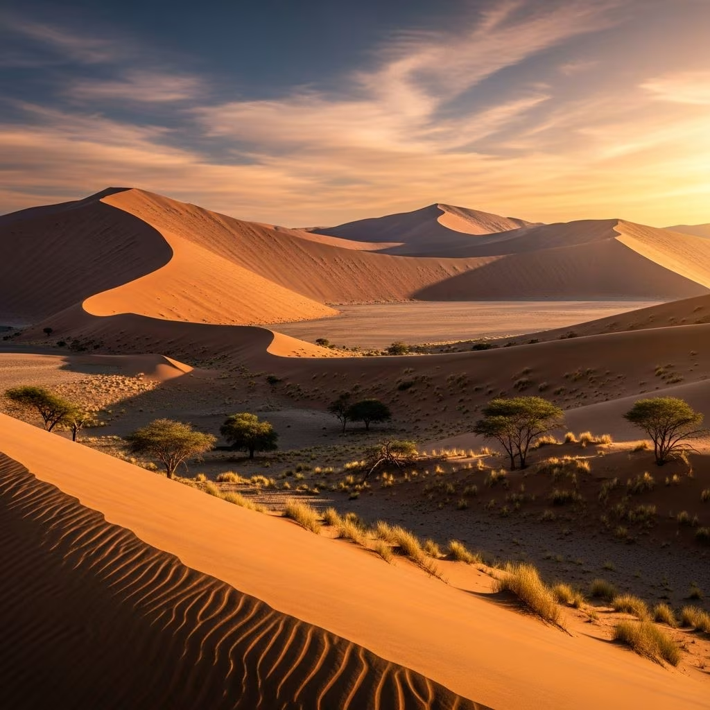
The Namib Desert in southwestern Africa represents another cool coastal desert, covering approximately 13,000 square miles along Angola, Namibia, and South Africa’s Atlantic coast. This ancient desert, potentially Earth’s oldest, features massive sand dunes and specialized desert wildlife adapted to moisture extraction from coastal fog.
North America contains numerous significant desert systems reflecting varied climatic conditions and geographical characteristics. The Great Basin Desert spans approximately 190,000 square miles across the interior western United States, featuring basin-and-range topography with interior drainage patterns. Temperatures in this cold winter desert fluctuate dramatically between seasons.
The Chihuahuan Desert, covering approximately 175,000 square miles across Mexico and the southwestern United States, represents North America’s largest desert. This region features diverse terrain including sand dunes, desert scrubland, and mountainous areas.
Death Valley, located within the Great Basin Desert, holds the distinction of recording Earth’s highest reliably documented temperature at 134 degrees Fahrenheit. Despite its extreme heat and aridity, Death Valley supports adapted vegetation including creosote bushes and desert wildflowers that bloom spectacularly following rare precipitation events.
| Desert Name | Location | Surface Area (sq mi) | Desert Type | Key Characteristic |
|---|---|---|---|---|
| Antarctic | Antarctica | 5.5 million | Polar | Largest desert globally |
| Arctic | Multiple continents | 5.4 million | Polar | Second-largest desert |
| Sahara | Northern Africa | 3.5 million | Subtropical | Largest hot desert |
| Arabian | Arabian Peninsula | 1 million | Subtropical | Extreme heat conditions |
| Gobi | China/Mongolia | 500,000 | Cold Winter | Paleontological significance |
| Patagonian | Argentina | 260,000 | Cold Winter | Extreme wind patterns |
| Great Victoria | Australia | 250,000 | Subtropical | Ancient Aboriginal lands |
| Kalahari | Southern Africa | 220,000 | Subtropical | Wildlife diversity |
| Atacama | Chile | 54,000 | Cool Coastal | Driest non-polar desert |
| Namib | Southern Africa | 13,000 | Cool Coastal | Ancient desert ecosystem |
Contrary to assumptions about desert barrenness, these regions support remarkable biodiversity comprising organisms specifically adapted to extreme conditions. Desert plants develop specialized water conservation mechanisms including deep root systems, succulent tissues, and reduced leaf surfaces minimizing water loss.
Desert animals exhibit behavioral and physiological adaptations enabling survival with minimal water. Nocturnal activity patterns reduce daytime heat exposure, while specialized kidneys concentrate urine, conserving precious moisture. Large ears in certain species facilitate heat dissipation, while light coloration reflects solar radiation.
Iconic desert wildlife includes camels demonstrating exceptional water conservation, desert snakes utilizing efficient hunting strategies, scorpions resistant to extreme temperatures, and numerous bird species extracting moisture from scarce vegetation.
Deserts are defined primarily by precipitation levels rather than temperature. Most deserts receive less than ten inches annual rainfall, with this moisture scarcity determining ecological classification regardless of temperature variations.
Despite abundant ice and snow, Antarctica and Arctic regions qualify as deserts because they receive minimal precipitation in any form. Annual snowfall is remarkably limited relative to temperate regions, technically defining these zones as extremely cold deserts.
The Sahara Desert and American Southwest deserts offer well-developed tourism infrastructure including accommodations, transportation, and guided experiences. The Atacama Desert also attracts significant tourism due to its distinctive landscape features.
Many deserts support indigenous and immigrant populations utilizing specialized knowledge and resource management strategies. Oases provide water sources supporting agricultural communities, while nomadic herding traditions remain prevalent in regions including the Sahara and Arabian deserts.
Desert vegetation develops extensive root systems reaching deep groundwater supplies. Some plants extract moisture from fog and dew, while others store water in thick succulent tissues used during dry periods.
Earth’s greatest desert expanses represent diverse ecosystems showcasing nature’s remarkable adaptability and beauty. From frozen Antarctic plateaus to scorching Saharan dunes, deserts demonstrate geological complexity and ecological resilience across planetary extremes. These vast landscapes continue inspiring scientific research, cultural exploration, and spiritual reflection, reminding humanity of nature’s power and grandeur.
