

 Travel Essentials
 Travel Essentials

Discover how to hike the 111km circular trail around Vilnius, Lithuania, featuring diverse landscapes, historical sites, and nature experiences suitable for various fitness levels.
 Travel Essentials
Vilnius, Lithuania’s vibrant capital, is renowned for its stunning Baroque architecture, dynamic arts scene, and cultural heritage. However, beyond the bustling city center lies an exceptional opportunity for outdoor enthusiasts: a remarkable 111-kilometer circular hiking route that circumnavigates the entire city. This comprehensive trail offers hikers an immersive experience that combines pristine natural landscapes, historical landmarks, and authentic cultural encounters in a single, cohesive journey.
The circular hiking path encircling Vilnius spans approximately 111 kilometers (69 miles), though the route is commonly referred to as the “100km trail.” This distinction matters significantly for trip planning and pacing strategies. The entire route has been thoughtfully divided into 10 distinct sections, each ranging from 9 kilometers to 19 kilometers in length. This segmentation allows hikers to customize their experience based on available time, fitness level, and personal preferences.
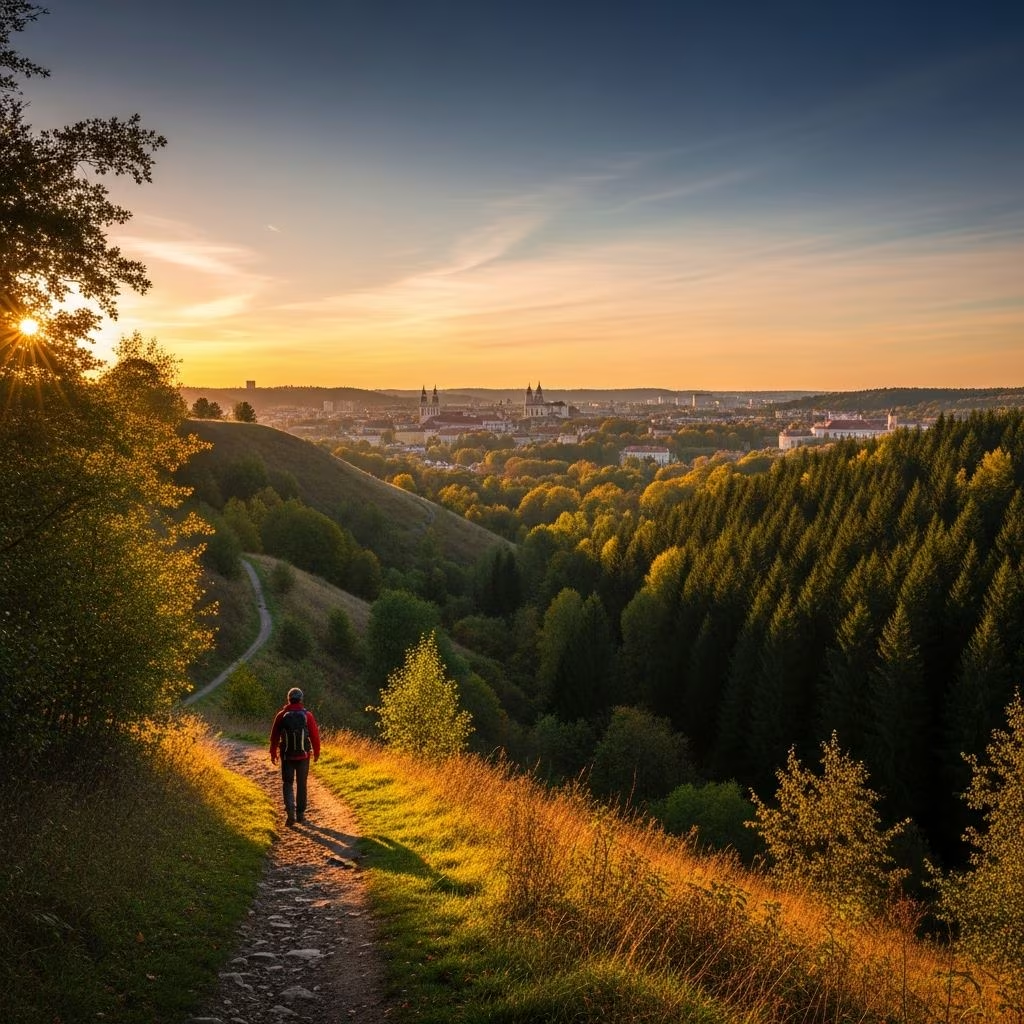
What makes this trail particularly appealing is the astonishing diversity packed into its relatively compact circuit. The path winds through dense, jungle-like forests, crosses ancient cobblestone roads that emerge unexpectedly between vegetation, and opens onto vast panoramic vistas overlooking the surrounding countryside. Simultaneously, hikers encounter cultural attractions, archaeological hill forts, the meandering Neris River, and intriguing Soviet-era residential structures, creating a striking contrast that characterizes the entire walking experience.
The flexibility of this trail means hikers can structure their journey according to their schedule and endurance levels. The most intensive option involves completing the entire route in four days, which combines multiple sections into longer daily distances. This accelerated approach suits experienced hikers with strong fitness levels and a desire for a challenging adventure.
For those seeking a more balanced experience, five days represents the ideal timeframe. This extended schedule allows daily distances to remain manageable while still providing an authentic multi-day hiking experience. With five days, you maintain reasonable evening hours for relaxation, meal preparation, and reflection on the day’s journey without sacrificing the genuine outdoor immersion that characterizes multi-day trekking.
The difficulty progression across the 10 sections varies considerably, ranging from easy routes suitable for beginners to very challenging segments that demand significant stamina and technical hiking skills. This varied difficulty distribution means that regardless of your experience level, you can select sections that match your capabilities or challenge yourself incrementally as you progress.
Understanding how experienced hikers structure their journeys provides valuable insight for planning your own adventure. One common approach combines the initial sections into a substantial first-day effort of 21 kilometers, spanning from Stalo kalnas to Serpentine. This opening stretch establishes momentum and provides a comprehensive introduction to the trail’s varied terrain.
The third day of a four-day itinerary typically encompasses three consecutive sections, totaling approximately 26 kilometers from Žemieji Paneriai to Verkiai. By this point in the journey, hikers have developed better rhythm and endurance, making the mid-route distance manageable despite its considerable length.
The final day presents the most demanding challenge, requiring hikers to complete the remaining sections in a single push spanning 37.9 kilometers from Verkiai back to the starting point at Stalo kalnas. This culminating stretch tests your physical reserves and mental determination but offers the profound satisfaction of completing the entire circuit.
The trail benefits from reliable marking infrastructure that guides hikers through both wilderness and urban sections. Red signs clearly displaying “100km takas aplink Vilnių” (100km trail around Vilnius) serve as primary navigation markers. These red indicators appear attached to trees, road signs, and various other surfaces throughout the route. Additionally, information plaques mark the beginning of each section, while directional signs appear at major intersections and within city areas.
However, seasonal conditions can affect navigation reliability. During summer months, tall grass, dense bushes, and overhanging tree branches occasionally obscure trail markings. Hikers should complement visual markers with offline maps or GPS devices, particularly for summer hiking ventures. This redundant navigation approach ensures you maintain correct orientation even when weather-related vegetation growth temporarily obscures signage.
Timing significantly influences your trail experience and comfort level. Summer, spanning May through September, represents the optimal season for hiking the Vilnius circular route. This period offers extended daylight hours that maximize your hiking time while maintaining safety and allowing time for camp setup or evening relaxation. Beyond practical daylight benefits, summer enables you to appreciate the Baltics’ unique extended twilight, perfect for enjoying outdoor activities and evening meals at regional establishments.
Beyond June and July’s peak summer conditions, May and September present attractive alternatives with pleasant temperatures and fewer crowds. Spring offers the advantage of witnessing nature’s renewal, while autumn provides comfortable hiking conditions with spectacular foliage displays. Winter and early spring present significant challenges due to reduced daylight, muddy conditions, and unpredictable weather, making them less suitable for this multi-day circumcircular journey.
Despite Vilnius’s growing popularity as a tourist destination, the circular hiking trail remains remarkably uncrowded throughout most of its length. Even during summer high season, most sections attract minimal foot traffic, with hikers often experiencing solitude surrounded by forest, wildlife, and natural sounds. Certain well-known attractions create temporary congregation points: the Belmontas Watermill, Pūčkoriai Outcrop geological formation, the Green Lakes, and Calvary Forest Park draw more visitors as locals use these recreational spaces. However, these popular sections represent small portions of the overall 111-kilometer circuit.
This relatively low crowd density means you can enjoy a genuine wilderness experience mere kilometers from a European capital city. The opportunity to hike for extended periods without encountering other people provides psychological and spiritual benefits that enhance the overall journey, allowing for personal reflection, wildlife observation, and uninterrupted connection with natural environments.
The trail encompasses numerous significant natural and cultural features that enrich your hiking experience. The Verkiai Regional Park represents one of the most substantial protected areas within the circuit, featuring the impressive 18th-century Verkiai Palace complex as its centerpiece. This extensive park also contains distinctive green lakes, riverside hiking paths along the Neris River, and the Way of the Cross pilgrimage route, which attracts visitors from throughout Europe.
The Pūčkoriai Outcrop stands as a unique geological formation offering stunning panoramic vistas across the surrounding landscape. This distinctive natural feature provides both visual drama and excellent opportunities for photography during mid-day hiking when light angles enhance the rock formations’ sculptural qualities.
For those interested in archaeological heritage, the trail connects to several historically significant sites, including ancient hill forts that represent Lithuania’s pre-Christian past. These elevated terrain features offer both historical education and strategic viewpoint advantages for surveying surrounding geography.
| Fitness Level | Recommended Approach | Daily Distance | Duration |
|---|---|---|---|
| Beginner | Select easy sections only; do partial circuit | 9-12 km | 6-8 days or longer |
| Intermediate | Mix easy and moderate sections; 5-day timeline | 18-22 km | 5 days |
| Advanced | Include challenging sections; 4-day timeline | 25-38 km | 4 days |
The Vilnius circular trail accommodates diverse fitness levels through its varied section difficulty ratings and customizable distance options. Beginners can comfortably tackle individual easy sections following well-marked paths without overexerting themselves. These introductory segments provide excellent opportunities to develop hiking skills, test equipment, and build confidence before attempting longer distances.
Intermediate hikers benefit from the five-day approach, which balances physical challenge with adequate recovery time. This timeline pushes fitness boundaries while remaining achievable for those with moderate regular exercise habits. Advanced hikers seeking significant physical challenge embrace the four-day intensive option, which demands substantial daily distances and accumulated elevation changes across consecutive days.
Successful completion requires thoughtful preparation extending beyond casual day-hiking. Multi-day hiking demands proper footwear tested on extended distances to prevent blisters and foot injuries. Quality hiking boots or trail shoes with appropriate ankle support protect feet across varied terrain encompassing forest paths, rocky sections, and urban pavements.
Accommodation options range from camping to guesthouses and hotels positioned near trail sections, allowing flexible lodging strategies. Carrying a lightweight tent, sleeping bag, and pad provides camping flexibility, while reserving accommodations in advance simplifies logistics if you prefer structured overnight arrangements.
Navigation tools including detailed offline maps, GPS devices, or smartphone applications prevent disorientation despite the trail’s generally reliable marking system. Physical maps prove valuable when electronic devices fail or batteries deplete during remote forest sections.
Water and nutrition planning requires attention to resupply opportunities. While the route passes through or near settlements offering refreshment options, carrying adequate water capacity and high-energy snacks prevents dehydration and energy depletion during extended daily hiking segments.
Lithuanian weather during summer hiking season generally remains mild and pleasant, with daytime temperatures typically ranging between 18-22 degrees Celsius. However, weather patterns can shift rapidly, requiring preparation for unexpected rain. Waterproof jackets, pack covers, and weather-appropriate clothing protect against sudden precipitation common in Baltic climates.
Insects, particularly mosquitoes in forest sections and around water features, can create significant discomfort during summer months. Carrying effective insect repellent containing DEET or natural alternatives mitigates this minor but persistent annoyance.
The circular trail’s proximity to the city center enables convenient integration with cultural exploration. Many trail sections connect directly to urban areas, allowing hikers to complete portions of the circuit while based in city accommodations. This flexibility means you can experience both intensive multi-day hiking experiences and shorter individual section explorations while maintaining comfortable city-center lodging.
This hybrid approach appeals to travelers balancing nature immersion with cultural engagement, allowing experience of both Vilnius’s renowned architectural heritage and its surrounding natural landscapes within a single trip.
Difficulty varies significantly across the 10 sections, ranging from easy to very challenging. The complete circuit suits intermediate to advanced hikers, though beginners can tackle individual easy sections successfully.
May through September offers ideal conditions with extended daylight, pleasant temperatures, and reliable weather patterns. Peak summer (June-July) provides maximum daylight but attracts more crowds.
Yes, the 10-section design specifically enables flexible exploration. You can hike individual sections as day trips or combine multiple sections across several days according to your schedule.
While the search results do not explicitly address camping permissions, options exist for both camping and guesthouse accommodations near trail sections.
The trail passes near settlements and recreational areas with facilities, though carrying supplementary water and snacks remains advisable for remote forest sections.
